

Finally some measurable rainfall is on the way. It's important to keep in mind that not only do we have rain coming later this afternoon and evening, but it's going to be windy for much of the area before the rain and storms even arrive later today and tonight.
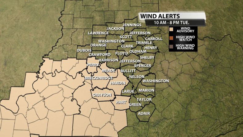
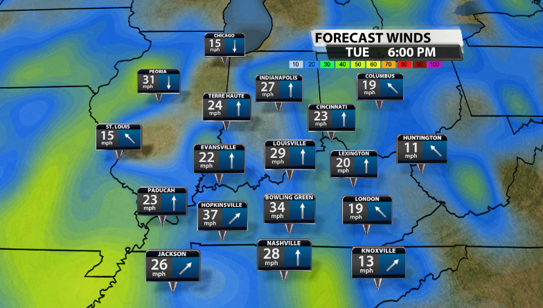
Wind Advisories are out for parts of our community through 8PM tonight. Those counties highlighted could see wind gusts up to 45mph during the afternoon. The rest of us should still expect increasing wind gusts 25mph+ this afternoon as well.
Now, let's get into the rain timing. By the early to mid-afternoon, a couple very light showers will be making their way through our area ahead of the main front this evening. These showers will have to battle a lot of dry air as we slowly increase our moisture content through the day today. So, anything that does fall at this time and reaches the ground would be fairly light.
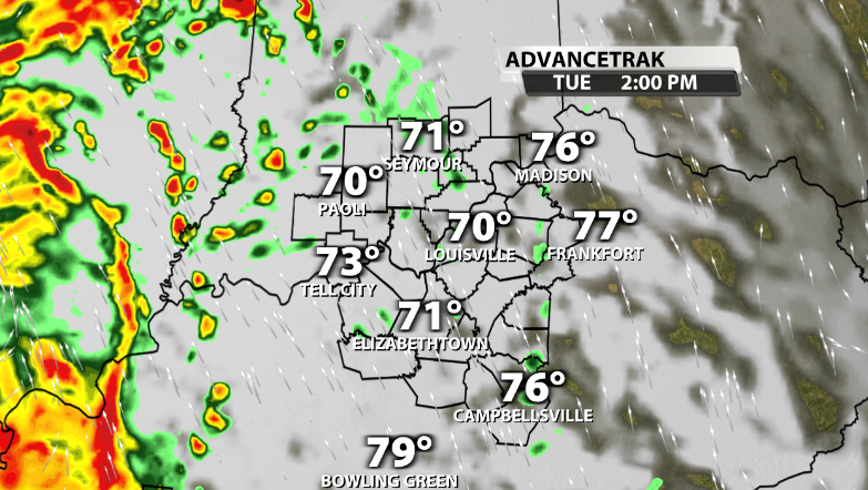
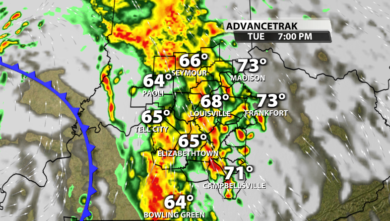
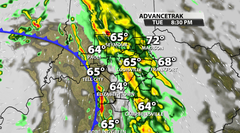
The main show will arrive toward our Western communities by late afternoon. This front will then start to move across our area from West to East, but will start to weaken as it does, especially moving East of I-65 since it will lose the daytime heating aspect, since it's moving through a little before sunset and thereafter for many.
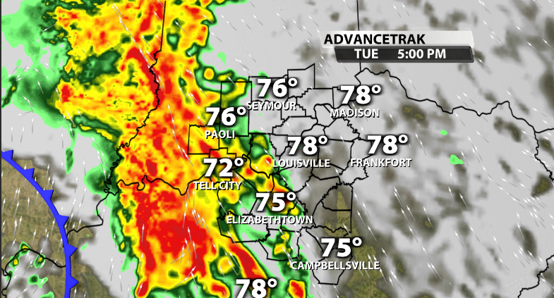
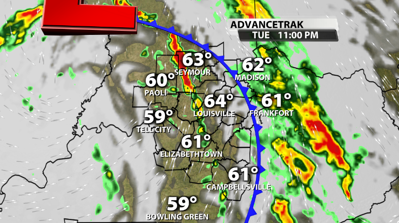
The rain becomes a little more light to moderate after the front moves East of I-65, again because of the weakening, but should still last a couple of hours for most locations.
By the time the morning rolls around again, that low pressure will be further to our North and will be swinging a few lighter showers across our area for the morning commute, but in very scattered nature.
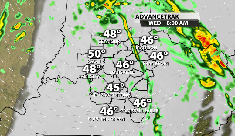
While this rain won't last very long, we will take what we can get at this point.
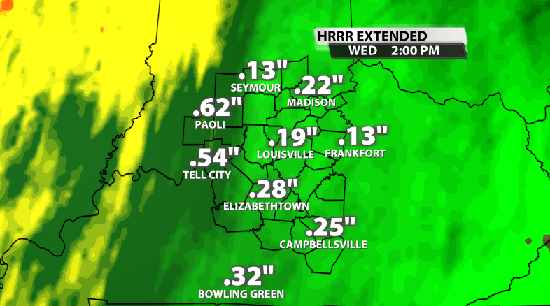
Now, in terms of measurable rainfall, we'll take anything at this point considering we've had a whopping 0.05" of rain the entire month when our average to date is nearly 3". The higher rain totals will more likely be West of I-65 since those locations will catch the front as it still has some daytime heating to work with, therefore allowing for heavier rainfall. West of I-65 could expect 0.5"+ of rain, while along and East of I-65 should expect close to 0.25" or less.
In terms of severe weather, our severe threat is not zero, but it is very low and very marginal. The best chance for organized severe weather is further to our South. However, by far our main impact and threat will be the strong wind gusts we could see this afternoon and this evening along the front.
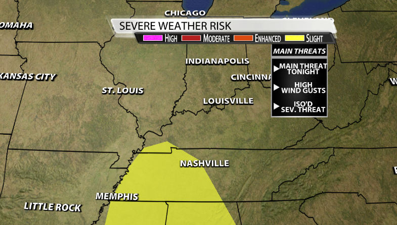
These winds could knock down some trees across our area as well, so that's something to keep in mind. While the threat of a very brief tornado is not zero, it is so low, that the threat for damaging wind gusts topples that by a lot and should be our main focus if any strong storms were to occur. There will likely be a lack of instability anyway that will hold most areas back from seeing strong storms and instead just have some much needed rainfall.


