

How about today, huh?? Talk about awesome! Temperatures well into the 60s and some of us even getting into the 70s..and in February? YES!
Well, I hope you enjoyed it because mother nature is about to take us back to reality by tomorrow morning. Before that cold air rolls back in though, we've got a rain chance for some tonight.
A front moving through our area puts the warmer air we've enjoyed today to a halt pretty quickly. That front is also going to spark showers and perhaps maybe even a few storms after sunset tonight. Let's dive into it...
Tonight
Showers start to pop near the Ohio River and south around 7pm this evening. Indiana will likely stay mostly dry. It'll be a close call whether or not Louisville gets clipped by any of these, but it definitely looks more likely south of Louisville.
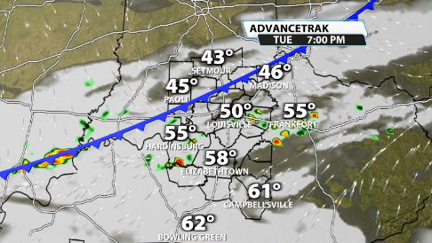
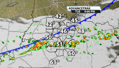
As the front pushes further to the south, you can see more downpours, and maybe even some storms increasing in our Kentucky counties.
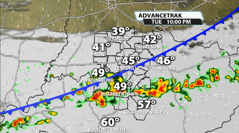
It gets out of here pretty quickly by around midnight or so before the colder air really starts to pour its way in behind the front.
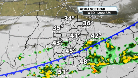
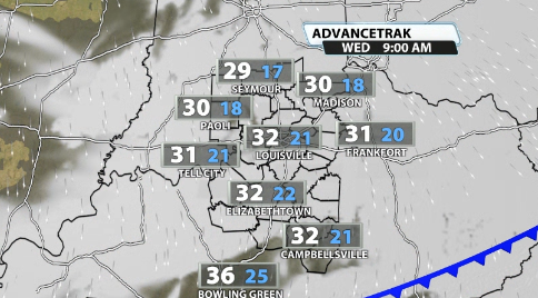
By Wednesday morning we'll be waking up to temperatures near the freezing mark and wind chill values that could be in the 20s walking out the door tomorrow.
As mentioned, some rumbles of thunder are possible in our Kentucky counties tonight. There is just enough CAPE (instability) to support it. You can see the numbers come up some in our southern communities tonight.
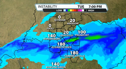
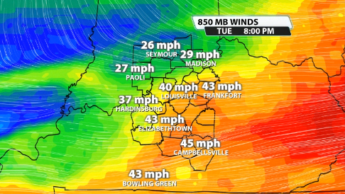
It's not a lot, but this time of year it doesn't take much to get some thunder rumbling. Interestingly enough, when you look for the chance of strong to severe storms, we look for winds at the 850mb level of the atmosphere to be around 40mph or greater. Tonight it is actually right around that threshold.
Is a bunch of severe storms possible tonight? No, but a rogue "stronger" storm or two can't be completely ruled out with some faster wind gusts.


