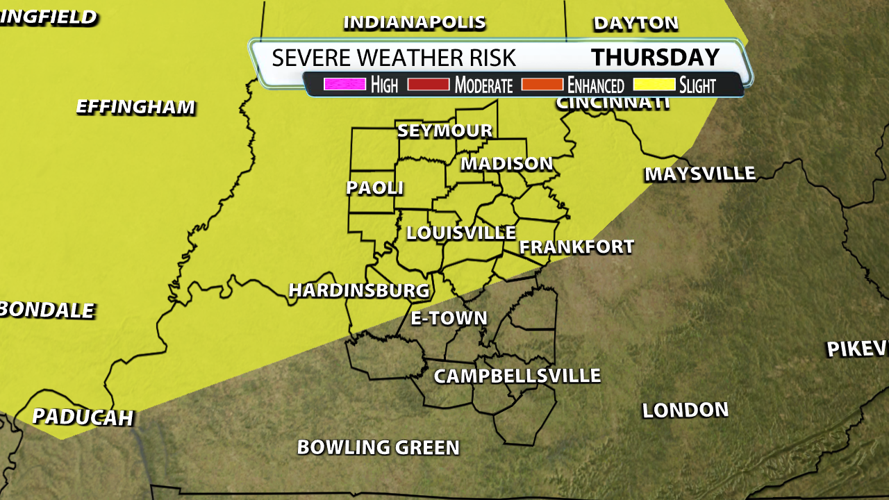


You can tell something is fishy in February when temperatures soar into the 70's. The Storm Prediction Center placed locations adjacent to the Ohio River and all of Southern Indiana under their "slight risk" for severe weather on Thursday. Louisville, Hardinsburg, New Albany, Mount Washington, Brandenburg, Shelbyville, La Grange, Madison and Seymour are included. Remember, "slight risk" means scattered severe storms are likely, but they would be short-lived and/or not widespread.

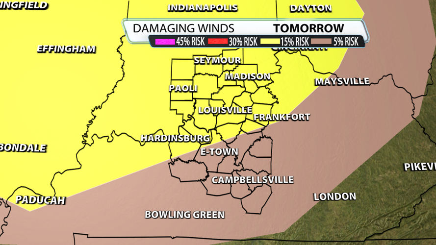
Damaging winds are the main threat, especially from 10 pm - 2 am Friday as the cold front arrives. If you get a warning it could be for gusts around 60 mph, or perhaps a brief spin-up. Again, damaging winds are the main threat at night because that's when wind energy comes up and instability goes down. The probability of damaging thunderstorm winds or wind gusts of 58 mph or higher within 25 miles of a point is 15% in Louisville and 5% to the southeast.

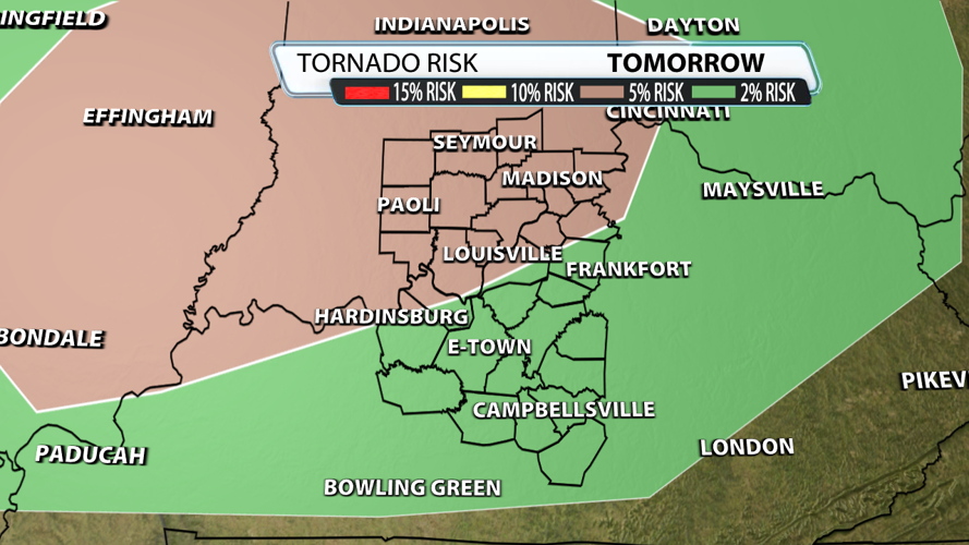
Before that happens, a warm front will lift across our area Thursday afternoon. As a meteorologist, you can't ignore these boundaries because storms that link up with a warm front rotate. That in turn enhances the severe weather potential. Here's the kicker, storms may not even fire in all of these locations as subsidence or descending motion of air exists above our head in some of the data. It's very important to note that the farther north you live, the more aware you should be from 1 pm - 6 pm. The probability of a tornado within 25 miles of a point goes from 5% to 2% from northwest to southeast. We've seen a consistent signal for tornadoes around Effingham and Bloomington, which is very close to our northern counties. That's where the highest concern exists Thursday afternoon.

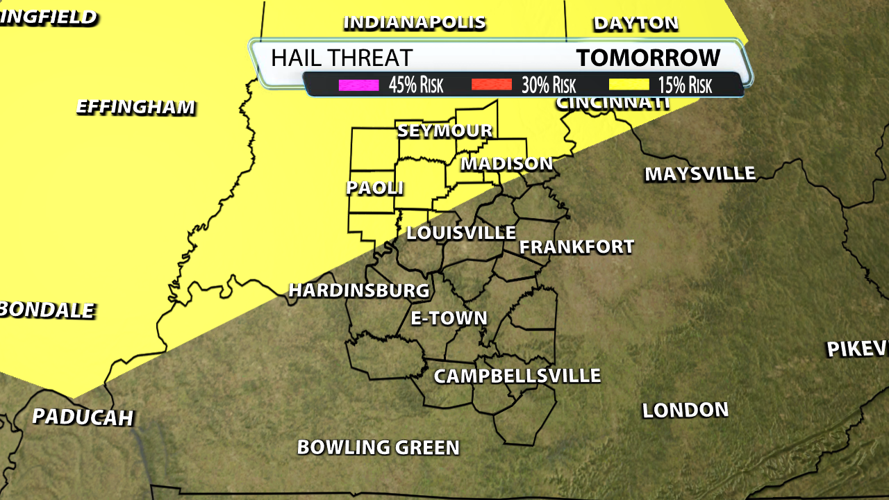
There's a 15% hail threat in our northwest counties. Hail getting big enough to do damage is at the bottom of our threat list, unless you get under one of those supercell thunderstorms. Those have updrafts strong enough to allow hail formation. The WDRB will be watching so follow us all and stay tuned!


