

Mother Nature will not give us a break. We have another severe weather threat for this afternoon/evening. Let's go through the timeline and impacts. (If a watch is issued, there will be a separate blog post covering it.)
Timeline
Let's get straight to it. Storms will be approaching our western communities likely around 4-6PM this evening. The further west you are in our viewing area, the earlier in that time frame you'll likely be.
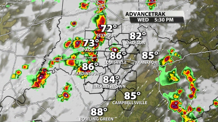
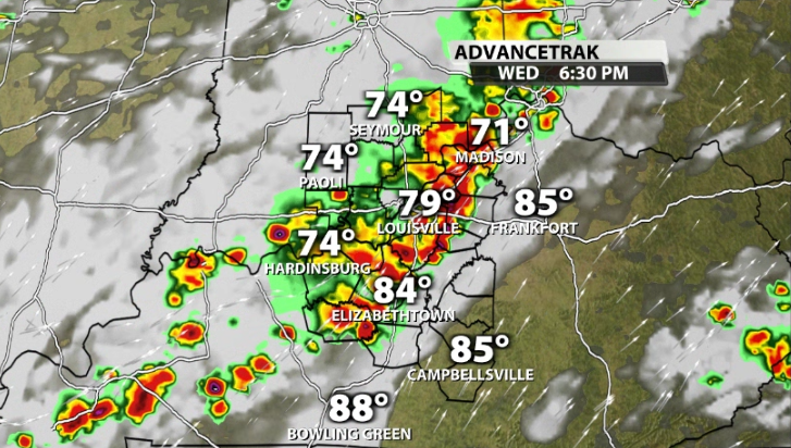
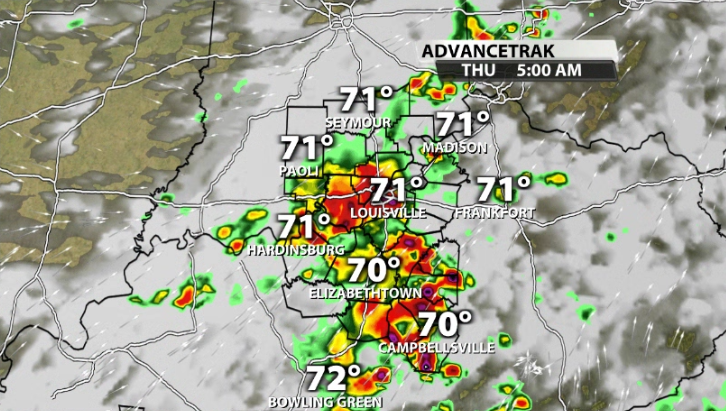
This line of storms races quickly off to the East across our area and will be approaching Louisville likely between 5-8PM. Some data has it arriving as early as around 5-6PM, but we will keep that window open to 5-8PM.
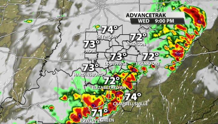
They move East of I-65 and the main line of strong storms will continue to weaken somewhat and exit our area by around 11PM-12AM. This isn't the end of storms, but is likely the end of the highest severe chance for the evening. More scattered storms, some of which could still be on the stronger side, roll through overnight and into early Thursday morning.
Severe Risk
The Storm Prediction Center has most of area now in the Enhanced (3/5) risk for severe storms, including most of Metro Louisville. The Slight (2/5) risk includes only locations near Green, Hart, and Adair counties in Kentucky as that line of storms slowly starts to weaken the further East that it goes.
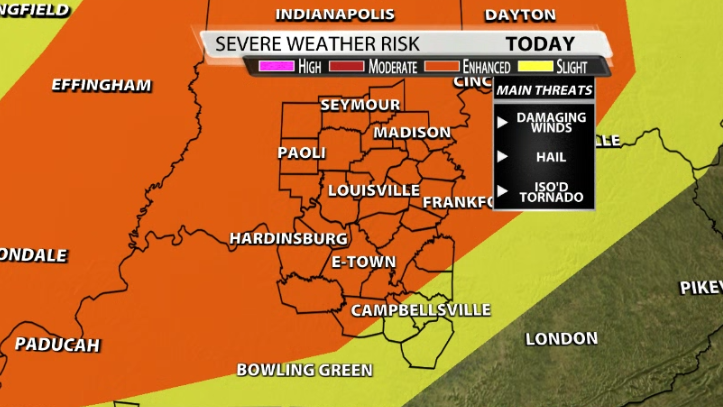
The main impact in any strong storm that rolls through our area today will be damaging wind gusts that could reach 60+mph. While tornadoes are not the main threat, a few spin ups cannot be ruled out in this scenario.
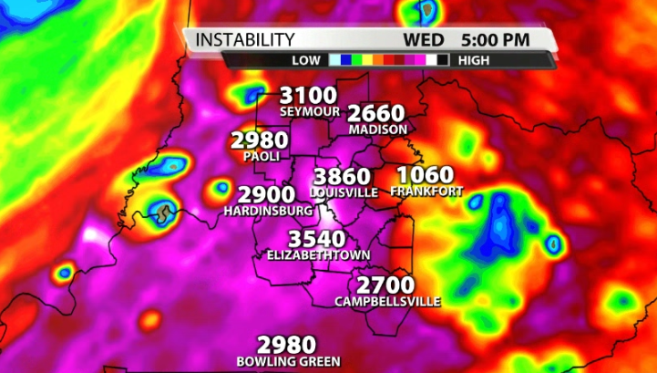
Let's take a quick look at the science. We have plenty of storm energy (CAPE) in our area this afternoon and evening. You can thank the warm air and the insanely high dew points for that.
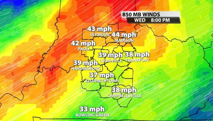
We know we need wind energy too. Specifically 40mph winds or stronger at the 850mb level (around a mile up) of the atmosphere. That is supportive enough in this set up too. We will have to watch and see if these storms speed up more and potentially get ahead of the strongest wind energy which would allow for more of an outflow structure in these storms and help our severe risk be a little lower.
Have a way to get warnings this evening just in case and be safe driving home from work as some of these storms could impact early evening traffic.


