
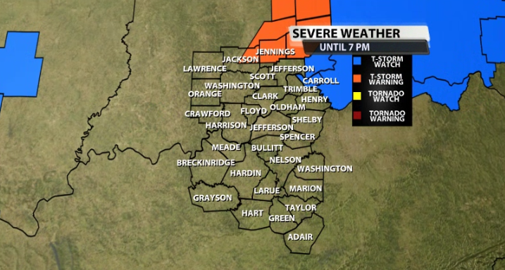
A Severe Thunderstorm Watch has been issued for part of our area. The first issuance is only for Carroll county in Kentucky until 7PM. This is for the storms that have remained mostly North of our area from the first wave of storms this early afternoon.
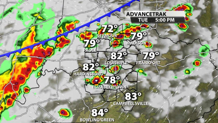
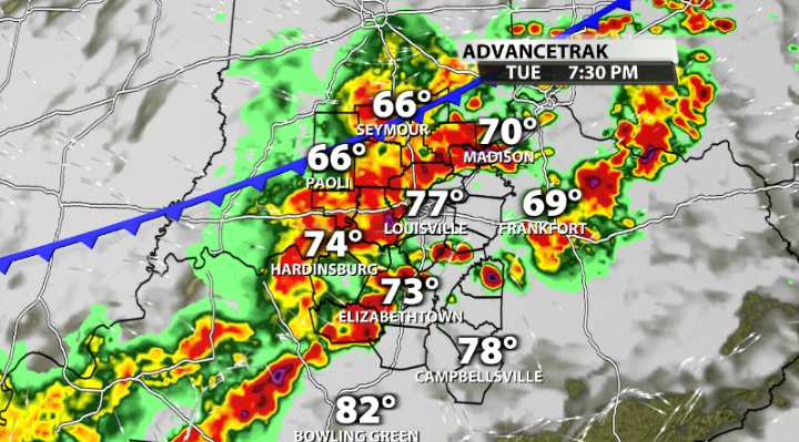
We will likely have a separate watch issued for a good chunk of our area later this afternoon for more storms that will be rolling through our area. Here's another look at the timing for those in the latest data:
Strong to severe storms increase across our area after around 3-4PM. These continue to increase in number as we go through later in the afternoon due to peak heating and the approaching cold front.
Again, we will likely have another watch issued for that batch of storms later today as needed. Here's more on the watch for Carroll county:
* Effective this Tuesday afternoon and evening from 1230 PM until
700 PM EDT.
* Primary threats include...
Scattered damaging winds likely with isolated significant gusts
to 75 mph possible
Scattered large hail events to 1.5 inches in diameter possible
A tornado or two possible
SUMMARY...A fast-moving cluster of thunderstorms over southeast
Indiana is expected to remains intense and track across the watch
area through the afternoon. Locally damaging wind gusts are the
main concern.


