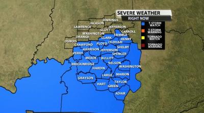
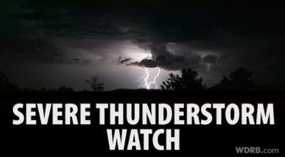
The Storm Prediction Center and National Weather Service have issued a Severe Thunderstorm Watch for most of our area until 1 PM.

Rounds of strong storms will continue to march through our area until the early afternoon when cooler air starts to flow in and rob us of good storm energy. Tune into WDRB in the Morning until 9 AM and the Midday News from 11:30 to 12:30 to see where the storms are and what threats they bring. All threats are on the table today: hail, damaging wind, heavy rain, and isolated tornadoes. Below is the text issued with the Watch:
The NWS Storm Prediction Center has issued a

   * Severe Thunderstorm Watch for portions of
     Extreme southern Indiana
     Central Kentucky

   * Effective this Thursday morning from 500 AM until NOON CST.

   * Primary threats include...
     Scattered damaging wind gusts to 70 mph possible
     Scattered large hail events to 1.5 inches in diameter possible
     A tornado or two possible

   SUMMARY...Clusters of storms with bowing and supercell structures
   will persist through the morning and spread into central Kentucky.
   The storm environment will support the threat for damaging winds of
   60-70 mph, hail up to 1.5 inches in diameter, and possibly an
   isolated tornado or two.

   The severe thunderstorm watch area is approximately along and 50
   statute miles east and west of a line from 25 miles south southeast
   of Bowling Green KY to 15 miles north northwest of Louisville KY.
   For a complete depiction of the watch see the associated watch
   outline update (WOUS64 KWNS WOU6).

   PRECAUTIONARY/PREPAREDNESS ACTIONS...

   REMEMBER...A Severe Thunderstorm Watch means conditions are
   favorable for severe thunderstorms in and close to the watch area.
   Persons in these areas should be on the lookout for threatening
   weather conditions and listen for later statements and possible
   warnings. Severe thunderstorms can and occasionally do produce
   tornadoes.


