
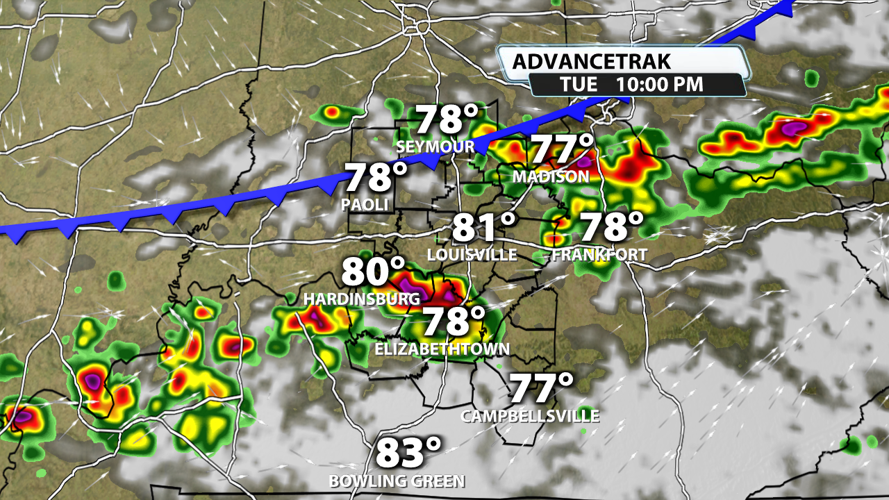
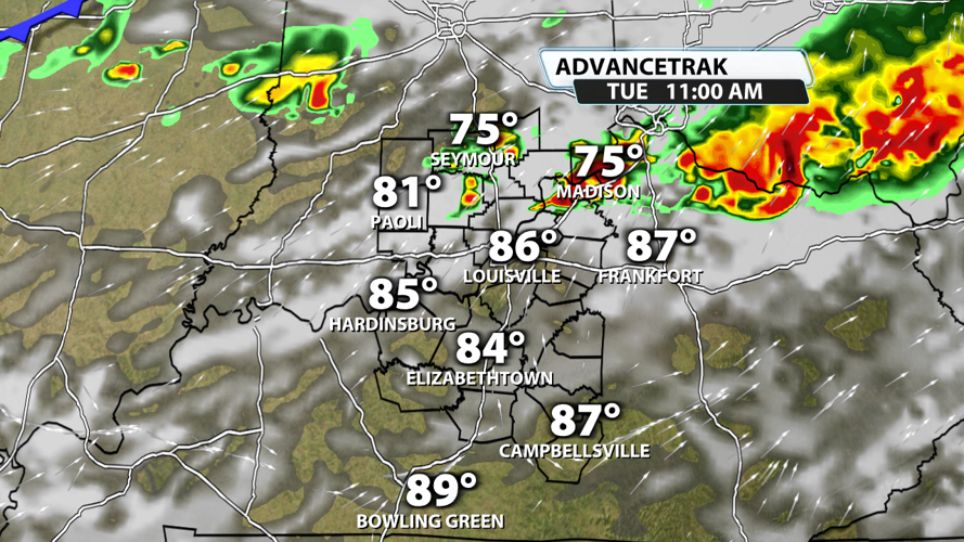


We've got a lot of dry time tonight and Monday with only isolated shower/storm chances. Tuesday is a totally different story. Showers and storms will be possible throughout the day, and severe weather is likely across the Ohio River Valley. Let's talk about it.

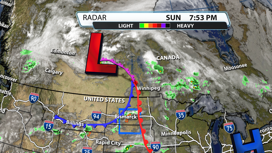
The area of low pressure situated over Canada's Saskatchewan Province will be moving east over the next few days. The trailing cold front that is currently creating storms in the Northern Plains will be a main lifting mechanism for our severe storms on Tuesday.

An initial round of storms is possible Tuesday in the late morning hours. Storms should bring primarily damaging wind and hail threats at this time. Heavy rain is also likely, and flooding won't be ruled out. This round of storms could help slightly reduce some of the energy storms later in the day might have to work with, but it doesn't eliminate it all. In fact, once the storms clear the area, there could easily be 4 - 6 hours for the sun to help reenergize the atmosphere to levels that would easily support severe storms. So don't let your guard down after that potential first round.

As the cold front moves across the region in the evening, a second organized round of storms is likely. The chance for damaging winds, tornadoes, and hail will be accompanied by more heavy rain and vivid lightning. The timing of both rounds of storms will need to be adjusted as more data rolls in, so be weather aware all day and stick around for updates over the next 48 hours.

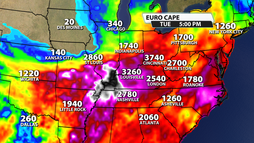
There is a solid chance the we have 2,000 - 3,500 j/kg of energy over our area. That's not unusual for summertime severe weather setups. This energy will help fuel storms as they grow and help keep them alive longer.

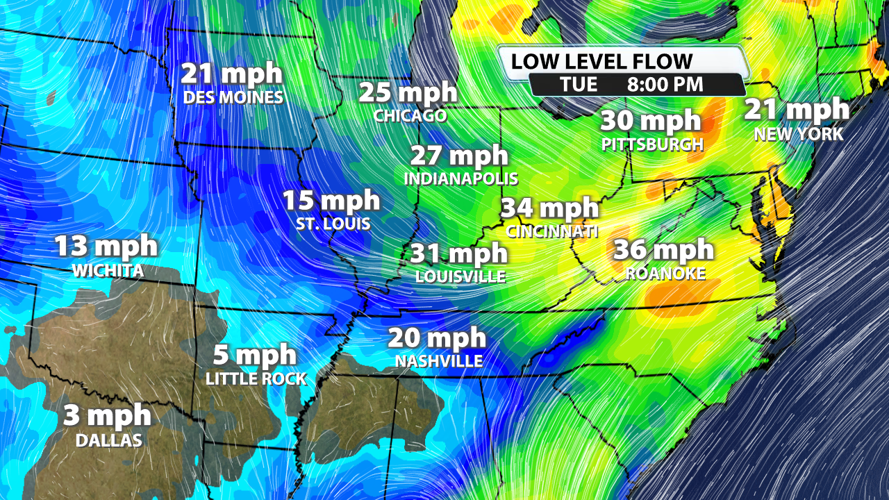
We also always look at the winds aloft, particularly around 850mb. With spring storm systems, these winds can easily be around 50 - 60 mph at this height. In the summer, they tend to be significantly lower. That is likely the case for us with Tuesday's setup. Winds at the 850 mb level will be somewhere between 25 and 45 mph for much of this event over our region, but they will be stronger to our northeast. Any uptick in windspeeds at this level will increase confidence that severe weather is likely.

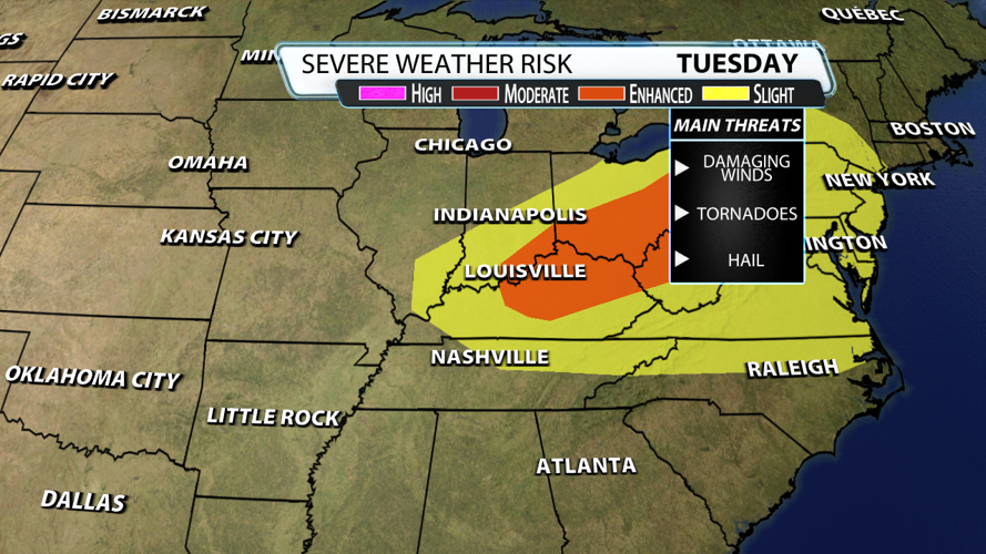
As mentioned before, much of the Ohio River Valley has a chance of seeing severe weather. The best chance for severe storms with the highest winds, largest hail, and highest tornado potential exists in the Enhanced risk, particularly over Ohio. This coincides with the fastest moving winds higher in the atmosphere with more turn to them. The severe weather potential extends into the Mid-Atlantic states as well.


