
A cold weekend is ahead of us once again, but there is light at the end of the tunnel! We'll be stuck in the upper 20s today and mid 30s for Super Bowl Sunday, but by the time the work week rolls around, it'll feel much better!
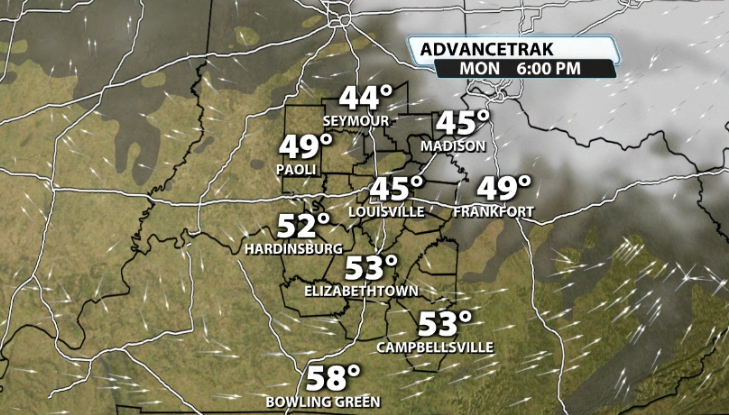
Monday should see temperatures climb back into the 50s for some of us, especially in our Kentucky counties where there is less snowpack on the ground. You can see that where there is thicker snowpack on the ground in Indiana, it is notably cooler, but still not awful. Monday should also come with some sunshine as well and that combined with the well above freezing temperatures should help melt a good amount of snow.
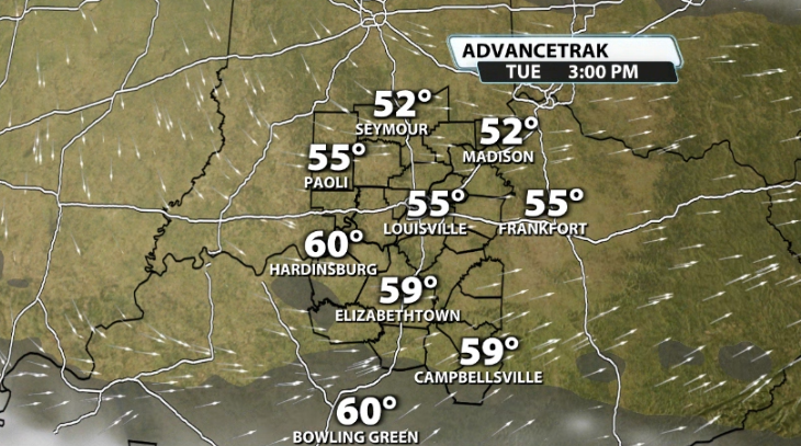
Monday isn't even the warmest of the week. That will likely come on Tuesday! More southwest wind brings temperatures in areas with low snowpack, mainly in Kentucky, into the upper 50s and maybe even to 60! Where the higher snowpack has been, low-mid 50s still look attainable! That will really help to onset even more melting!
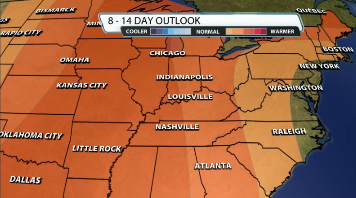
The long-range still looks around normal to warmer than normal. All of the snow won't be melted by the time Tuesday ends, but it will definitely progress a lot further after a couple of days in the 50s for most of us!


