

What a spring-like day in our area! Temperatures climbing into the low 70s this afternoon will have no problem doing so due to winds that are going to continue to climb through the rest of the day and tonight. Wind gusts during the daytime are expected to climb up to around 30-35mph.
Due to that strong wind, a high temperature record should be set today as long as we get above 70. The main show, however, arrives tonight.
A strong cold front starts to slide into our western communities between 7PM - 9PM tonight. Storms along that front will be at their strongest for our western communities and should be slowly weakening the further east that they go. There is a lot of wind energy to help these storms, but fuel is limited.
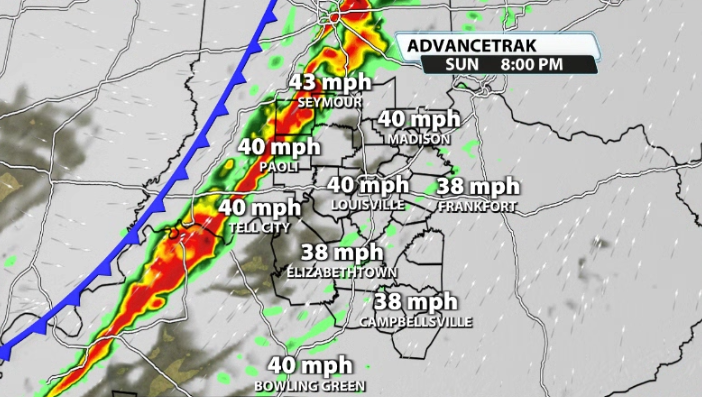
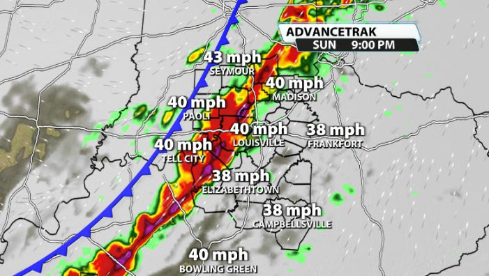
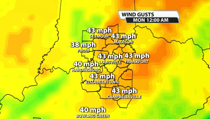
The line arrives in the Louisville area between 8PM - 10PM tonight. Again, most storms have weakened by this point, but some could still pack a punch with just a little bit of fuel left over. The main impact along the front and in any shower/storm will be the potential for damaging wind gusts.
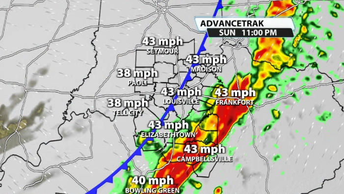
That line should be out of our hair by midnight, and the winds should subside a little bit, but not completely slack off once the front rolls through.
We have a Slight(2/5) severe chance for parts of our area, mainly for our northwestern counties in Indiana, for locations like Paoli, Bedford, and Seymour. This is mainly for strong to damaging wind gusts that will be along the cold front this evening, but there is a very low, non-zero tornado threat. Tornadoes are not very likely, but with the amount of wind energy we have, it's not impossible.
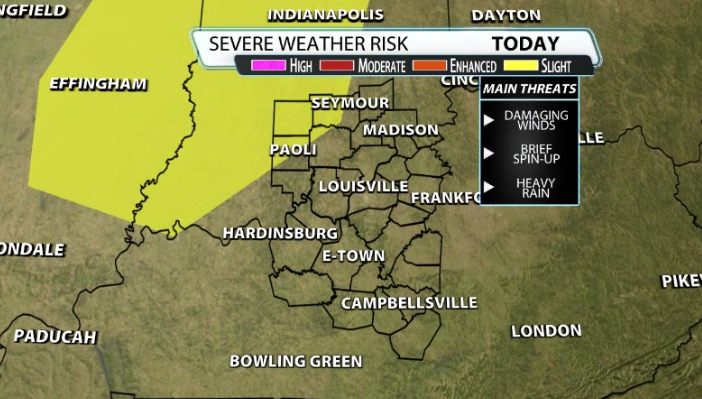
Louisville is still included in a low-end damaging wind threat along the front tonight as well, even though not included in the Slight risk.
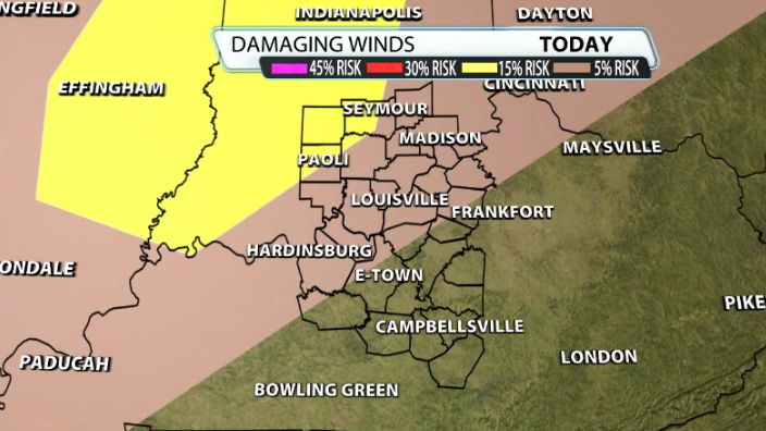
Some wind gusts could climb north of 55mph+ at times, especially as the front is rolling through.
Temperature Crash
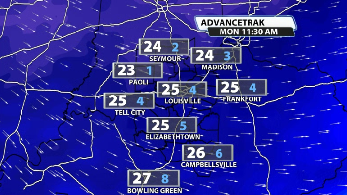
Temperatures behind the front crash almost immediately. With the wind still whipping around, temperatures will crash very fast and down into the 20s for our area by the time daybreak rolls around on Monday. Some could see temperatures drop and much as around 50 degrees by tomorrow.
For what it's worth, the greatest 24 hour temperature drop ever in Louisville was 58 degrees back on January 23rd, 1963. We likely won't get to that extreme, but the fact we're even getting somewhat close is crazy!
Watch out for the strong wind gusts tonight as the front rolls its way on by and make sure the Christmas inflatables are down!


