

Now that the morning line of storms is moving its way on out, let's dive into the data together to see what this second wave has in store for this afternoon and evening.
First, you'll see some data has us drying off through early afternoon, which we can confirm the data is doing well in that department. The question from there is, when/do we get any clearing and will it be for long enough to make our atmosphere unstable enough for severe weather?
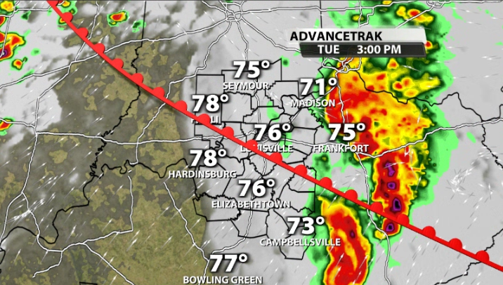
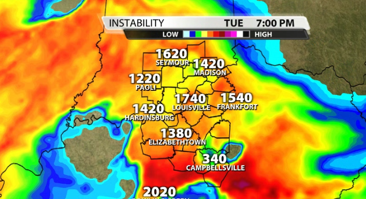
Data does have clouds clearing making way for some sunshine by 3-5pm across our area. Again, is that going to be enough time for our atmosphere to become highly unstable again?
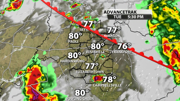
For our southern Kentucky communities it looks more likely, where they will be warm with higher dewpoints and a little more of a favorable wind environment. Storms begin to thrive and return to our southwestern communities as early as 5-6PM, and move across our entire area by around 8-9PM.
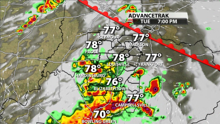
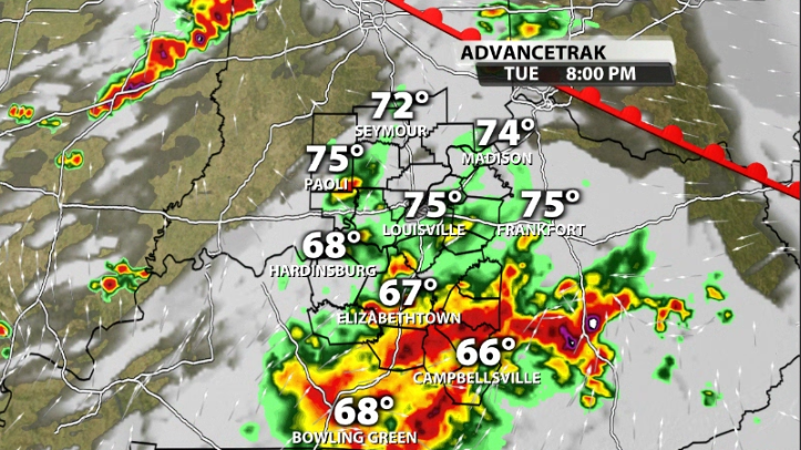
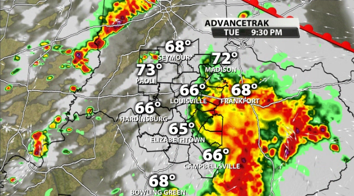
You'll notice that this particular model has the stronger storms mainly south of Louisville. Could Louisville still get severe weather? Yes! However, the higher likelihoods for tornadoes, destructive winds, and very large hail do appear to be more south of the metro.
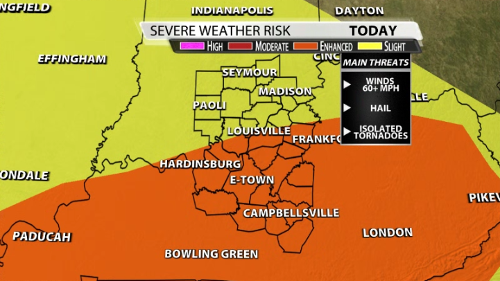
The SPC still has the Enhanced risk up to the Louisville metro anyway, and includes everyone along and south of the Ohio River. The main threats across our area will be damaging winds 60+ mph. A few isolated tornadoes cannot be ruled out, especially south of Louisville.
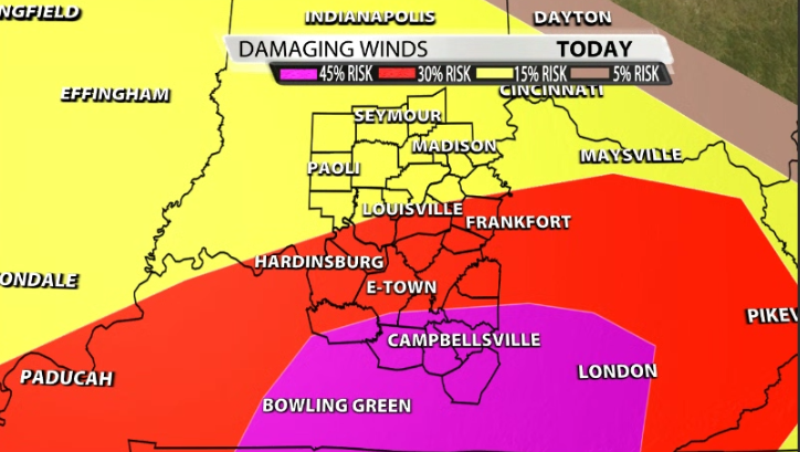
You'll notice the SPC still has a 30% risk area out for Louisville and south for winds at that 60+mph caliber, with a higher 45% risk for areas like Greensburg, Campbellsville, and Columbia.
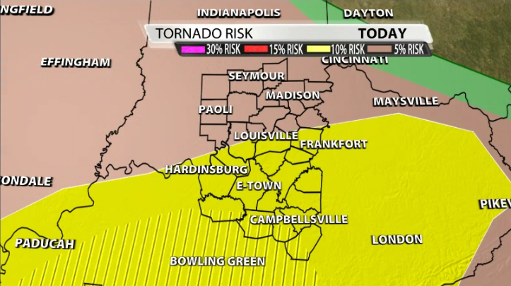
The SPC's tornado risk is still pretty far north considering what the data is showing. Either way, they have a 10% risk for everyone along and south of the Ohio River, with a "hatched" area for areas like Leitchfield, Campbellsville, and Columbia.
A lot of the higher severe risk reaching as far north as Louisville depends on how much CAPE we can build after we clear mid-afternoon. Data supports a decent amount, but nothing insane like what we saw on Friday, when we had over 4,000 units in part of our area.


