
As a cold front moves through our area Thursday evening, a chance for strong to severe thunderstorms arrives with it. A warm front will come through Thursday morning and open us up to the "warm sector," the area of a system in between the warm front and cold front. That is an area with warm, humid air and more abundant storm energy, so that's when we are most likely to see stronger storms.

SETUP
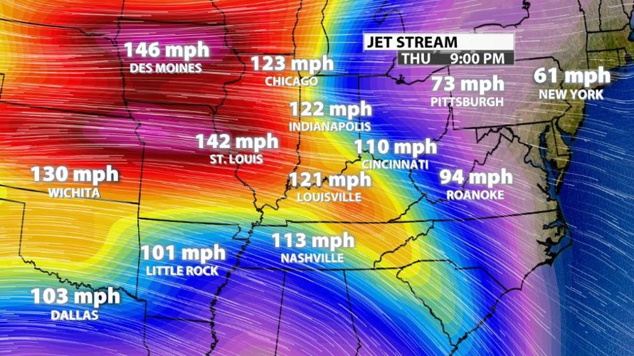
We will take a top-down approach to combing through the atmosphere for this severe weather threat. In the top layer of the atmosphere where we look for weather, we find the jet stream. This is the large-scale flow pattern that drives our weather systems. Within that larger flow, you get smaller pockets of stronger wind called "jet streaks." While we are not in the area of strongest wind in this setup, there is a tongue of stronger wind (the yellow part sticking out over Kentucky and eastern Tennessee) that will create divergence in the upper levels of the atmosphere. Divergence in the upper levels leads to convergence at the surface and rising air through the column.

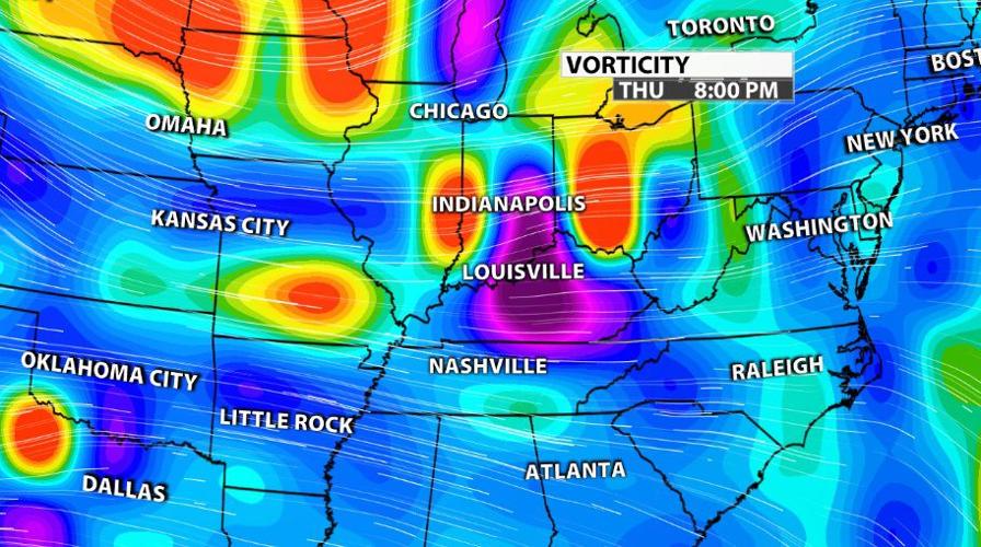
Next we move down to the middle levels of the atmosphere where we look for vorticity advection - where the stronger areas of vorticity are moving. In the image below you can see the dark purple colors over our area showing a region of strongly negative vorticity. Notice how that is surrounded on three of four sides by bright colors showing positive vorticity. As all of these areas of different vorticity move around each other, it creates rotation in the atmosphere.

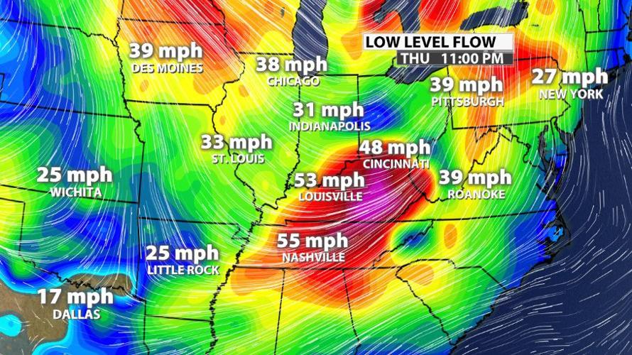
Closer to the ground, in the lower levels of the atmosphere, we look for the low level jet. Similar to the upper level jet we've already discussed, here we are looking for places where the wind is stronger and where we are positioned relative to those. From the image below, the strongest wind at this level will be positioned over our southern communities as it moves through.

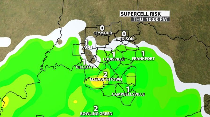
We will talk further down in this post about what threats all of those factors create. Now let's look at the surface. The image below shows Supercell Composite which is not a variable like wind or temperature that can be measured. This is calculated using those kinds of variables, so it's an extra step. It's trying to show you where supercells are most likely, if anywhere. Pay more attention to the color shading than the numbers to see where cells are most likely.

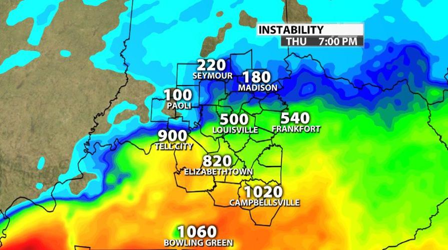
CAPE (Convective Available Potential Energy) shows where we have the best energy to support storm development. Again, notice how we are highlighting our communities along and south of the rive for greatest storm potential.

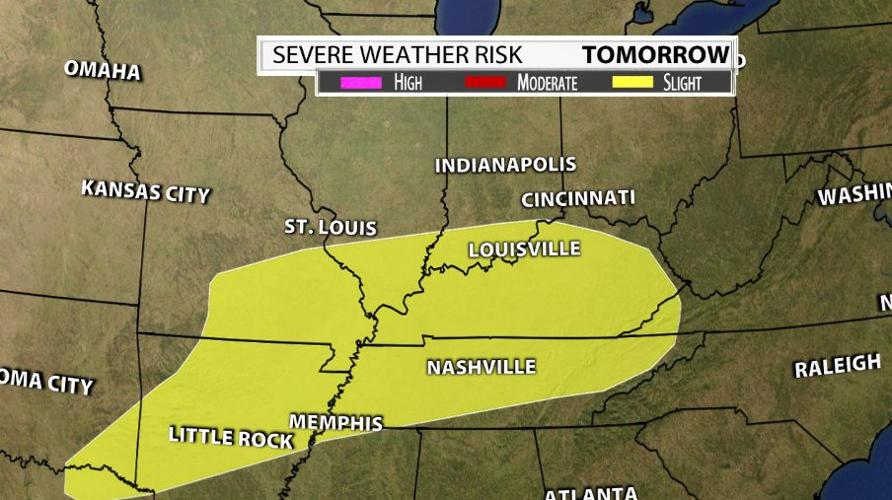
The Storm Prediction Center expanded their Slight risk of severe weather for Thursday to include nearly all of our WDRB communities. There is a zoomed in view farther down in this post where we talk about threats. Notice how large this area is - it extends well south and west of us. We really are on the northeast edge of this Slight risk.

THREATS
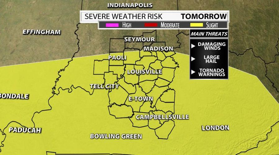
Here's that zoomed-in view where you can see nearly all of our WDRB communities are included in the Slight risk (level 2 out of 5) from the Storm Prediction Center.

Based on what we discussed above here are the threats we expect:
- Strong wind gusts: outside the thunderstorms, gusts up to 45 mph are possible. Since that low level jet is fairly strong and right over our area, wind will be the primary threat from this event.
- Isolated tornadoes: based on how the speed and direction of the wind changes from the surface through the lower levels of the atmosphere, this will be one of the threats we watch especially in southern Kentucky.
- Hail: since CAPE values are fairly low and this event looks mostly wind-drive, the threat for hail is lowest on my list but is still present.
- Heavy rain/flood potential: as the storms move through, they will drop heavy rain but it won't last long. Since this is coming late in the evening, watch for flash flooding if you are out in it. But please don't be out in this weather.
TIMING
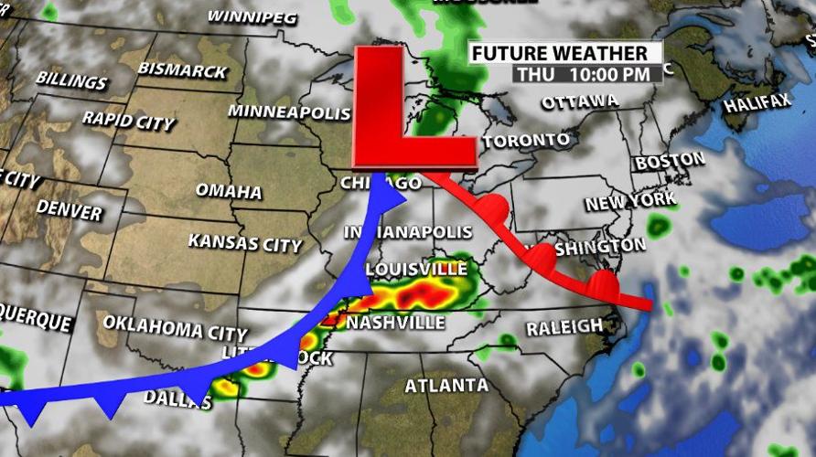
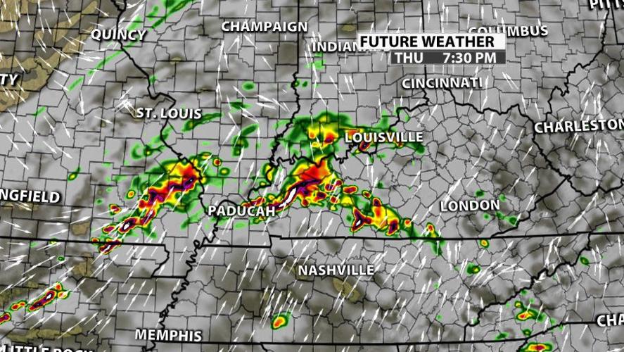
The timing is likely to change by a couple hours so please continue to check for updates on WDRB through the day Thursday. Around dinner time this cluster of storms starts to form just west of us.

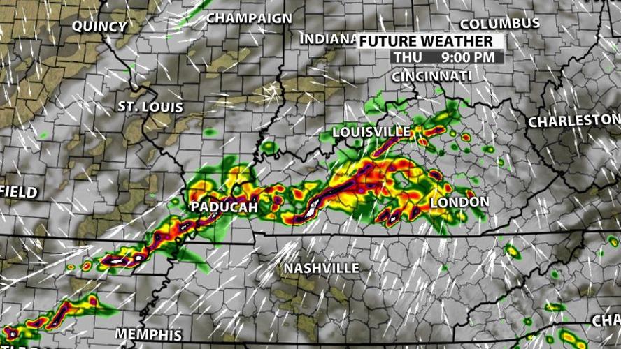
As it crosses through our area, which we've already established is favorable to storm development, it matures into a complex of storms. Notice how it's not one continuous line in the image below - there are segments that bow out ahead and clusters where the storms look stronger.

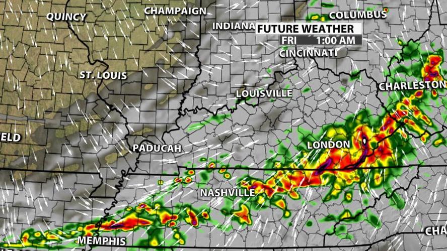
The line will dive east and southeast and start to decay after it leaves our area. The best timing for the strongest storms Thursday is 6 PM - midnight.

Tonight on WDRB News, Meteorologist Rick DeLuca will share the updated data with you, including the latest timing.


