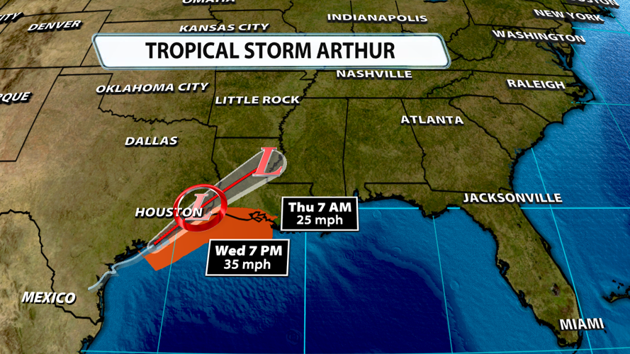
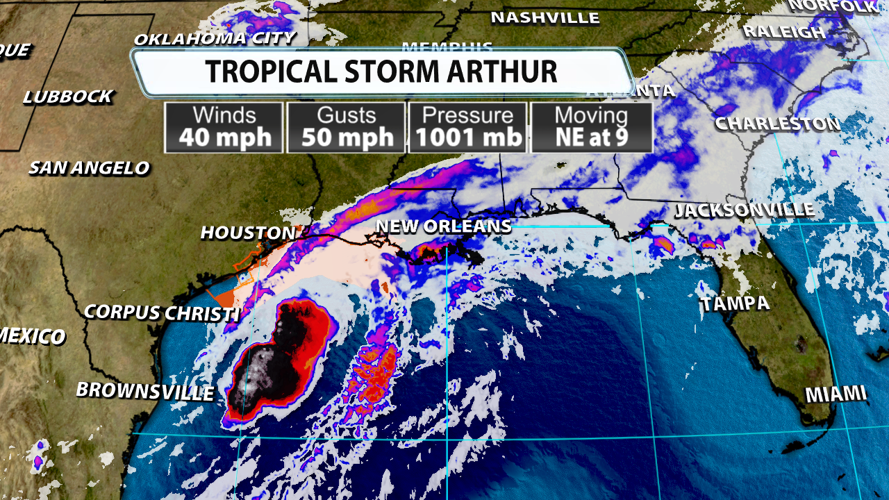


The first named storm of the Atlantic hurricane season is here! Tropical Storm Arthur officially formed in the Gulf around 11 AM EDT today. It currently has winds of 40 mph and is moving northeast at 9 mph.

Tropical Storm Watches and Warnings have been issued for the Texas and Louisiana coastlines, but sustained winds should generally stay below tropical storm strength. Gusts could top out around 45 mph at times. While winds won't be a significant threat, flooding could become problematic. Heavy rain could lead to river and stream flooding, and coastal erosion and flooding are likely with up to 4 feet of storm surge possible. A couple of tornadoes are also possible across the Gulf Coast States. These would likely be weaker in nature. Flooding could extend farther inland over the next few of days for many places across the Southeast.

The season is off to a relatively slow start compared to what we've seen over recent years. Overall, storm activity during the 2026 Atlantic hurricane season is expected to be below average. A lot of that is contributed to the potential for a very strong El Niño this year. A strong El Niño tends to create more wind shear across the Gulf, Caribbean, and Atlantic, which usually tears storms apart despite also usually having very warm sea-surface temperatures that tend to help fuel stronger storms. It's just the beginning of the season, so stick around for more updates from the WDRB Weather Team!


