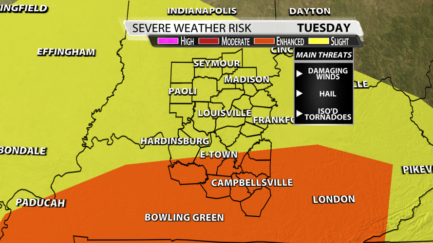
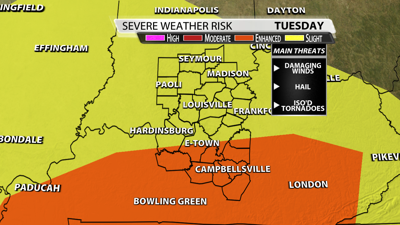

Homes were wiped off their foundation and at least 19 people are dead from the storms Friday night. It's terrible to see the damage from Eli to London, Kentucky. Believe me, the last thing I want to talk about is more severe weather, but Tuesday may offer up just that. The Storm Prediction Center has a "slight risk" for severe weather in Louisville with an "enhanced risk" along and south of the Western Kentucky and Bluegrass Parkway.

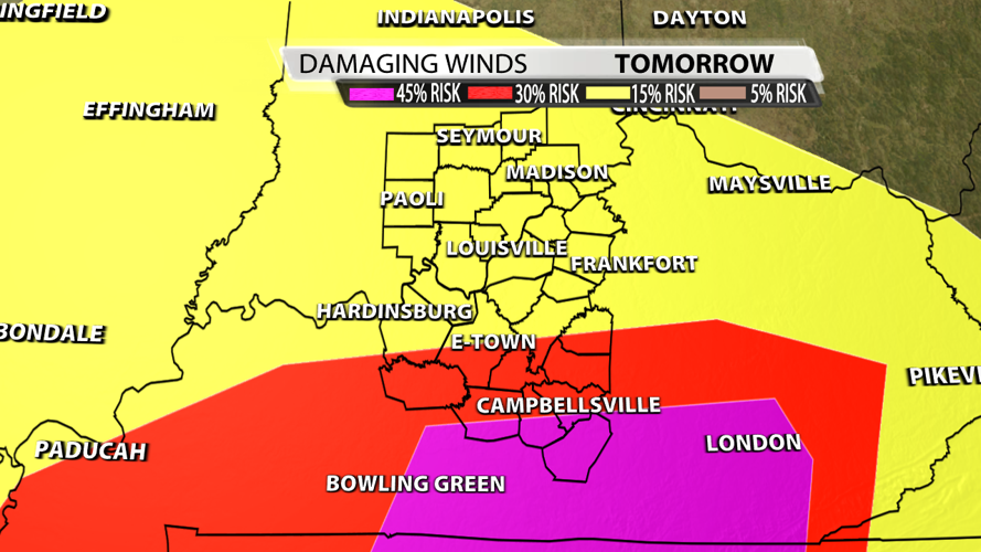
The Storm Prediction Center has a 15% probability of damaging thunderstorm winds or wind gusts of 58 mph or higher within 25 miles of a point. Upon closer inspection, you see how that escalates to a 45% probability in southern Kentucky. Damaging winds are the most concerning threat in that purple zone which also includes London, Kentucky.

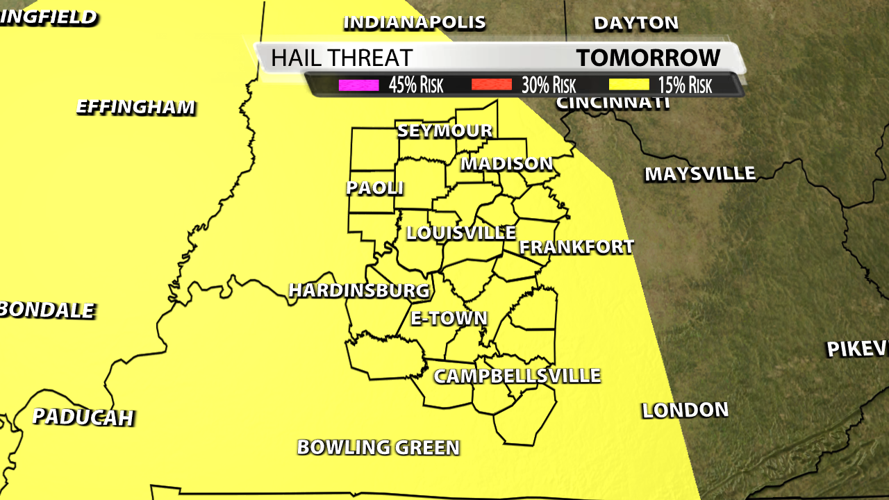
We could also see hail, but nothing huge. It's highly dependent on how much the atmosphere can recover from the morning wave of storms. Right now, the data only shows about 3 hours between waves which isn't much time for the atmosphere to reenergized. There's a 15% probability of one inch diameter hail or larger within 25 miles of a point.

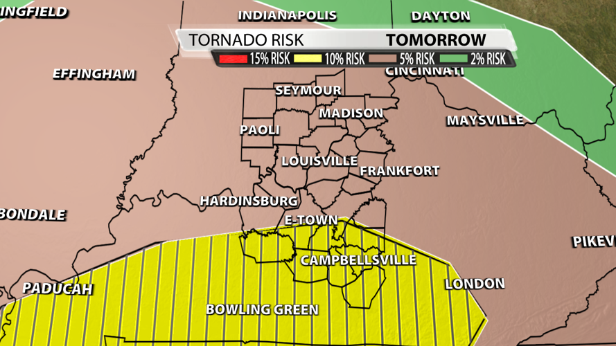
In Louisville, the probability of a tornado within 25 miles of a point is 5%. Southern Kentucky is once again in a higher probability of 10%. The hatched area represents a 10% or greater probability of EF2 - EF5 tornadoes within 25 miles of a point. We do have directional shear Tuesday, so winds turn from the southeast to the southwest as we look up in the atmosphere.

Wind and tornadoes are the main two threats for southern Kentucky. The longer it rains during the morning, the safer will be during the afternoon. While Louisville could see warnings, storms are far more likely to be severe to our south. Please keep those suffering in your prayers and help out with the recovery efforts if at all possible. We will be watching as always.


