

We've said it for a while now: we need rain! And this past week, we got it. In fact, we got a ton of it! Let's talk about what has fallen and what changes we've seen in the drought monitor from last week to this week.

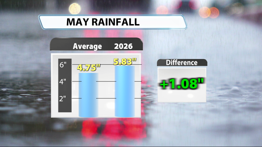
Louisville has recorded 5.83" of rain during the first 28 days of May. That's just over an inch more than we would expect to have received at this point in May. Since May 16th, we've recorded almost exactly 4" of rain! And 1.8" of that fell in one day, May 22nd.

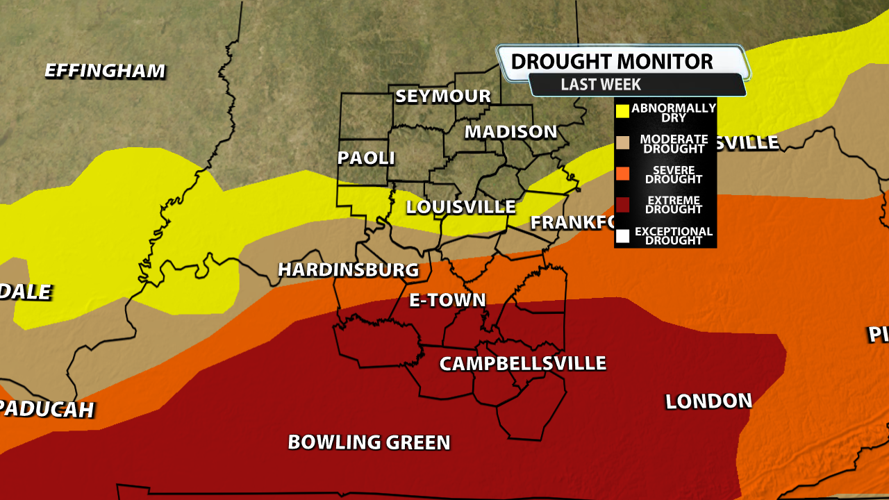
Last week's drought monitor map takes into account only the rain that fell before 8 AM on Tuesday, May 19th. At that point, we were in quite a deficit, and it shows across Kentucky. Extreme drought had spread across most of Southern Kentucky, and moderate drought got right up to I-64 in our viewing area.

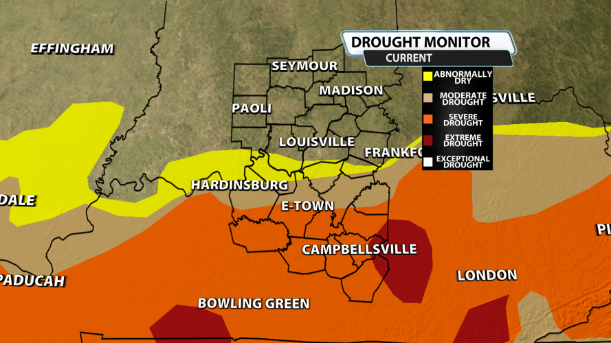
This week's drought monitor map takes into account only the rain that fell before 8 AM on Tuesday, May 26th. That means it missed much of the rain that fell on Tuesday. But the impacts from the heavy rain the week prior can easily be seen with the extreme drought reduced significantly across Southern Kentucky. Even moderate and severe drought were pushed south. We don't have any substantial rainfall expectations over the next 7 days, so drought conditions will likely be fairly unchanged or slightly worse when the next drought monitor is issued.


