

Another week in Kentuckiana and yet another opportunity for wintry weather. The main concern this time around will be freezing rain, which is the worst type of precipitation. It can make travel dangerous to nearly impossible at times. It also adds hundreds of pounds to trees and power lines, which ultimately results in scattered power outages. There seems to be some confusion about freezing rain and sleet, so I wanted to take this opportunity to fill you in on different types of precipitation.
RAIN
Rain is simply liquid water droplets and falls when temperatures in the air and at the surface are above freezing. Rain can start as water droplets or ice crystals in a cloud but always falls as liquid water. If you get too much rain in short period of time, flooding can become an issue.
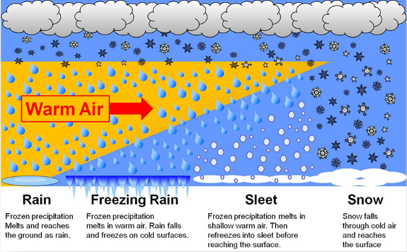
Image Credit: NOAA
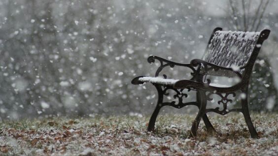
SNOW
Most precipitation that forms in wintertime clouds starts out as snow because the top layer of the storm is usually cold enough to create snowflakes. Snowflakes are just collections of ice crystals that cling to each other as they fall toward the ground. Precipitation continues to fall as snow when the temperature remains at or below 0 degrees Celsius from the cloud base to the ground.
- Snow Flurries. Light snow falling for short durations. No accumulation or light dusting is all that is expected.
- Snow Showers. Snow falling at varying intensities for brief periods of time. Some accumulation is possible.
- Snow Squalls. Brief, intense snow showers accompanied by strong, gusty winds. Accumulation may be significant. Snow squalls are best known in the Great Lakes Region.
- Blowing Snow. Wind-driven snow that reduces visibility and causes significant drifting. Blowing snow may be snow that is falling and/or loose snow on the ground picked up by the wind.
- Blizzards. Winds over 35mph with snow and blowing snow, reducing visibility to 1/4 mile or less for at least 3 hours.
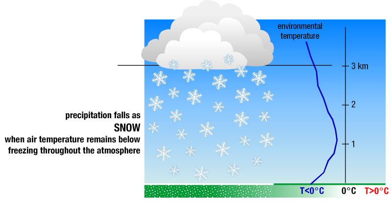
Image Credit: NOAA
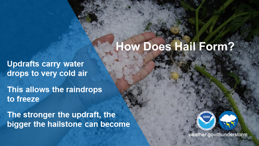
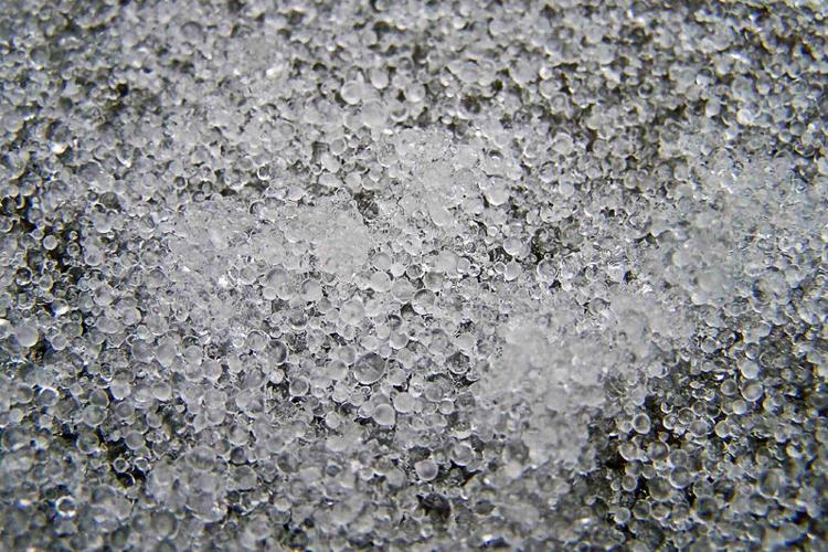
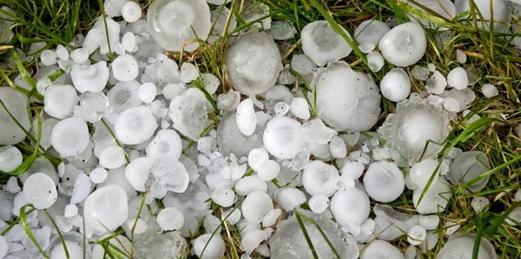
Hail
Hailstones are formed when raindrops are carried upward by thunderstorm updrafts into extremely cold areas of the atmosphere and freeze. Hailstones then grow by colliding with liquid water drops that freeze onto the hailstone’s surface. If the water freezes instantaneously when colliding with the hailstone, cloudy ice will form as air bubbles will be trapped in the newly formed ice. However, if the water freezes slowly, the air bubbles can escape and the new ice will be clear. The hail falls when the thunderstorm's updraft can no longer support the weight of the hailstone, which can occur if the stone becomes large enough or the updraft weakens.
Hailstones can have layers of clear and cloudy ice if the hailstone encounters different temperature and liquid water content conditions in the thunderstorm. The conditions experienced by the hailstone can change as it passes horizontally across or near an updraft. The layers, however, do not occur simply due to the hailstone going through up and down cycles inside a thunderstorm. The winds inside a thunderstorm aren’t simply up and down; horizontal winds exist from either a rotating updraft, like in supercell thunderstorms, or from the surrounding environment’s horizontal winds. Hailstones also do not grow from being lofted to the top of the thunderstorm. At very high altitudes, the air is cold enough (below -40°F) that all liquid water will have frozen into ice, and hailstones need liquid water to grow to an appreciable size.

Image Credit: NOAA
Sleet
Sleet has a beat! Sleet occurs when snowflakes only partially melt when they fall through a shallow layer of warm air. These slushy drops refreeze as they next fall through a deep layer of freezing air above the surface, and eventually reach the ground as frozen rain drops that bounce on impact.
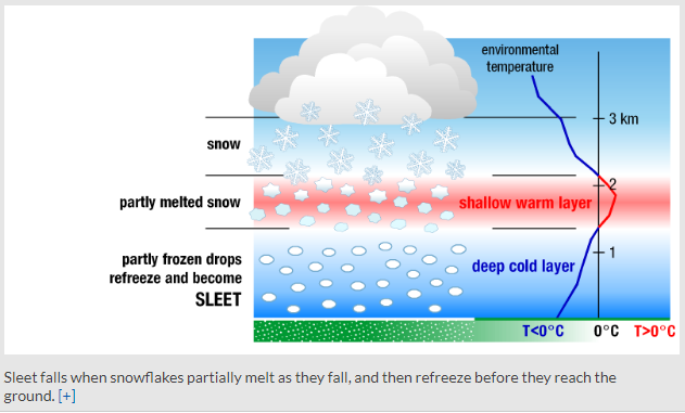
Image Credit: NOAA

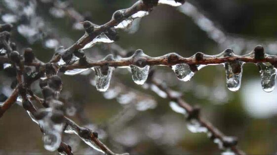
Freezing Rain
Freezing rain occurs when snowflakes descend into a warmer layer of air and melt completely. When these liquid water drops fall through another thin layer of freezing air just above the surface, they don't have enough time to refreeze before reaching the ground. Because they are “supercooled,” they instantly refreeze upon contact with anything that that is at or below 0 degrees C, creating a glaze of ice on the ground, trees, power lines, or other objects. A significant accumulation of freezing rain lasting several hours or more is called an ice storm.
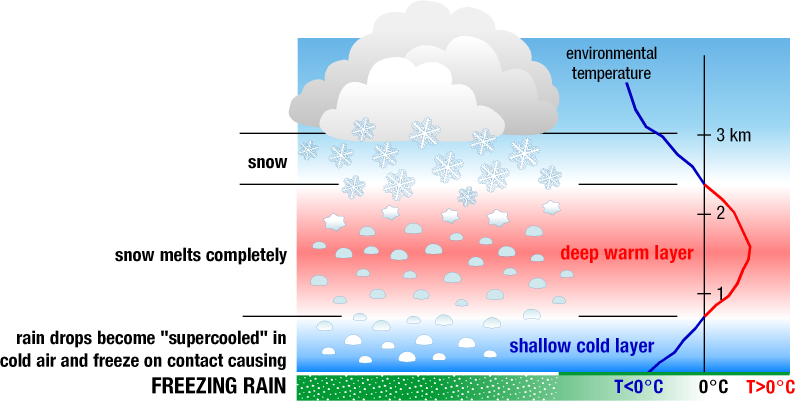
Image Credit: NOAA
Graupel
Graupel are soft, small pellets formed when supercooled water droplets (at a temperature below 32°F) freeze onto a snow crystal, a process called riming. If the riming is particularly intense, the rimed snow crystal can grow to an appreciable size, but remain less than 0.2 inches. Graupel is also called snow pellets or soft hail, as the graupel particles are particularly fragile and generally disintegrate when handled.


