
Despite what you see online from "weather pages" (that are just using scare tactics to get clicks and are *not* meteorologists), Hurricane Erin is not forecasted to make landfall in the United States.
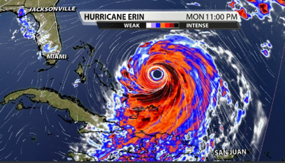
Hurricane Erin is situated near the Bahamas right now. That is getting a little too close for comfort for those on beaches along the East coast.

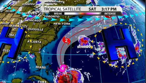
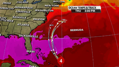
So, where is it going now. Well, it's not going to make landfall along the East coast, and it is going to continue to move northward and eventually get pulled out further East and into the Atlantic Ocean as it goes North of Bermuda. How do we know? Due to its steering pattern.
Take a look at the image below. With a Bermuda high over the Atlantic, and another high pressure over the southern US, Hurricane Erin is sandwiched in between. Tropical systems like to follow the path of least resistance, meaning it will flow in between them and Northward and off the coat of the US.
There is also a low pressure trough in the jet stream that will also pull it further to the East the further North it goes. This is how we know where Erin will most likely go over the next week.
Erin will continue to grow in size as it goes further to the north and will still be moving over very warm ocean waters where the sea surface temperatures are north of 87 degrees! That will help keep Erin going along with low shear as it goes to the north.
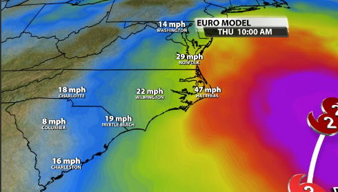
While it won't impact the East coast directly, many areas will be increased and dangerous rip tides and surfs along the coast from the waves that Erin is pushing out. Some of the Carolinas could also still reach Tropical Storm-force winds as Erin passes by.
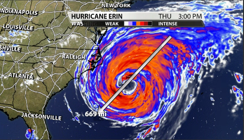
At its peak, while Erin weakens into a Cat 2, the general size of the storm grows exponentially to over 600 miles across!!


