One of the hardest forecasts to make each year is the one leading up to the Kentucky Derby. With so many people outside in one place all day, the weather becomes really important! And obviously the weather will dictate some of your fashion choices for outfits you may have been planning for months by this point.
This week you will see the forecast leading up to the Derby continue to change a bit, and you've probably already noticed it changed some through this weekend. This post explains why, what's so tricky about this year's weather pattern, and what you can reasonably expect from the weather leading up to the most exciting two minutes in sports.
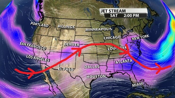
Jet Stream
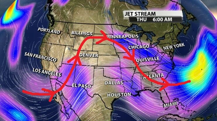
We start by looking at the top levels where we study weather - the jet stream. To provide some context, this is roughly where commercial airliners fly. As you flip back and forth between the two images above, you'll see the Omega pattern drawn on top of the jet stream. It's named that way because it resembles the Greek letter omega, and this setup happens when there's a low pressure to the west, a high pressure more central, and another low farther east. That causes the wind to curve around these pressure centers in a way that sort of looks like a Greek omega.
That's the large-scale flow pattern setting up above our heads this week that drives the weather we feel down here at the ground. As long as that Omega block holds, we will hold on to similar weather here (meaning no big changes). Now let's dive into what means for our weather this week.
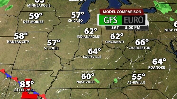
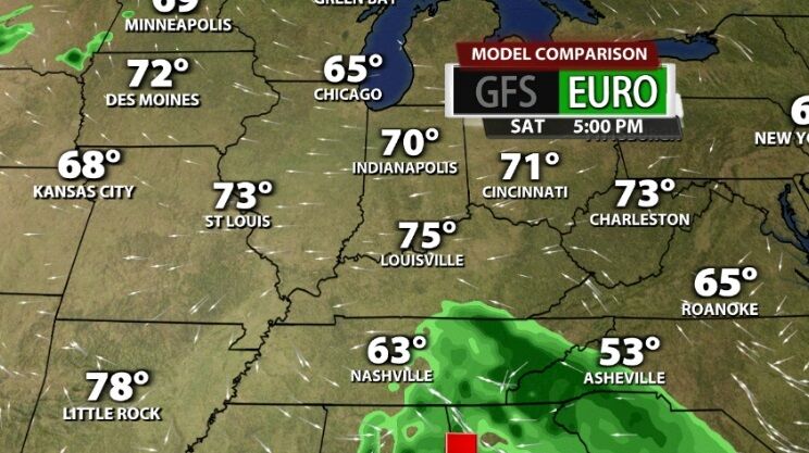
GFS
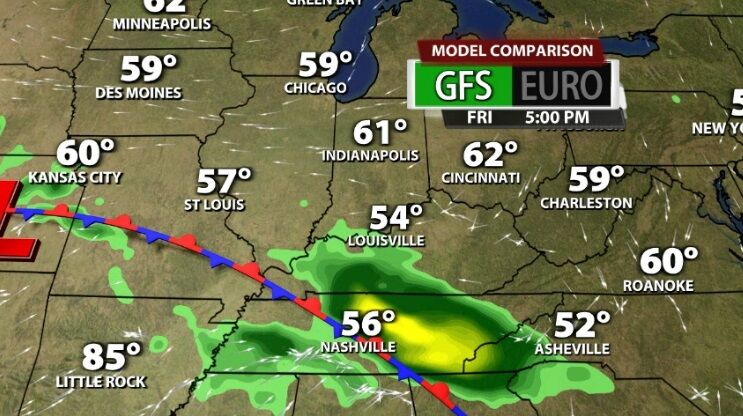
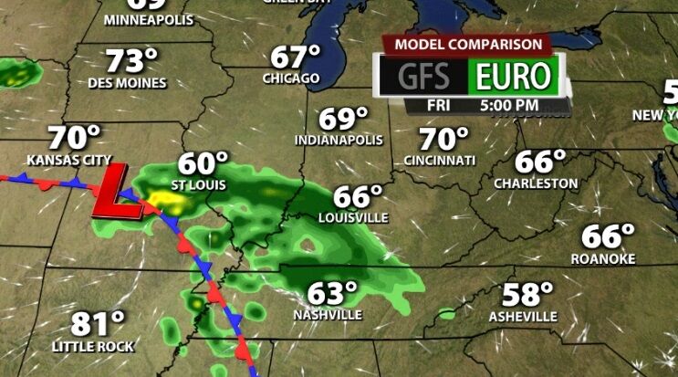
The pair of images above are the GFS or "American" long-range forecast model, and the ones below are from the European model. In both sets the first image is what the model is forecasting for 5 PM Friday and the second is 5 PM Saturday. We use these to make comparisons and see pattern developments, not to promise rain or dry this far out at 5 PM Saturday.
The GFS shifts the front and the disturbance bringing the rain farther south faster than the European does. That's largely driven by how the jet stream is evolving and where the fastest wind (jet streak) is setting up in each of these models. The Euro is more progressive with the omega block at this point, meaning is moves weather patterns through more quickly and starts to show the pattern changing the following week. The GFS is not as progressive and doesn't show that omega block breaking down for another week. Right now these different ways the pattern plays out will be the difference between rain vs. no rain for Oaks and Derby and between high temperatures near 70 vs. near 60.
Euro
As we get more and better data on how the jet stream is actually moving and where these centers of low pressure are actually developing, the forecast will get more accurate. If we never changed the forecast from what we first put out last week, it would not be an accurate picture of what we expect to happen. And we've all heard the joke about Meteorologists getting paid to be wrong, but our forecast accuracy is in the high 80% to 90% range. That's an A or B on a test, so you can trust you're getting a good forecast. When the forecast changes, it's because we feel more confident something different will happen. It's not because we're trying to make changes so you'll watch TV more. We will continue to update the forecast this week to give you the best idea of what to expect from the weather at this year's Run for the Roses.


