

The system expected to bring a winter storm to our area has officially entered the continental US, which means data from here on out will be more reliable! We will know a lot more by this evening! For now, here's what data is showing as of Saturday morning. Prepare for the storm, but please don't panic. It would be so much easier if we were just getting pure snow, but it becomes far more complicated when you add sleet and freezing rain into the equation. Let me walk you through this hour by hour so you know when to expect the worst.
Sunday
The timing is nearly the same as it was on Friday. Snow starts to roll into our area between 7AM- 10AM Sunday morning.
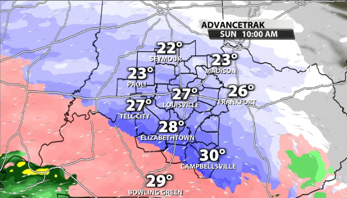
As we progress closer to late morning and near the noon time frame, we start switching between snow and sleet as warm air starts to infiltrate the atmosphere about a mile above our heads. As we rock back & forth between snow & sleet, we refer to this as sleet contamination because the sleet really cuts back and eats away at snow potential. Remember, sleet is an ice pellet that refreezes before reaching the ground and bounces off the surface.
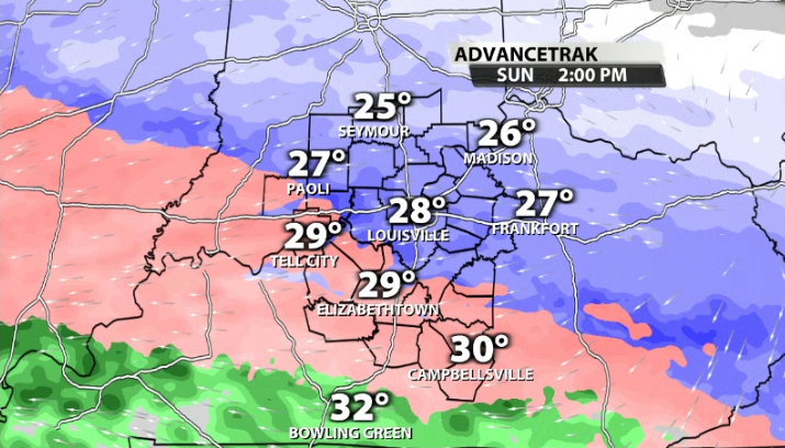
By mid to late afternoon, we start to transition to the most impactful winter precipitation, that being freezing rain. Freezing rain (in most models), lasts through the evening and into the overnight hours.
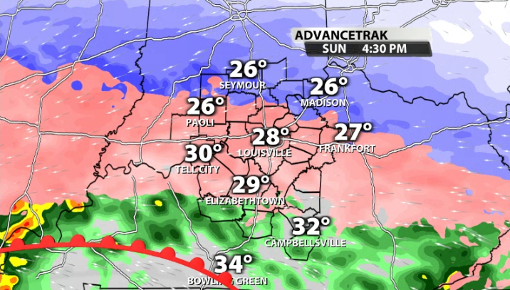
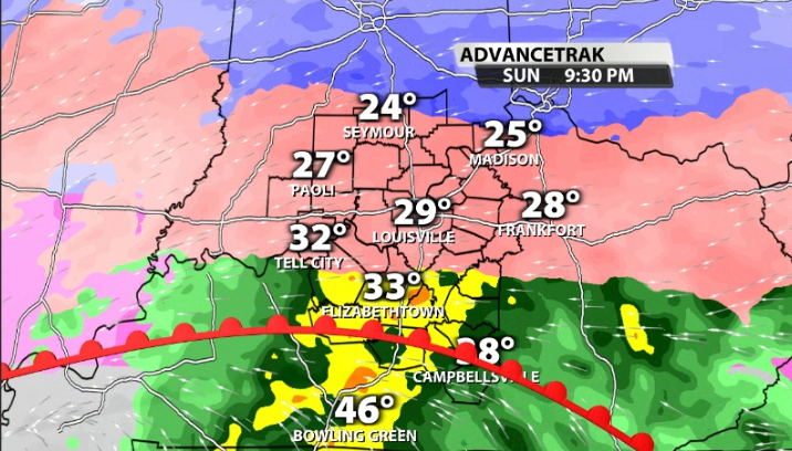
While the intensity of freezing rain is pretty heavy to begin, it could lighten up the later into the evening and night we go. While that may sound like a good thing, it's really not when we talk about ice accretion. Heavy freezing rain makes it more difficult for it to stick and accrete on power lines and trees. When the rain is heavier much of it runs off without freezing on contact. However, when it becomes lighter, more is able to accumulate.
There will be even more precipitation variability to our south where it's closer to the warm front and temperatures at the surface are closer to freezing.
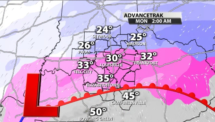
Monday
As the night wears on, the precipitation type remains in the same exact zones, however, it becomes lighter after 2 am which allows the ice to build up on trees and power lines as we previously discussed. The winds also begin to get stronger as gusts range from 30- 35 mph. That combination is not good when in comes to keeping the lights on. You need to have a plan in case you lose power because we may not get above freezing for 125 to 150 hours.
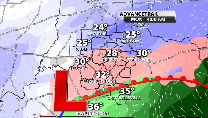
Just to be clear, scattered to numerous power outages are possible, especially in areas where the lines are above ground. Around 7 am Monday is when we switch from the wintry mix back over to pure snow. Don't forget that a layer of ice will be hiding beneath the snow.
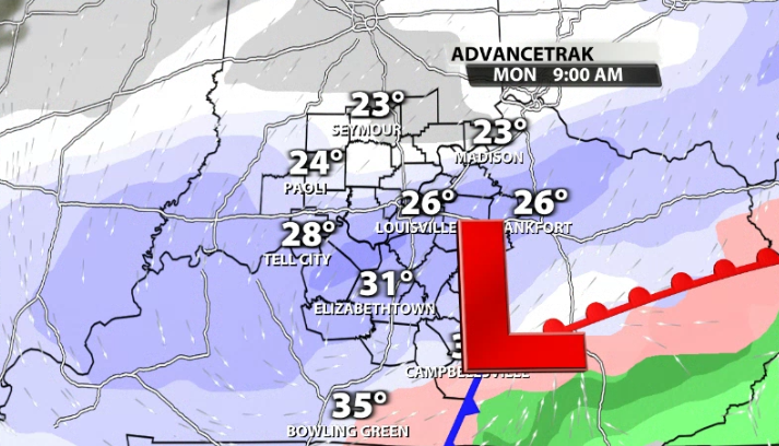
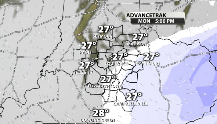
This snow on Monday will likely last for a good chunk of the day with the heavier snow being in the morning. By late afternoon, we start to dry off. Again, try not to panic, because this isn't an "end all be all" storm, but we will likely see a lot of travel impacts through the rest of the weekend and into Monday.
We will have more updates all weekend long and will be covering what is happening on the ground on WDRB. Stick with the WDRB weather team as we continue to track this system!
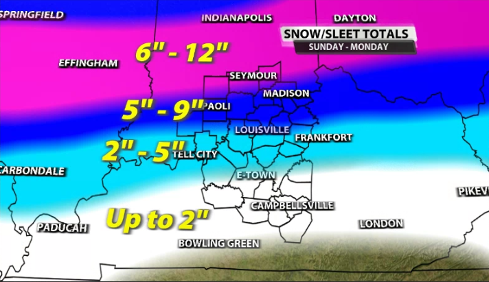
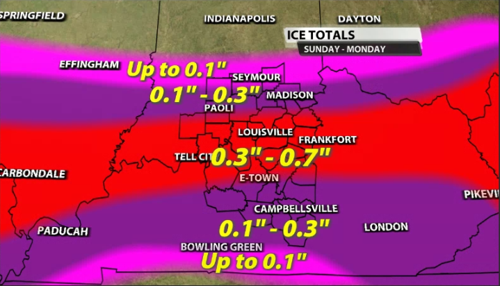
Totals
Here's what we have as of 10AM Saturday morning. Pick out your location on the map and follow the legend to see the range in your location. Please don't just look at the top number. Full disclaimer, there's so much liquid and so much energy with this dynamic storm that these numbers are going to change. Keep checking back with us all weekend for updated snow and ice totals!


