We have now made it through the coldest part of this winter storm! Temperatures (and wind chills) will stay dangerously low, but it does slowly get better from here. We all know this system brought crazy cold air, but you might be surprised at how some of these statistics stack up!
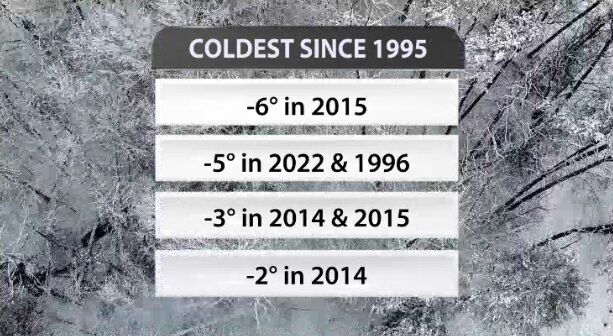
First up, the low temperature Friday morning. Louisville measured a low temperature of 5 degrees below zero. That's tied as the second coldest temperature Louisville has measured in the last 27 years! You have to look back to 1994 to find colder air.
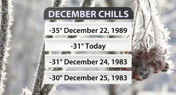
Similarly, the coldest wind chill from Friday morning tied as the second coldest December wind chill on record in Louisville at -31º.
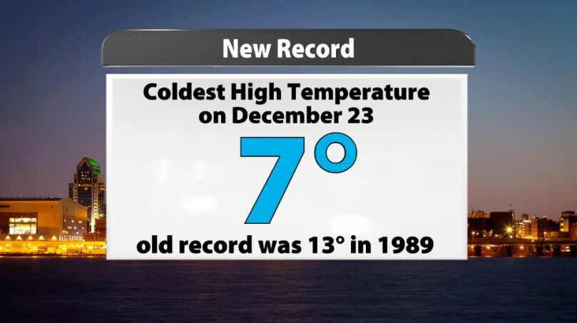
The highest the temperature ever reached Friday was 7º which happened at midnight between Thursday and Friday. That is now the new record for coldest high temperature on December 23 in Louisville! The old record was 13º and was set back in 1989.
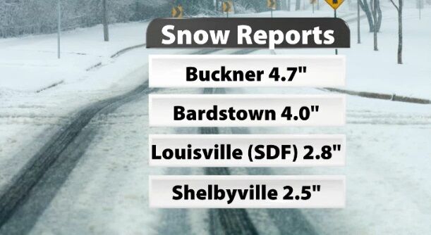
Obviously the same storm also brought snow which has caused some big issues on roads around our area. We didn't get as many snow reports from this storm as normal, and we are glad so many of you stayed inside during the worst of it instead of getting out to measure the snow. Above are a few snow measurements from around our area, and the map below shows the preliminary snow reports collected by the National Weather Service office in Louisville.
Here's a PRELIMINARY snowfall map based on reports we've received this morning. We have some gaps in our reports across central and southern Kentucky, so please let us know what you've seen so far this morning! #kywx #inwx pic.twitter.com/Tt8iGmmEnV
— NWS Louisville (@NWSLouisville) December 23, 2022


