
*Snow Update*
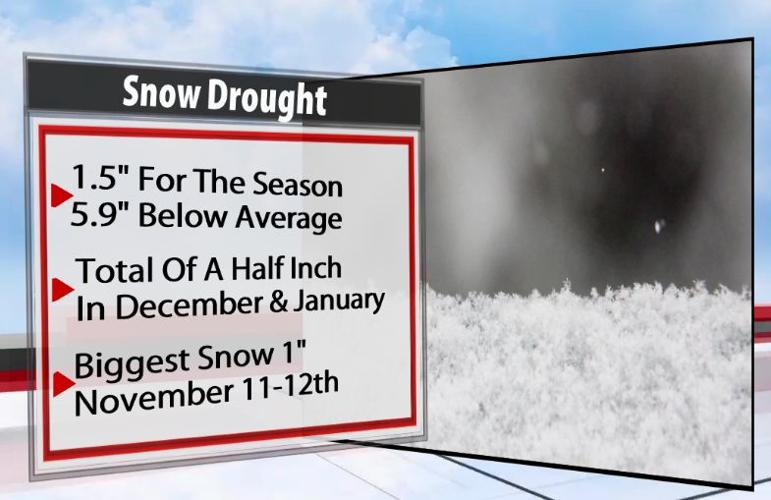
Up to this point we haven't been able to buy a snowflake this winter. Looks like that changes tonight. If Louisville gets a half inch of snow that will equal what we saw for the months of December and January combined.

Scattered snow showers develop late afternoon & early evening. These aren't expected to have any impact on travel.
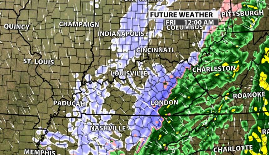
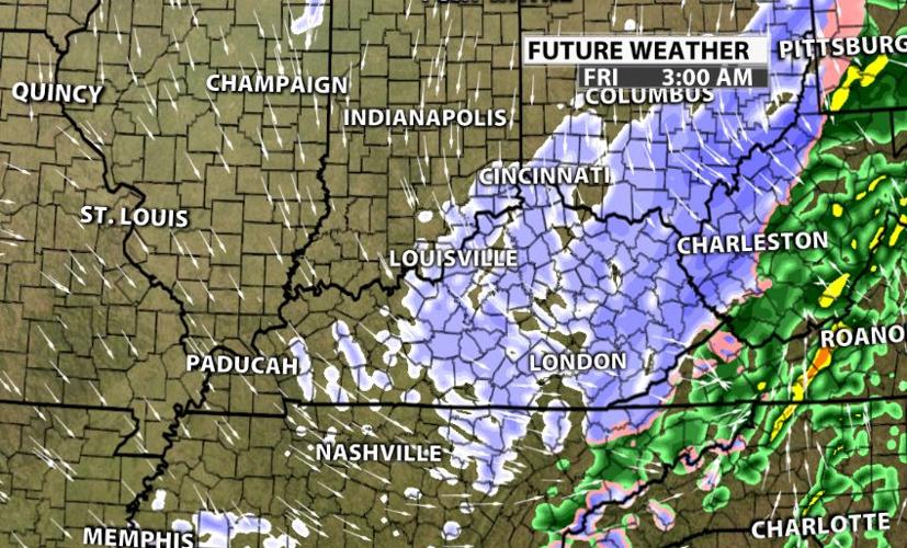
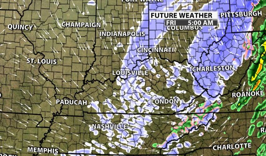
Steadier snow gets going between midnight and daybreak Friday. This is when most of the accumulation is expected.
This event will *MOST LIKELY* prompt a winter weather advisory for much of Kentuckiana.


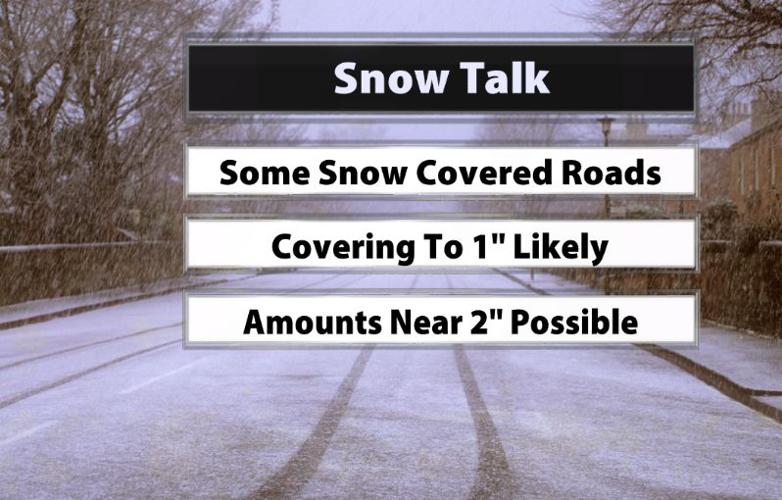
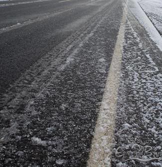
Since the snow is falling at night and pavement temps are colder, some of it will stick to untreated roads. This doesn't appear to have a high impact on interstates. I'd imagine it's a bigger concern for bridges/overpasses and residential areas.
Most areas should expect a covering up to an inch by Friday morning. A band of snow that could have higher totals closer to 2" is *POSSIBLE* If we get the higher totals they are more likely to occur between I-65 and I-75 in Kentucky.