

July in our area this year was an interesting one. After the second wettest June on record for Louisville, July followed up with a whopping 7.18" of rain when we only average 4.05", making it the wettest July in 11 years! While it was a very wet month, it really wasn't that much of a hot month for July standards. Based on average high and low, we actually ended up exactly average for the month of July. For high temperatures alone, we actually ended up a little over a degree below normal!
So, what does August have in store for us?
TEMPERATURE
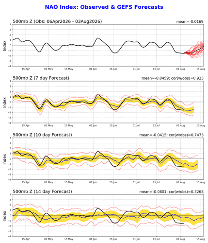
The biggest influence on your outlook, especially through the first half of the month, is the North Atlantic Oscillation. The NAO is a teleconnection that has a major impact on our weather. A teleconnection is a large scale pressure change in one place that leads to a change in wind pattern and thus influences change in temperature and/or precipitation somewhere else. For example, the NAO describes a pressure change over Greenland and another one over the central Atlantic, but it will change our temperature pattern here in Kentuckiana.

NAO has generally been around zero for several months meaning a generally cooler/near normal Eastern United States. A negative NAO sets up a block in the north Atlantic creating a trough in Eastern Canada. We need that block to be particularly strong for it to influence us this time of year. Right now NAO is trending negative, but it may be a short-lived negative. The graph at the bottom of the picture above looks farthest into the future, and it shows the NAO likely to turn positive again by the end of August. So a quick negative turn before going back positive likely continues the slightly below normal temperatures we've been seeing recently to a quick warm-up toward the middle of August.
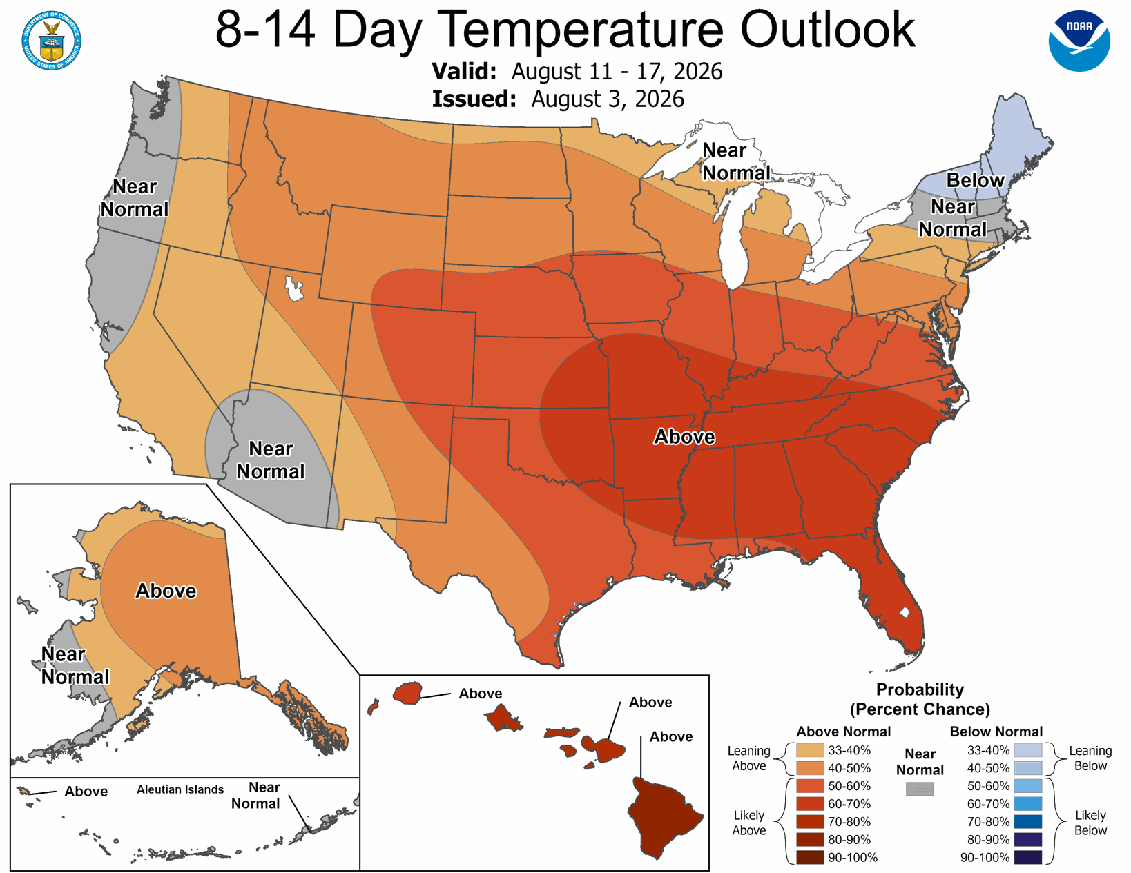
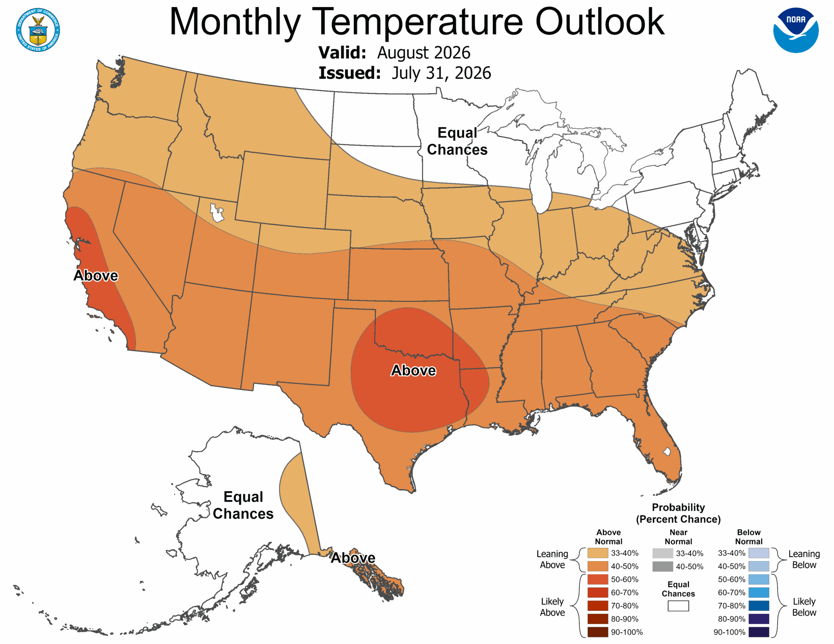
This makes the CPC's 8-14 Day outlook through the middle of August make more sense now, right? The monthly temperature outlook looks something similar, showing around a 33%-40% chance of seeing above normal temperatures for the month.
PRECIPITATION
When looking for pattern changes that would affect our rain chances, there is a bit of a trend perhaps for the first half of August. Wetter than normal...again.
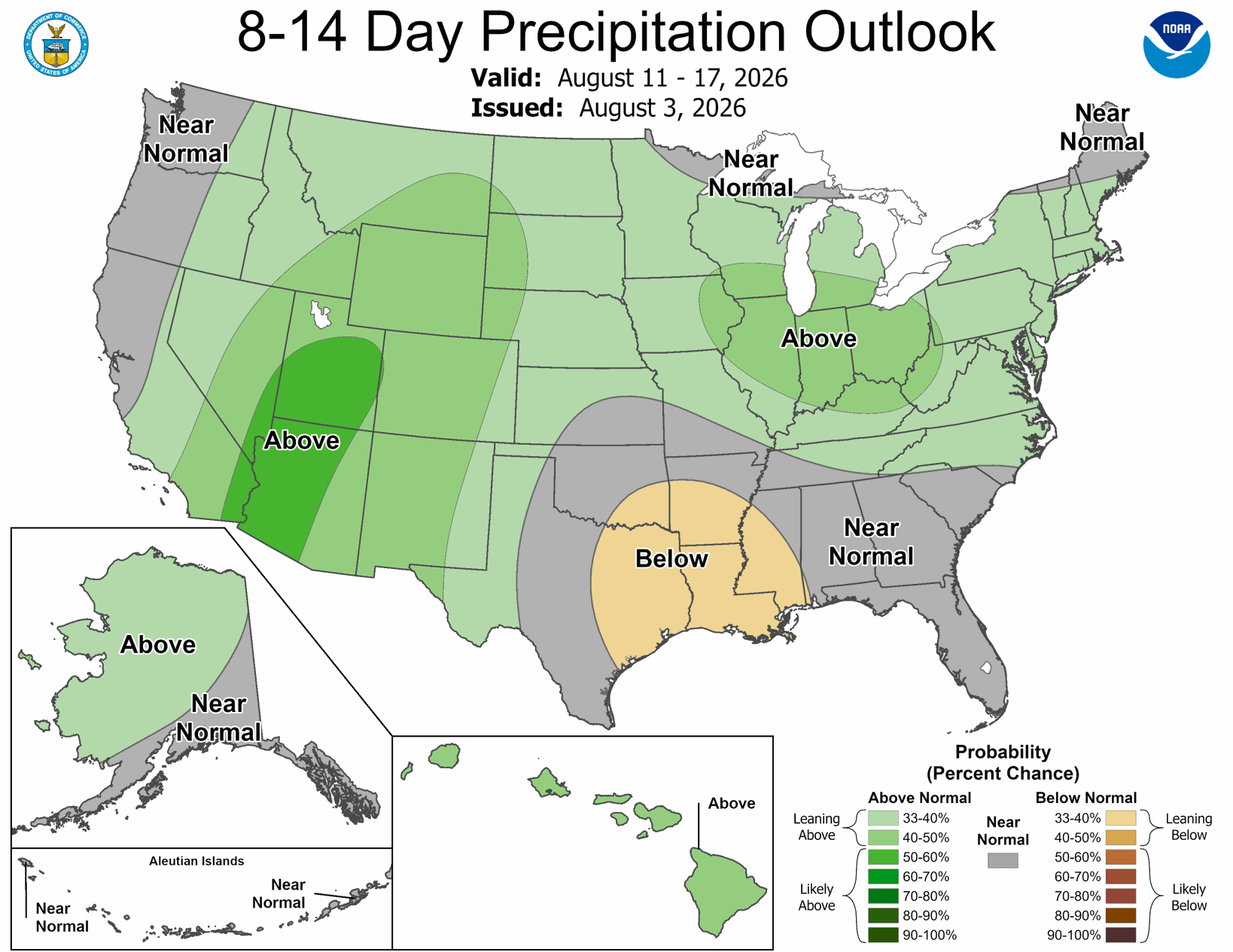
Note that the dates for that probability are only through the first half of August, when we're still NAO negative.
It's worth noting with the flow pattern influenced by a negative NAO, we will likely see more northwesterly flow which doesn't typically bring us a lot of rain. However, what it can do is allow weather patterns to become blocked and slow down over the Eastern US. That is what is in play for the first half of the month. For the second half as we start to go positive, that will build the ridge over the Atlantic and expand it over the Eastern US. That would bring us less widespread long-lasting rain.
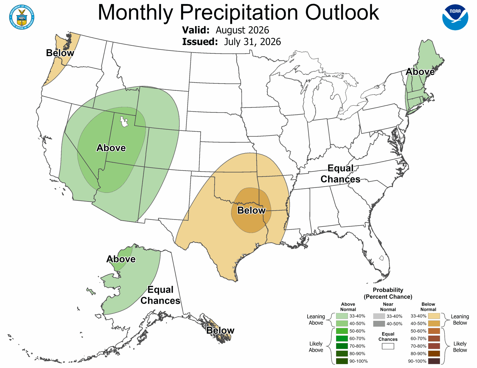
The Climate Prediction Center's precipitation outlook for August shows Equal Chances (EC) for either a wet or dry month, suggesting they agree we will likely be near normal. We will start wet so that will cut in to our overall number, but normal rainfall in August is 3.33" in Louisville.
Please note: long-range forecasting like this is one of the most difficult forecasts to make because so much can and will change between now and the middle of August, even more so by the end of the month. This discussion should advise you about patterns setting up, not specific high temperatures and rain totals to expect.


