Tuesday afternoon the National Weather Service office in Louisville hosted a conference call for their partners to discuss the next round of winter weather. While this call is actually about the next storm, we started with a brief discussion of why the forecast for Tuesday didn't pan out exactly as expected:
- dry slot - the "hole" that opened up on radar Monday afternoon
- too much warm air just above the surface (32*F-35*F) which caused the sleet instead of snow
We started with that discussion because what we saw Monday (and the limitations/errors in the model data) factor heavily into forecasting this next storm.

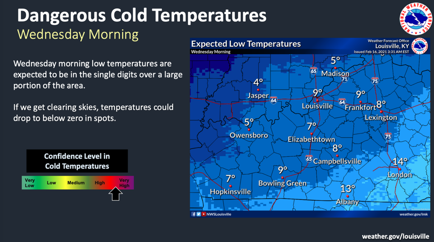
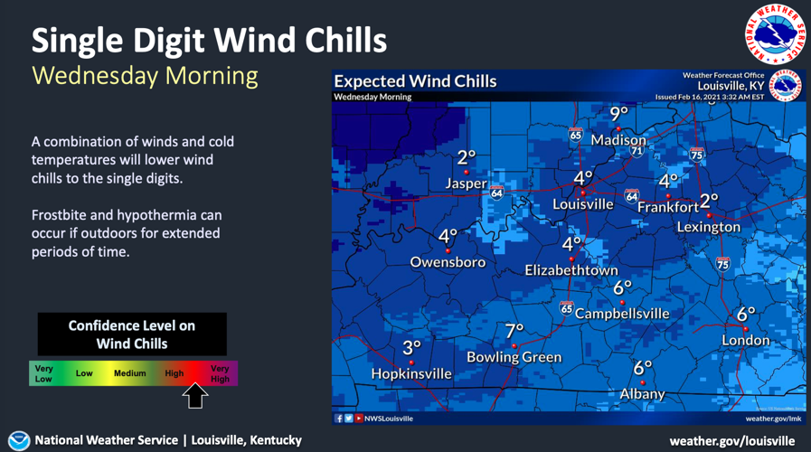
Tonight and tomorrow will be cold again; there is high confidence in that fact. In fact, the discussion went as far as to mention the threat of frostbite for people who have to be out in the elements for extended periods of time. Any clearing of the clouds tonight will allow temperatures, and consequently wind chills, to drop even farther.

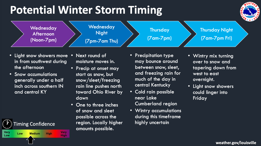
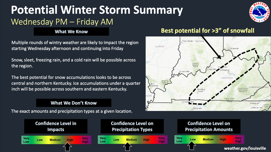
Then we turned our discussion to the main reason for the conference call - the next winter storm. John Gordon with the National Weather Service pointed out this is the third winter storm in just 8 days for our area. This one will affect more of our southern and eastern communities with the storm coming in from Texas. Initially moisture will spread across the whole area, but the NWS is expecting less than half an inch of accumulation from this first burst of energy.

After dark Wednesday the next round of moisture starts, first as snow but then mixing to snow/sleet/freezing rain. That will start in our southern communities and push toward the Ohio River by dawn. Confidence remains on the lower end regarding exact timing of the change in precipitation times and arrival of these different bursts, and the accumulation on Thursday is "highly uncertain," according to the National Weather Service. With that said, they did throw out roughly 1"-3" of snow and sleet from Wednesday night through Thursday.

Slight snow showers and flurries, like what we are seeing Tuesday, are likely again on Friday. The main burst of precipitation is expected overnight Wednesday, and the main concern is precipitation falling during commutes. At this point that would be Wednesday night and Thursday morning.
Already a few forecast models are suggesting the potential for another dry slot to form during this upcoming storm which would cut into the overall snow totals like what happened Monday. The placement of that dry slot is very hard to predict this far in advance, but that will be a factor we watch for in the coming days and include in our forecast discussions.

Looking just past this storm, Friday will again see incredible cold. Heading into the weekend there is a chance for rain, but the threat for flooding has dropped a bit since we last talked about this because we should miss the heaviest rain in that weekend system. We still need to think about what that rain means for potential snow melt over the weekend. During this call the National Weather Service also let us know they planned to issue a Winter Storm Watch for this event. You can click here to see who is included in the Watch.


