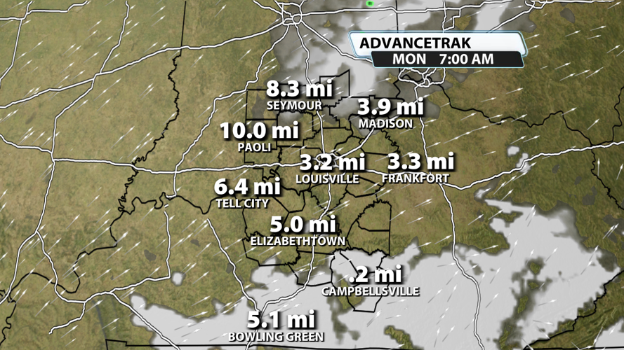

Tonight will be chilly with temperatures dropping down into the 30s area-wide. But the worst part will be the fog that develops late tonight and hangs around for the Monday morning commute. Based on the latest models data, quite a few spots across KY will have some moderate fog. The most likely area to experience dense fog will be places south of I-64 and east of I-65, specifically south central Kentucky.

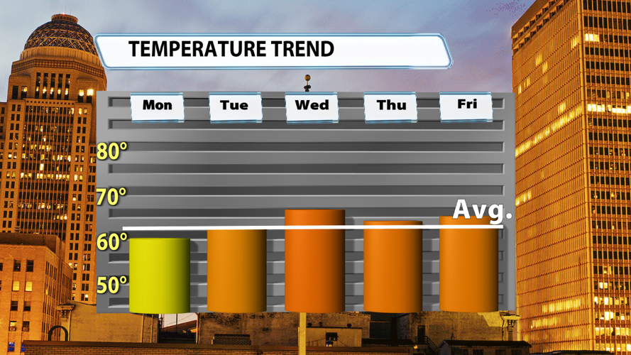
After 7 straight days spent in the 50s, our afternoon highs will make a nice rebound this week. We could touch 60 degrees in the warmest spots on Monday, but 60s become the norm for many, if not all, of us the rest of the work week.

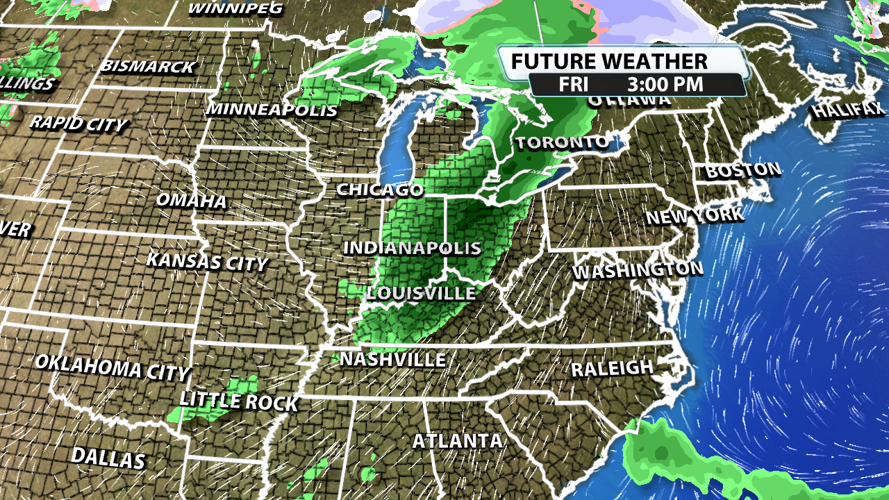
Rain is likely to end the work week as a cold front slides by on Friday. We don't have the timing nailed down just yet, but confidence is increasing in the overall setup and chance for rain to occur.

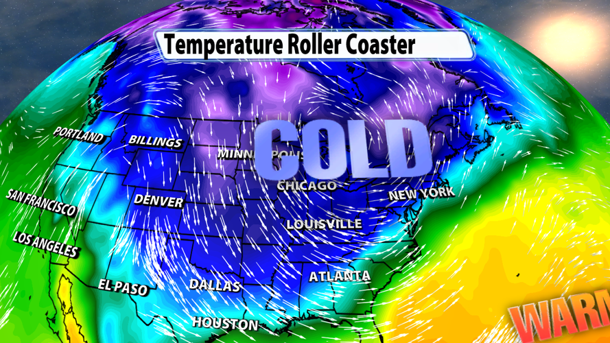
Cold air could take over the entire eastern half of the U.S. next weekend and early next week. It might not stick around long, but it will be quite a shock to the system after the pleasant days we will have had prior to it.


