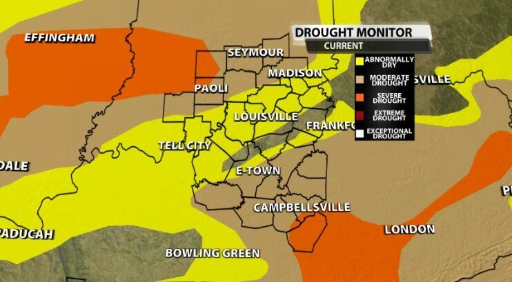
It's Thursday which means the new U.S. Drought Monitor was released this morning, and there has been slight improvement in our area!
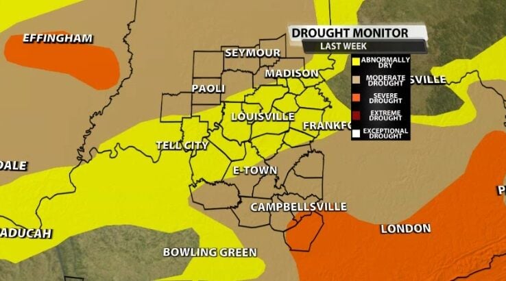
South of Louisville drought conditions have improved, going from Abnormally Dry to not being highlighted at all on the drought monitor. However, drought conditions have also worsened in our far northwestern communities. You can see the new orange shading indicating Severe Drought north of Paoli in the image below.
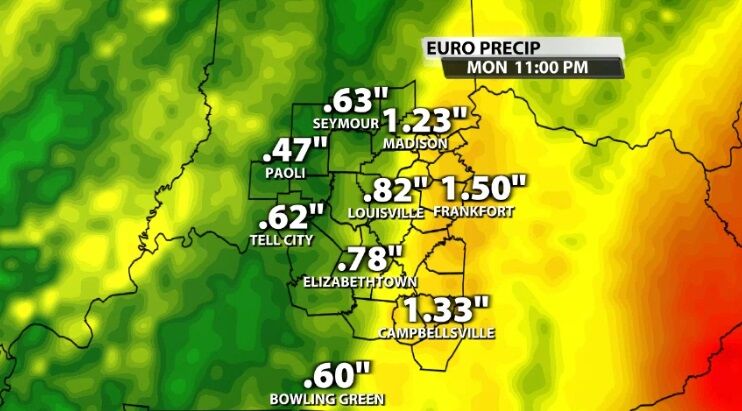
We will enjoy a couple more dry days before rain moves into our area Saturday night. That rain should be enough to help with these drought conditions, like the rain we saw last week did. A pair of low pressure centers will move toward us and combine east of our area to bring continued moisture through Sunday and potentially lingering into Monday.

With that placement, we expect the heaviest rain in our area to be in our eastern communities with lower rain totals to the west where the rain will be lighter and end earlier.
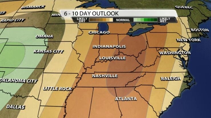
This rain is especially positive because the extended range forecast looks dry. The map below from the Climate Prediction Center looks six to ten days in the future and shows a high likelihood of drier than normal conditions.
Tune into WDRB News to see our latest forecast including any future rain chances to help alleviate these drought conditions.


