

Unfortunately we are not done with severe chances in our area despite what we went through on Friday night. Every storm is different though, so let's dive into what the data is showing so far for Tuesday.
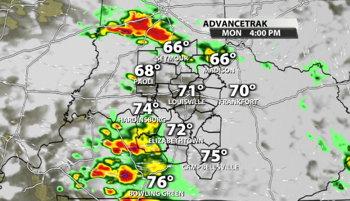
Storms will actually begin on Monday, but we have a very low threat of severe weather. Could a few storms on Monday pack a punch? Sure, but chances climb much higher by Tuesday.

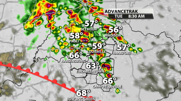
Tuesday starts off with a warm front rolling through our area. Along this warm front, strong storms are possible for the first half of the day as it lifts its way through our area. These storms come with a spin-up chance, but since a lot of these storms will initially be elevated, these will mainly be large hail producers with a lot of heavy rainfall and lightning.
After that warm front rolls through, our surface storm energy climbs and strong storms become possible right through peak heating of the day.
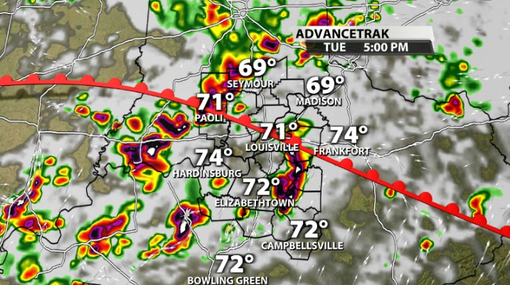

You can see there are numerous waves of when strong storms could be possible. These will come with damaging wind gusts being the main threat, followed by hail and once again, another spin-up tornado threat.
When we look at what's needed for severe weather, we do have plenty of storm energy available as dewpoints climb into the 60s & 70s as we warm up.
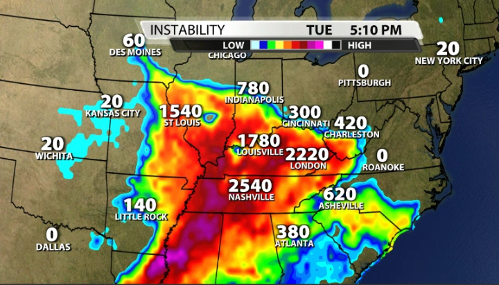
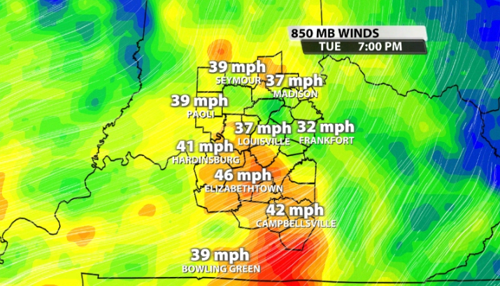
Having storm energy though is of course not the full equation. We need wind energy; specifically, we look for 40mph winds at the 850mb level (about 1mi above the ground) to support organized severe storms.
Most data shows that we do climb just over that threshold for Tuesday, but we don't exceed it by a crazy amount. Still, it is enough wind energy to support severe storms.
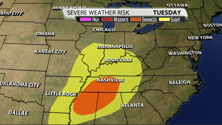
The SPC this morning has our entire area under a Slight (2/5) risk for severe storms on Tuesday with an Enhanced being placed to our south near the KY/TN border.
Many of you may be wondering how this compares to what we just saw on Friday night. As of now, our atmosphere will not be as volatile as what we saw on Friday. However, it doesn't mean strong storms are not possible. We'll continue to watch the trends in data over the next 48 hours as we nail the nitty gritty details for Tuesday.


