

Let's talk about this weekend....It has received a LOT of attention on social media. The majority of that attention has been non-scientific model data runs that have puked snow totals on a map for you to see.
Here's the problem...we're still 5 days away from this potential system reaching our area. It is way too early to discuss exact snow totals for our area or even a lack thereof. Specifics like that this far out are impossible, at least accurately.
Ok...so, what DO we know?
Ok ok so snow totals that are being shown 5 days out are pretty bogus. We got that. What DO we know then about this weekend?
To put it simple, we know that a large scale winter storm system is likely heading toward the south/southeastern US. It will likely have a lot of moisture with it and will likely put a lot of snow/ice/rain down somewhere along it's path. The question is WHERE.
What is the data showing right now?
To accurately make a forecast is not to look at computer model data then puke that stuff out on social media. Even a chance at accuracy begins with understanding why the data shows what it does. The EURO shows snow in our area and the GFS weather model does not. Why?
The GFS model is much further south with this system producing snow than the Euro is. This comes down to what is generating the snow. This looks to be a jet stream induced precipitation band on Saturday, not a strong surface low pressure. Why does that matter?
Well often during the winter, we can use history to help us determine the track of storm systems. For example, often with a winter setup with a low pressure, it will often go under and around our area, then ride up the spine of the Appalachian mountains. Since this isn't based on a strong surface low pressure, we cannot rely on that.
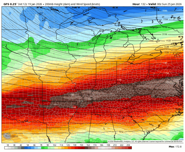
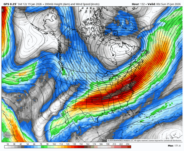
GFS Jet Streak
So we're looking for a jet streak in the data. The GFS and Euro both show it, but in different spots. THAT is the difference. A jet streak is an area in the jet stream where you can generate favorable lift and rising motion, needed for snowfall.
We look at the GFS and note the jet streak (brick red) is location in southern KY to southern MO. That puts the favorable right entrance moving through Tennessee.


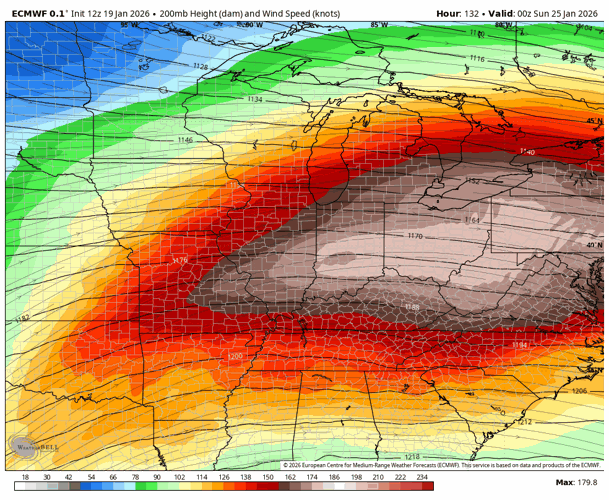
Euro Jet Streak


So why does the difference exist? First we must understand what the jet stream is. It is a thermal wind meaning it locates itself over the largest temperature gradient.
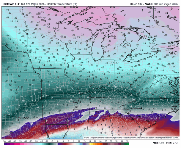
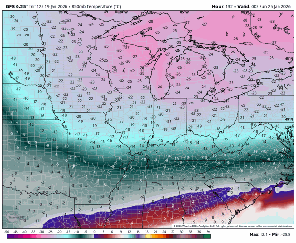
GFS Temperatures
Now we look at the temperatures about 1 mile above the ground. This gives us a good idea on how far south the arctic air will go. This can push the system further south and away from us if it goes far enough.
The GFS is notably colder at this level over the Ohio Valley. Notice the temperature aloft in Louisville is -15C. That puts this massive temperature contrast over southern KY driving the jet stream (and streak) south.

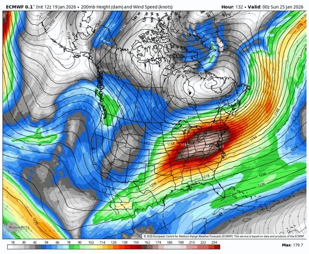
Euro Temperatures

Potential Paths Of Storm System
So with all of that in mind, what are the possible paths this thing could take? Remembering what we just talked about the GFS, how the arctic air pushes further south, and how the jet streak is also more favorable in southern KY and southern MO, the GFS for now has most of the snow going south of our area and missing a good chunk of us.
Now remember what the Euro was showing. The all important right entrance of that jet streak being right over the Ohio Valley and southern Indiana, and the arctic air not pushing as far south. The Euro is more favorable for snow accumulation (some heavy) because of these factors.
Summary
So, is snow accumulation possible in our area this weekend? Yes. Could some of it be heavy? Yes. However, not everything shows this. Some data, like the GFS show little to nothing for our area. The trends with the scientific reasons on how and why the path of this system changes will dictate who sees what. We will watch the trends the next few days as the path alternates some before looking more deeply at snow totals by late week.


