
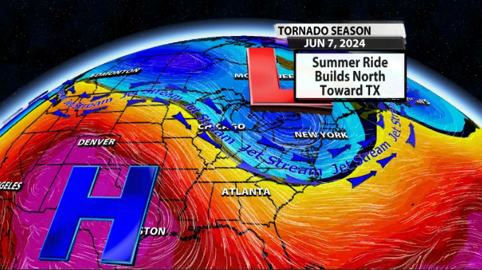
You may have heard us talk about a "death ridge" as a good thing to see in weather patterns because it means the worst of our severe weather season is coming to an end. Let's talk about what we look for to find that death ridge and why that brings an end to storm season.
A ridge is defined by the American Meteorological Society as "an elongated area of relatively high atmospheric pressure, almost always associated with and most clearly identified as an area of maximum anticyclonic curvature of wind flow." In plain English a ridge is a large area of high pressure. Think about a high pressure center as an area where the air in the atmosphere is moving down, applying a slightly higher amount of pressure to the surface of the Earth. We use the title "death ridge" to refer to a strong, long-lasting ridge that switches our weather pattern. Chief Meteorologist Marc Weinberg puts it in other words:
"...storm chasers for decades have called onset Summer the "death ridge" because of the end of the Southern Plains tornado season. For us, a "death ridge" means the onset Summer or the beginning of a weather pattern where the jet stream lifts northward. When this happens, our traditional tornado season ends and we move into MCS (straight line wind) storm season."
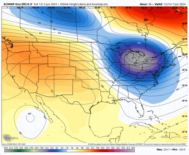
The image below shows that ridge building over the eastern United States. Notice the high pressure around the Southwestern US? That's the ridge building! This image is from the EURO ensemble mean on June 7th, which is this Friday!
Here's what that looks like in model data starting on June 7th when the ridge starts building over the desert southwest.

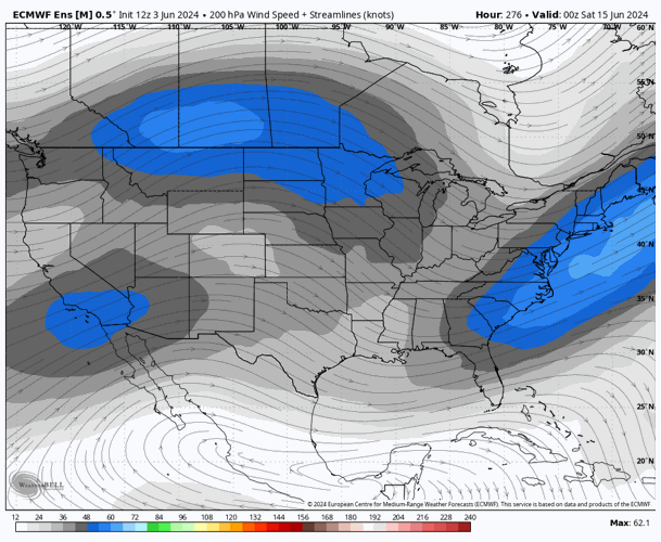
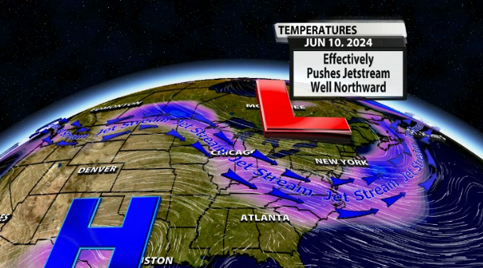
Something else we can look into the ensemble data and see is the jet stream weakening over our area significantly and lifting further North. You can see the winds over our area by the end of this week have fallen off a lot. The stronger winds in the jet stream, as mentioned, are further North heading into late this week.
Here's what that looks like in model data looking further into the future:

This "death ridge" doesn't mean we never see another thunderstorm or tornado. Instead it transitions us away from large-scale severe weather outbreak days supported by upper-level wind and into MCS season. MCS stands for Mesoscale Convective System meaning we would see smaller-scale storm threats that mostly bring strong wind, not as many tornadoes.


