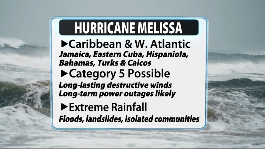
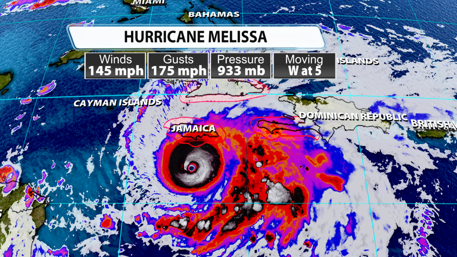

What is about to be the storm that will dominate headlines of the 2025 Atlantic Hurricane Season is about to make landfall in Jamaica in roughly 36 hours. This will be a catastrophic situation for the people of Jamaica and a very intense situation for other Caribbean and Western Atlantic Islands.

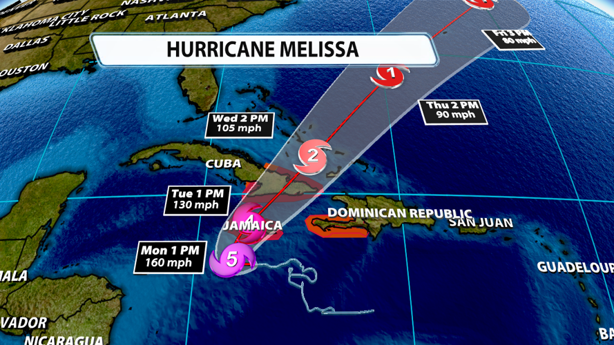
Hurricane Melissa has sustained winds of Category 4 strength at 145 mph with gusts of 175. As if the intense winds aren't bad enough, the storm's slow, westward movement at 5 mph will exacerbate the problems for Jamaica. This will make for long-lasting destructive winds and long-lasting intense rainfall.

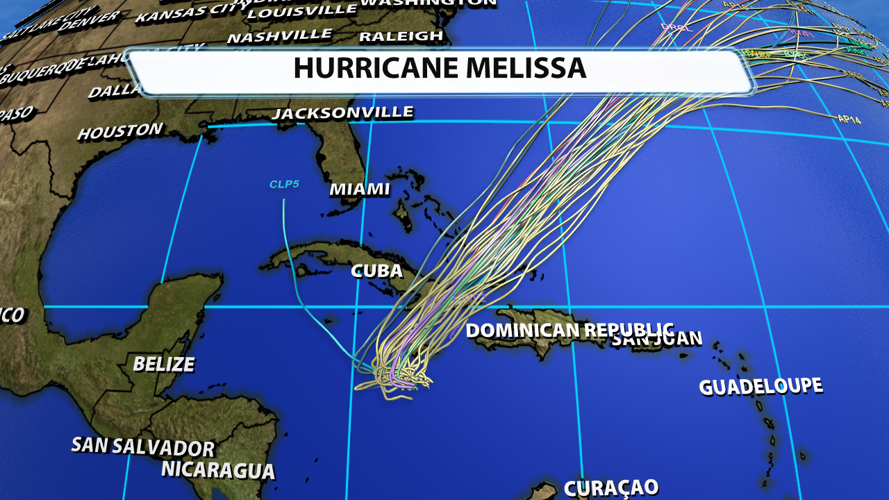
The storm will make a northerly turn on Monday and eventually head northeast Tuesday through the end of the work week. It will probably weaken to category 3 status by the time it makes landfall in Cuba and weaken further before impacting the Bahamas.

There is still some uncertainty about when Melissa makes its turn to the north. The farther west it goes before turning, the worse the rainfall and wind impacts will potentially be for more people in Jamaica. At this point, the storm's official track does have it going a little farther west than what was forecast yesterday.

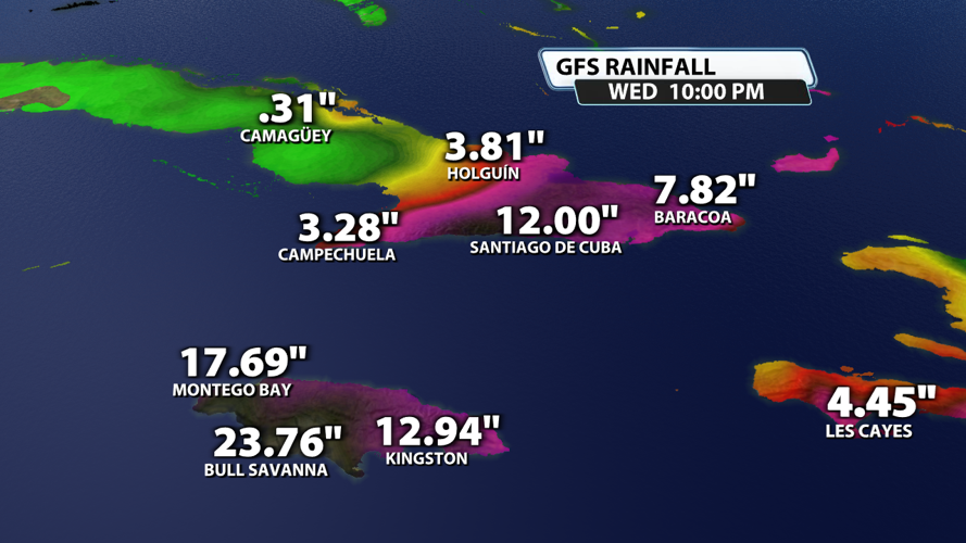
Rainfall amounts in the Caribbean will be extreme. Models show a wide swath of 15" - 30" of rain possible for Jamaica. Some even indicate more than 40" of rain in the inner-mountain regions of the island. This could end up being almost half of Jamaica's average yearly rainfall in just a couple of days. More than a foot of rain is expected in Cuba with lesser amounts likely for other Caribbean and Western Atlantic islands.

Impacts across the Caribbean and Western Atlantic will be extreme. Roads will be washed out, infrastructure will be demolished, power outages will be numerous, and some communities will likely be unreachable. Loss of life is anticipated.


