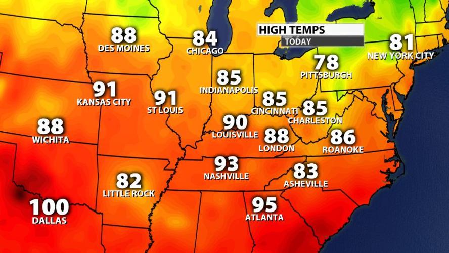

Saturday was another 90º day in Louisville, and this is just the beginning. Saturday was a relatively dry heat without tons of humidity, but as humidity climbs early next week, the heat will become more dangerous.

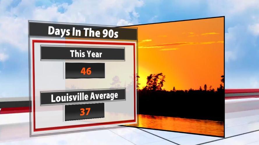
Including Saturday, Louisville has seen 46 days with high temperatures in the 90s this year and more days in the 90s are on the way. According to the National Weather Service, Louisville should only see about 37 days in the 90s based on climate statistics. 2010 saw the most 90º days on record in Louisville - 85 days in the 90s.

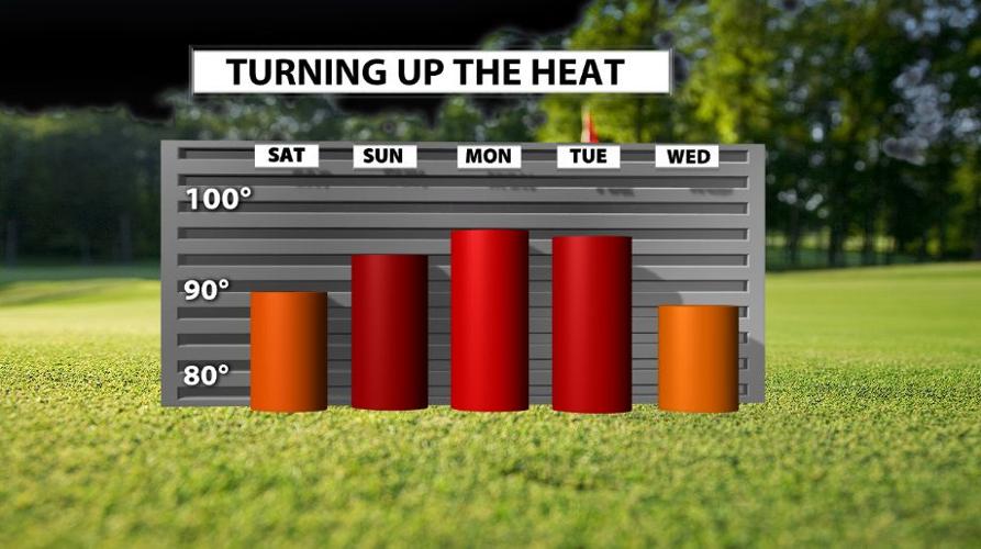
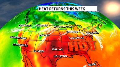
From here temperatures climb with the hottest air arriving Monday and Tuesday in our area. High temperatures will be in the 90s through that time period.

Humidity will be a little higher Monday but soars Tuesday. Monday is potentially shaping up to be the hottest day of the year, but the air will feel much worse Tuesday because we add much more humidity to the equation.

To answer the initial question of "is this heat normal," not really. We have seen more 90º days than normal; the high temperature should be in the upper 80s this time of year, but the majority of the month of July and what we have seen so far in August have been high temperatures in the 90s.

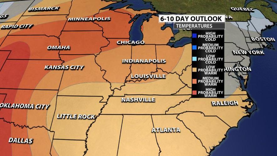
The Climate Prediction Center even shows Louisville is likely to see above normal temperatures for the next 2-3 weeks!


