
Now that the storms have left our area, we turn our attention to the chance for snow. While Sunday morning's snow chances have dropped to nearly zero, we might see more snow showers late Sunday/early Monday.
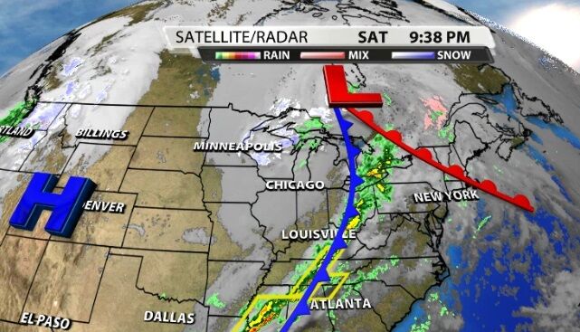
First thing Sunday morning, the chance for snow doesn't look good. The heavy moisture is still hanging in eastern Kentucky and the low pressure center hasn't moved far enough away for us to get wrap-around moisture yet. By Sunday evening, though, the wind has shifted enough around the Low to bring a few of these light snow or mixed-precip showers. However, if that wind shift doesn't happen or if there's not enough moisture left, we won't see these snow showers.
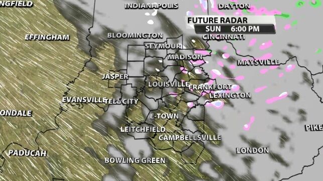
These are most likely east of I-65 and in our northeastern spots. Any snow you see would be the kind that looks pretty falling through the air but doesn't stick or stack up. The ground will still be too warm for any snow to accumulate. Tune into WDRB News Sunday morning for an updated look at any early flurries and if this snow chance still looks on track.


