


With all the talk being about this weekend, deservedly so, a quick hitting chance for some light mix snow/freezing rain/sleet could fly under your radar.
While this front doesn't have much moisture with it, if we get snowflakes or a little freezing rain Wednesday morning, that can bring impacts that could catch you off guard.
When?
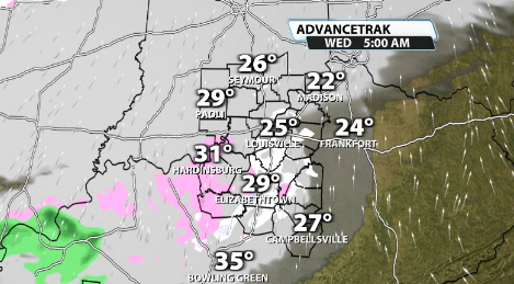
Data has this beginning before sunrise Wednesday morning, but lasting past sunrise and through the morning rush. We'll start to see some light snow/perhaps some freezing rain mix in around 5 a.m., especially south of Louisville.
This mix continues as the front moves on by and will continue to fall lightly until late morning and maybe until around noon.
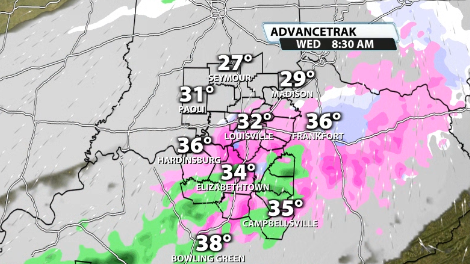
You can see during that time there's a little bit of a gungy mix going on, especially since we will be warming quickly through the morning.
Impacts
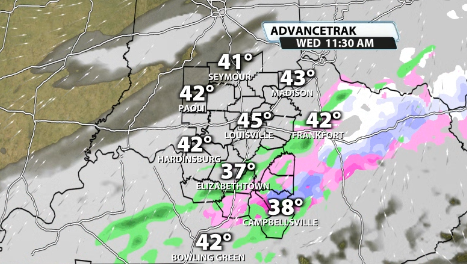
While we warm quickly through the morning, it's important to remember that the pavement temperatures are below freezing. So, for example, even if its a mostly rain mix, that rain can still freeze onto the pavement and cause slick conditions since it is below freezing.
Data Tuesday afternoon continues to show very light accumulations of spotty freezing rain, mainly south of Louisville, especially between Shepherdsville through around Hodgenville. While very light, any accumulation of freezing rain can cause issues.
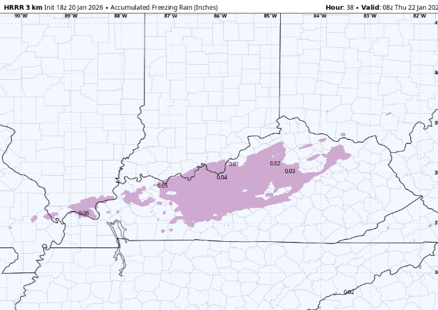
This is our forecast for potential light freezing rain accumulation:
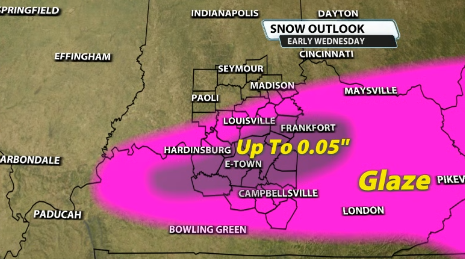
While the freezing rain accumulation is not a guarantee, it wouldn't take much to cause some traffic issues even if we just got a little bit. Therefore, it's worth mentioning. Any snowflakes that mix in there as well would also have the chance to stick due to the pavement in most areas being below freezing still.
The good news is that by the afternoon our temperatures should warm up into the low 40s, but specifically for the morning and perhaps midday commutes on Wednesday, to be watchful of that slick potential.


