

After a busy few days last week with 2 round of severe weather, we deserve the break we're getting now!
Unfortunately great things can't last forever. We've got more storm chances on the way before we get to some actual summer heat again next week!
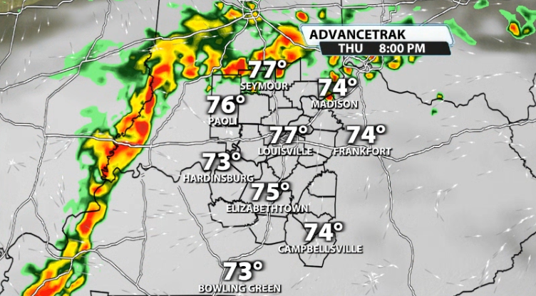
We are pretty quiet through Thursday morning. Once we get into Thursday afternoon, that's when things become a little more active. Data is showing storms rolling into our area after peak heating and try to using a good amount of instability and some wind energy to produce possibly a few strong to severe storms that evening. Depending on timing will dictate how strong storms then will/won't be
Then we do it again on Friday. Friday afternoon and Friday night carry another storm chance. This one will also have some wind energy with it and efficient instability. This once again could lead to strong storms Friday night/early Saturday morning.
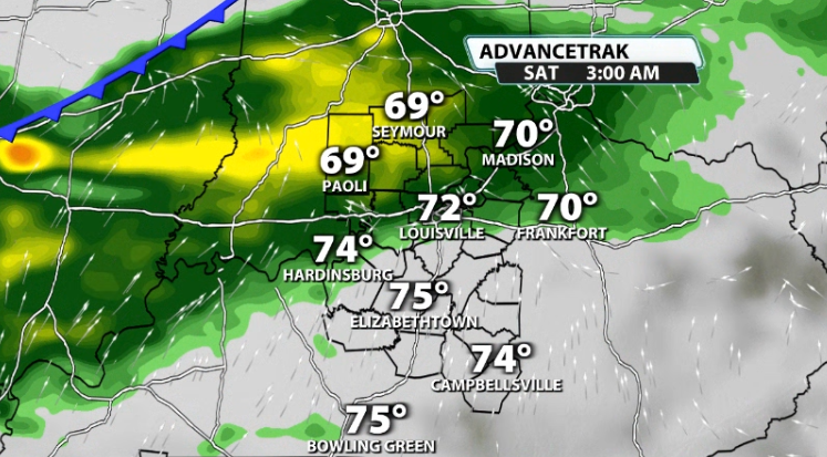
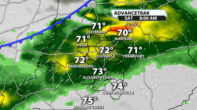
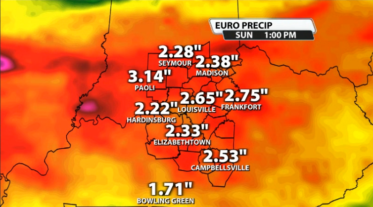
Storms will likely linger through part of the weekend, especially on Saturday as the boundary that has stalled over our area and has brought us all this mess, finally starts to get out of our hair. With that four day period alone, some data is showing an additional 2-3" of rain by the end of the weekend.
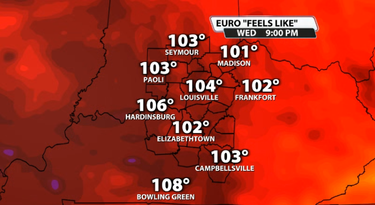
Once we get into next week, the heat is on! Ridging in the jet stream will allow for some actual summer heat to roll into our area again, with all of us reaching the low 90s and perhaps some of us reaching the mid 90s! Add in humidity into that and we're talking heat index values over the century mark!
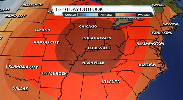
The CPC's 6-10 Day Temperature Outlook agrees and has us right in the bullseye for above normal temperatures over the next week to week and a half.


