

We're settling into a slightly more wet pattern than what we saw for most of the month of April. We need the rain badly though, with drought increasing across much of our Kentucky counties. The rain we got on Tuesday night will help some, but we're not done yet. More rain & storm chances are on the way and unfortunately that does include Mother's Day on Sunday!
While we could also have some storms late Friday night and early Saturday morning, the Mother's Day storm chance for this Sunday looks a little better than the end of the work week.
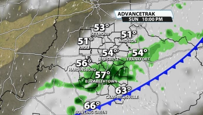
For now, it does look more like an afternoon/evening timing than it does early in the day. While this can change since we are still 4 days away, that would still allow for Mother's Day brunch to be good to go if that timing holds.
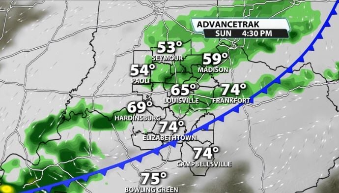
For now it looks more like those late lunches and dinners would be more impacted as storms roll into our area. Our temperatures will still be in the mid 70s more than likely, but of course with increasing rain chances in the afternoon.
Again, this isn't set in stone, but that storm chance is still a little more elevated for Mother's Day than the rest of the week.
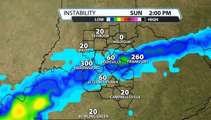
Here's the good thing, severe weather at the moment doesn't look like much of an issue. CAPE (storm energy) looks to be pretty limited which won't allow much to work with to make storms stronger. There is a little more "elevated" CAPE to work with, which can still allow for thunderstorms with hail, but without that being at the surface storms will be limited.
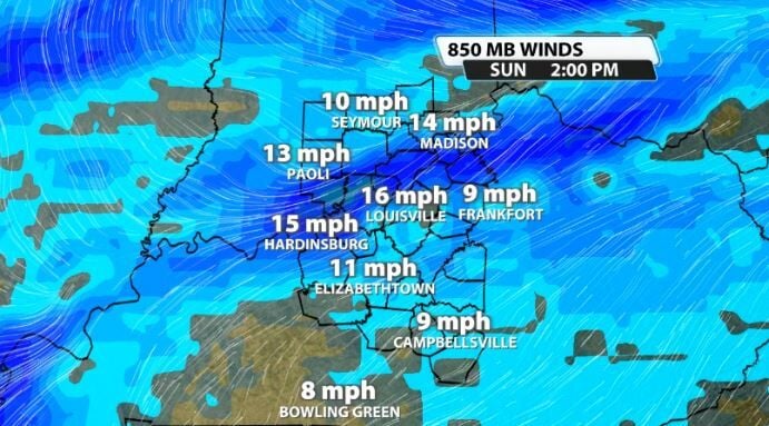
Also, the wind energy doesn't look impressive either. With that front on Sunday we still don't reach the needed threshold for winds at the 850mb level of the atmosphere (40mph), so that also will not allow for severe weather to develop.
This forecast will change some between now and Sunday obviously, so be sure to check back with the WDRB Weather Team for the newest timeline and rain chances for Mother's Day plans.


