A Severe Thunderstorm Watch has been expanded from our North and into part of our area in Southern Indiana. This includes Jackson and Jennings county for now until 5PM ET. This is a separate watch than the one I am about to mention below.
NEW Severe Watch Info
Now, a NEW severe thunderstorm watch has been issued for Scott, Jefferson(IN), Trimble, Carroll, & Henry counties until 8PM ET. Again, these are the locations with the best chance of seeing the storms this evening. If needed, this can be expanded.
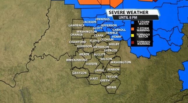
Here is the information attached to that new watch until 8PM:
* Severe Thunderstorm Watch for portions of
Southeast Indiana
Northeast Kentucky
Southwest Ohio
* Effective this Tuesday afternoon and evening from 235 PM until
800 PM EDT.
* Primary threats include...
Widespread damaging winds and isolated significant gusts to 80
mph likely
Isolated large hail events to 1.5 inches in diameter possible
A tornado or two possible
SUMMARY...A line of storms over central Indiana/Ohio will track
southeastward across the watch area this afternoon. Hot and humid
conditions and strong winds aloft over much of the watch area will
aid in the development of fast-moving storms capable of considerable
wind damage.
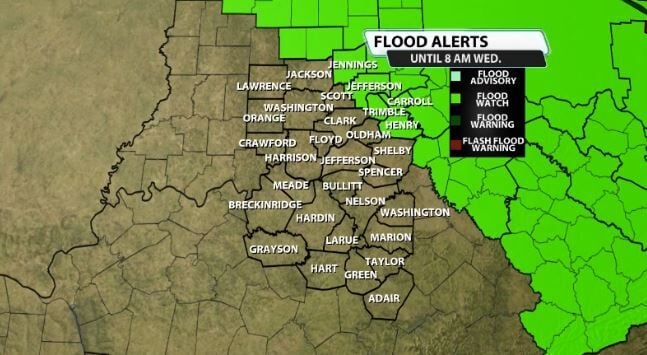
There is also a Flood Watch out for part of our area too. The counties that are included are the most likely to get clipped by the storms later this evening. Again, this could be expanded if needed. This is in effect until 8AM tomorrow (Wednesday) morning.