

No, this is not some lame, late April Fool's joke -snow is approaching the Ohio Valley tonight. This is also not the latest our area has ever seen snow! If you're curious about that, check out this post I wrote yesterday:
Don't panic - we're not predicting a major snow storm. But as a cold front comes through this week, it's possible a few snowflakes could mix in with the raindrops.
Now to the issue at hand: tonight's snow.
SETUP

A cold front is passing through our area today. That's why Indiana feels colder than Kentucky, but remember, the cold air doesn't arrive all at once. Over the next several hours, temperatures will drop significantly. That's a critical step in any discussion about a snow potential tonight considering how high our temperatures climbed this afternoon.

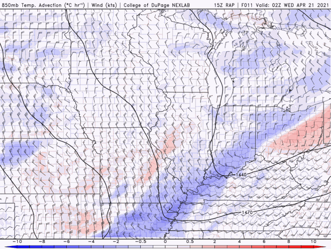
The image above is looking a little less than a mile above our heads at temperature advection. This shows us if the wind is bringing air to us that will be significantly warmer or colder - it just looks at how temperatures are changing with the wind moving. You can see the blue shades over our area which tell us cold air advection is happening above our heads. That means colder air is filling into our area above our heads. That's a critical piece to remember, too. This forecast hinges on how cold and saturated that air above our heads is, not just on what the surface temperature will be.

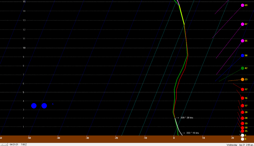
These three images come from Bufkit, a software program that helps us see a lot of the changes that are happening up through the atmosphere. The red line is the temperature, the green line is the moisture and the small section of purple or yellow is the "snow growth zone." The image above is at 11 PM Tuesday. The column of air is fully saturated - the red and green lines are right next to each other. But the temperature in the lowest 2000 feet is above freezing, and the temperature is actually very close to the freezing mark in the lowest 6500 feet. This image tells us snowflakes are forming and falling, but they will likely melt before they reach us. To us here on the ground, that just looks like rain.

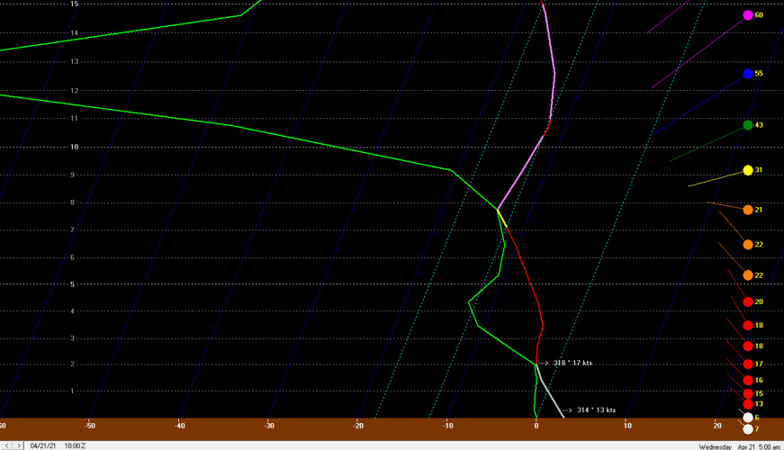
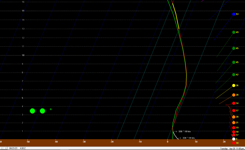
By 2 AM (the image above) the column has cooled and the surface temperature has dropped closer to freezing. Melting would likely only happen in the lowest 1000 feet, so we can get snow from a sounding like this one. The final image (below) is from 5 AM when the column is drying out. Notice how far the green line has moved away from the red line above 8000 feet. That's too much dry air to grow snowflakes, so we won't be getting snow anymore by this point.

TIMING
Using what we've seen in the information above about the air above our heads, now we look down to the surface to see what temperatures look like and when snow will be possible.

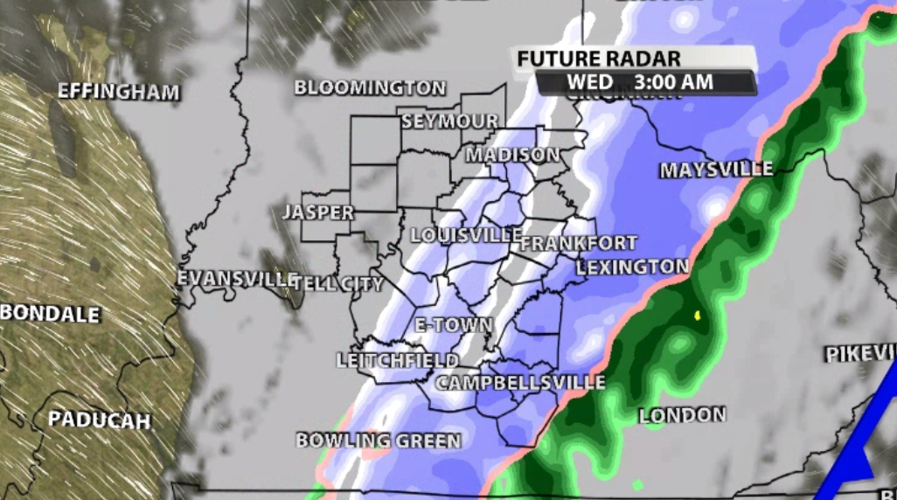
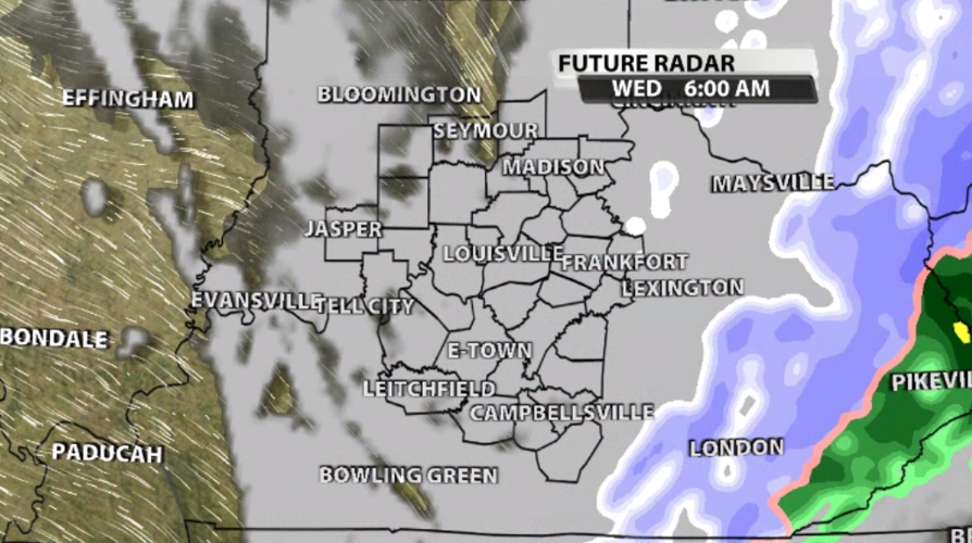
Light rain showers will start to pop up around the front near sunset, but the broader band of moisture arrives a little later. Between 7-9 PM our northwestern communities will start to see more of that moisture. It starts as rain then changes to snow as the precipitation helps to cool the column of air above us. That heavier moisture will arrive in Louisville around 10 PM - 12 AM and continue to move east overnight.

There will be plenty of breaks in the snow, and it will only be here for a few hours while many of you are asleep. By Wednesday morning nearly all of it should be well east of our area.

IMPACTS
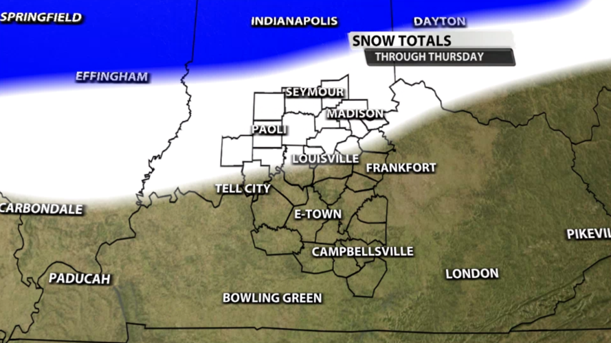
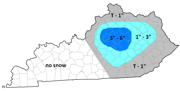
Any time snow falls from the sky, the number one question we get asked is "how much," so let's start there. Snow totals will be higher in central Indiana, and it will be hard to get snow to stick in our area because the ground is relatively warm. After two days of high temperatures at or near 70, no matter how fast the air temperature drops, the ground won't cool as fast.

With that in mind, most of you should see less than an inch of snow stack up. Minor accumulations will be most likely in the white shading through southern Indiana in the map above. Roads will likely be wet Wednesday morning and the air will be cold, but widespread road impacts here seem unlikely.

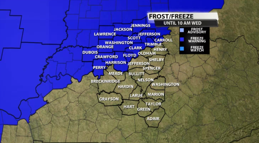
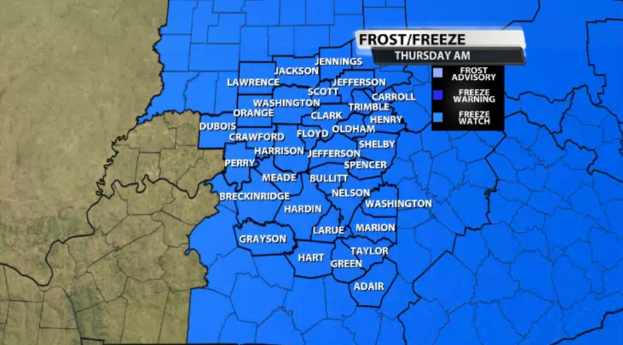
With all the cold air moving in, keep in mind there is a Freeze Warning in effect for basically all our Indiana communities Wednesday morning (the map above) and a Freeze Watch for Thursday morning for all of our communities (the map below).

If you're looking for more updates through the night, check in with Marc and Rick tonight on WDRB News at 10 and 11. They will be tracking the rain as it arrives, how quickly temperatures are dropping, and when the snow transition will happen where you are.


