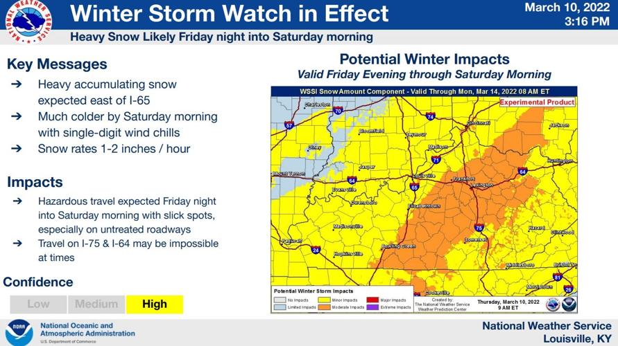
This afternoon we had a conference call with the National Weather Service and their partners to talk more about the forecast for incoming winter weather this weekend. What follows is a discussion of our conversation and their forecast.

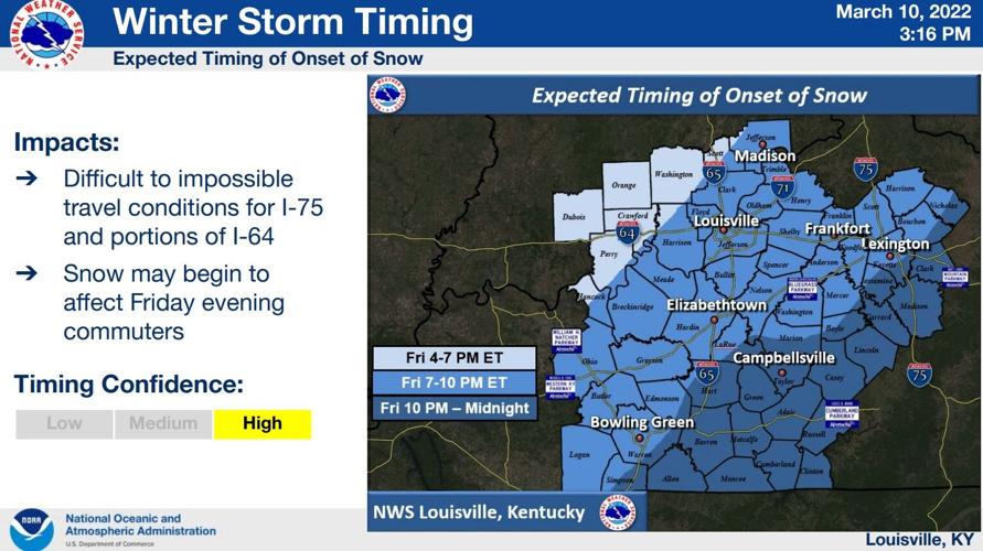
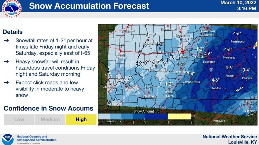
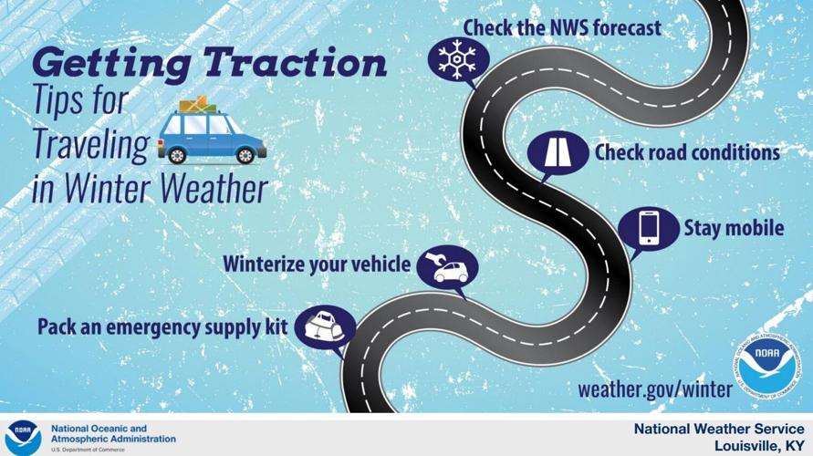
One of the concerns here, and any time we get winter weather, is impacts to roads and driving conditions. Quick snowfall rates (must be around 1"-2" per hour) will cool the road quickly to allow for more accumulation and more difficult driving conditions. That's mostly for I-75 and for I-64 east of I-65. In many spots that see lighter snow, the pavement will be too warm for snow to start sticking or to add up to much on roads.

Light rain ahead of this during the day Friday, transitioning to snow during the afternoon/evening. Some of you, but not everyone, will see snow start to fall during your Friday evening commute. Please use caution and know the longer the snow falls, the worse the roads will get.

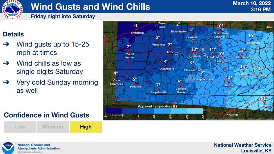
At the same time, temperatures will drop into the 20s and 30s with wind gusts up to 25 mph. That will bring wind chills into the single digits Saturday and Sunday.

We did spend some time discussing possible worst case scenarios, the higher-end snow potentials. Since that is not a forecast, though, and not likely to happen, I have not included that here.

Tune into WDRB News tonight to see our snow totals map and to hear Marc and Rick share their thoughts about timing and impacts.


