


An Extreme Heat Warning has been issued for a couple of counties in our viewing area today through Thursday night. If you're wondering what an extreme heat warning is, it's the same thing an excessive heat warning was, but the NWS recently changed the name within the last couple year to help convey the severity of the situation. Here's the counties included today. This is in effect until 9PM this Thursday:
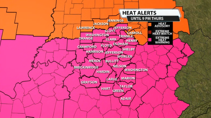
An Extreme Heat Warning is a step above a heat advisory. Heat advisories, while they still need to be taken seriously, are for heat index values "around" 105.
However in this case, those counties included in the extreme heat warning could see heat index values around 110-115 through Thursday. We don't get these warnings very often, once or twice a year at most, so take this one seriously.
Here's more on the warning from the NWS:
..EXTREME HEAT WARNING IN EFFECT UNTIL 9 PM EDT /8 PM CDT/
THURSDAY...
* WHAT...Dangerously hot conditions with peak heat index values
between 100 and 115 degrees Fahrenheit. Mild overnight
temperatures will also not allow for much reprieve from the hot
and humid conditions.
* WHERE...Portions of south central Indiana and east central, north
central, northwest, and south central Kentucky.
* WHEN...Until 9 PM EDT /8 PM CDT/ Thursday.
* IMPACTS...Heat related illnesses increase significantly during
extreme heat and high humidity events.