

Here we go again. Another day above normal in March leads to another strong storm chance this evening/tonight as another cold front slides its way through.
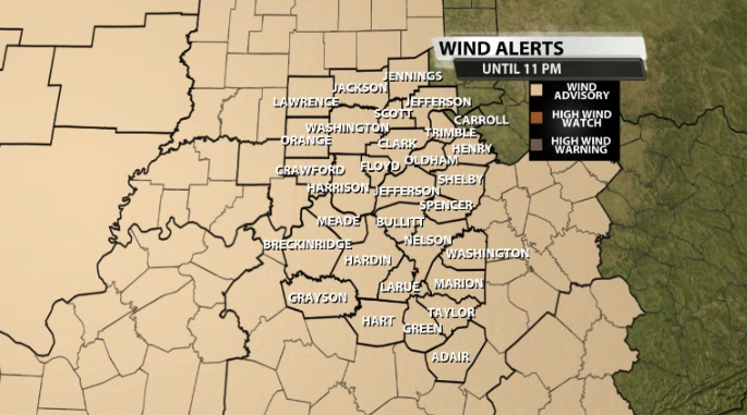
First, we have a Wind Advisory currently in effect until 11PM tonight. This is for winds gusts outside of thunderstorms climbing to 45mph at times.
The good thing about today is that storms do not arrive until after sunset for most of us, so if you have any outdoor plans for the rest of the afternoon, they should be good to go!
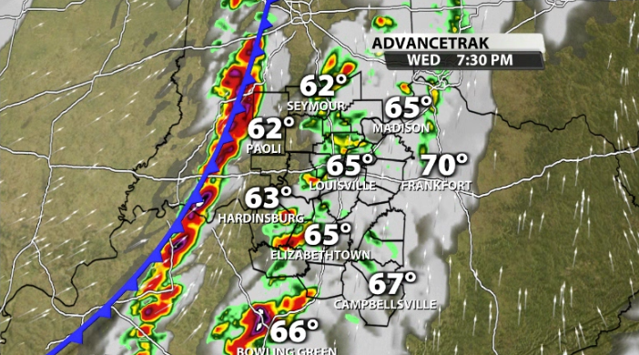
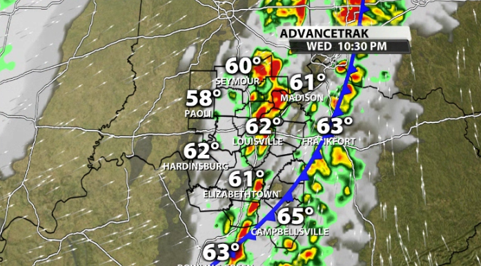
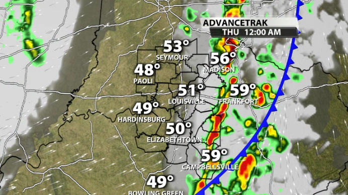
While a few showers could pop-up after 5pm, most storms start to pop-up in our western communities around 7PM-9PM tonight. The storms continue to push their way toward the Louisville area between 9PM-11PM. Finally, they'll reach our eastern communities and exit our area between 10PM-12AM.
These storms do have the potential to be strong to severe for some of our area. While widespread severe weather doesn't look likely, it doesn't mean some of these can't pack a punch. We will have some surface instability needed to keep storms at their strength as they approach us from the west this evening.
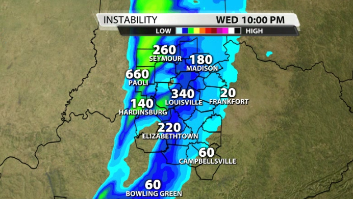
Along with that, there is once again ample wind energy with this system with winds about a mile above the ground near 50-60mph, which is sufficient enough for severe weather. With some minor directional wind shear, a few quick spin-up tornadoes cannot be ruled out for tonight.
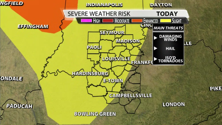
With that being said, the Storm Prediction Center currently has a large chunk of our area (including Louisville) included in a Slight(2/5) risk for severe storms this evening. The main impact would be strong gusty winds, followed by large hail and that small, but non-zero quick spin-up tornado threat.
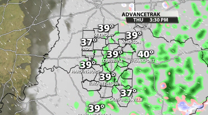
Severe to SNOW??
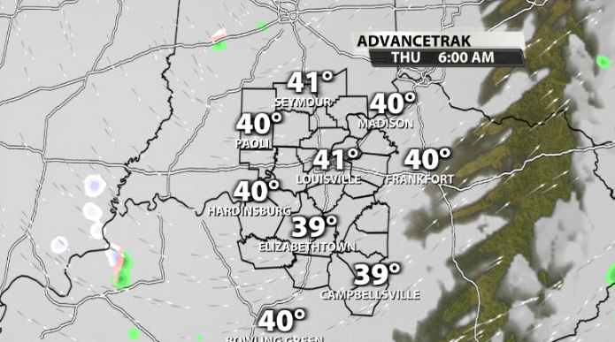
Whether you see severe weather or not, what you will see is cold air rushing in behind the front tonight. Ironically, tomorrow is the first day of spring, but it is certainly not going to feel like it. Temperatures crash into the upper 30s and low 40s by Thursday morning.
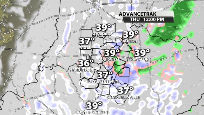
With some leftover moisture and temperatures a few thousand feet up below freezing, it is possible that we mix in some snow showers along with cold rain through Thursday afternoon.


