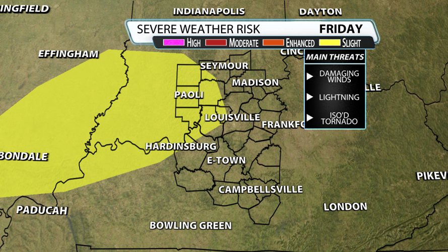

It's probably the last thing you want to hear, but we're not done with severe weather. The Storm Prediction Center placed locations in far west Louisville under their "slight risk" for severe weather on Friday. That also includes Georgetown, Borden, Corydon, Crandall, English, New Amsterdam, Whiskey Run, Salem, Paoli, Mitchell and Bedford. Remember, "slight risk" means scattered severe storms are likely, but they would be short-lived and/or not widespread.

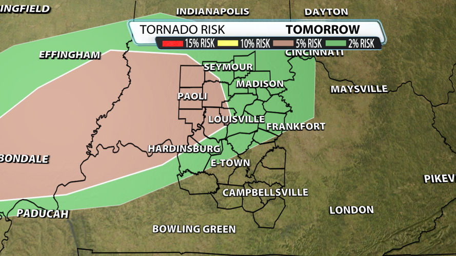
Unfortunately, there is some directional shear, or winds changing direction with height. Shear like this allows storms to rotate which explains why there is a 5% risk east of Louisville defined by the brown color on the map below. The probability of a tornado within 25 miles of a point is only 2% in areas shaded green. The bottom line, we won't have as many tornado warnings compared to Sunday, but a couple are certainly possible.

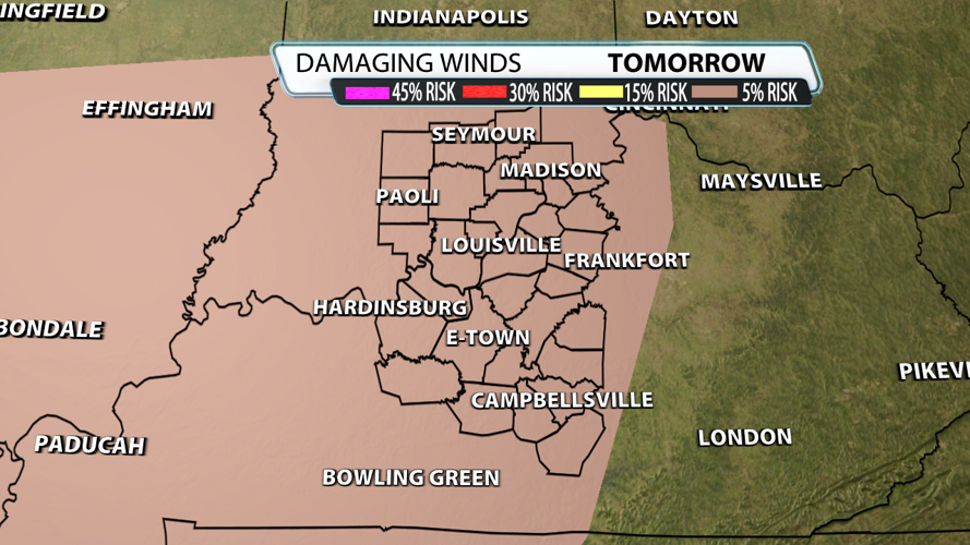
Equally concerning is the damaging wind potential. Without strong mid-level wind energy, localized downburst style winds are the more likely outcome. Downbursts are powerful winds that descend from a thunderstorm and spread out quickly once they hit the ground. The probability of damaging thunderstorm wind gusts of 58 mph or higher within 25 miles of a point is 5% across all of our area.

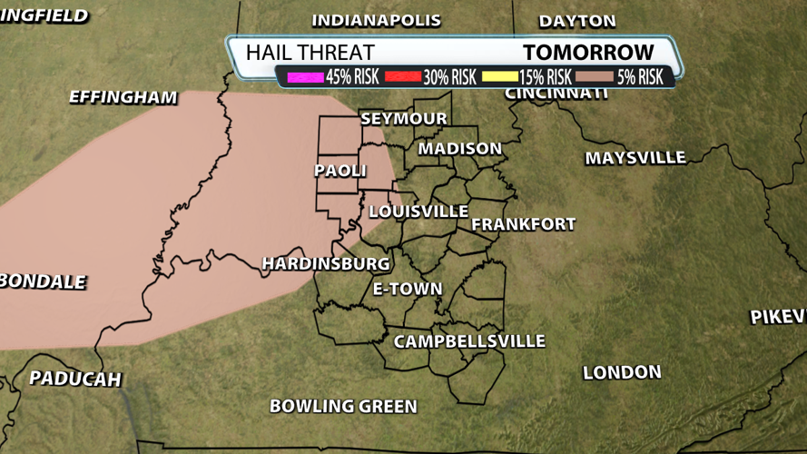
Hail can't be ruled out either, but it's the lowest threat of them all. Most hail should remain around 1" in diameter which is the threshold for severe. Updrafts don't look strong enough to generate hail larger than 1.5" in diameter, but areas off to the east need to use caution.

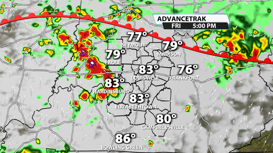
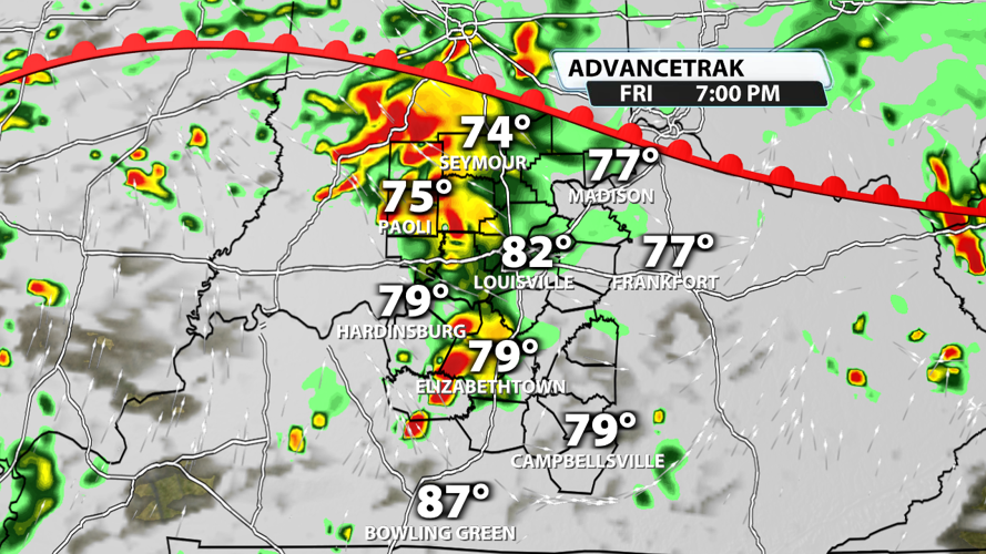
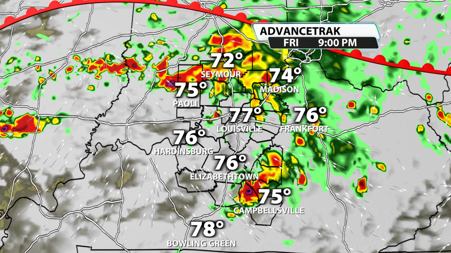
Check out the future radar images below to a get a rough idea of the timing. At this point, 4pm - 8pm is the window to be weather aware. Please make sure you have multiple ways to get warnings and stay with WDRB Weather for updates.


