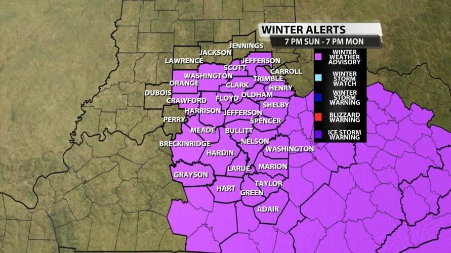
The Winter Weather Advisory issued for Sunday night and Monday has now been expanded so it lasts longer. For Breckinridge, Grayson, Hardin, Hart, Jefferson, Larue, and Meade counties in Kentucky and Clark, Crawford, Floyd, Harrison, Orange, Scott, and Washington counties in Indiana it still ends at 1 PM Monday, but now it starts at 7 PM Sunday instead of 8 PM. For Adair, Green, Taylor, Marion, Washington, Nelson, Spencer, Shelby, Oldham, Henry, and Trimble counties in Kentucky and Jefferson county Indiana it also starts now at 7 PM Sunday and goes until 7 PM Monday. This extension is the NWS's way of saying they expect we will see road impacts earlier and longer than initially thought.

This post will focus on IMPACTS from the snow and how much will fall since that's largely why this Advisory was extended. The forecast timing has not changed much, so click here to see Katie's blog post from earlier today to see a discussion of the timing of when rain changes to snow and that snow moves into your area.

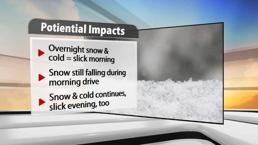
The first impact you will notice Monday morning is ice or snow on your car if it was parked outside overnight. Scattered snow will fall overnight, so if you're out driving pay attention for slick spots. Temperatures will drop into the upper 20s for most of you, so snow left on untreated roads will freeze by morning.

As you get in your car and start to drive, keep in mind a few snow showers will still be falling during the morning commute. As the snow falls, it reduces visibility so it's harder to see as far ahead. You will need to slow down, so leave yourself enough time to get to your destination safely.

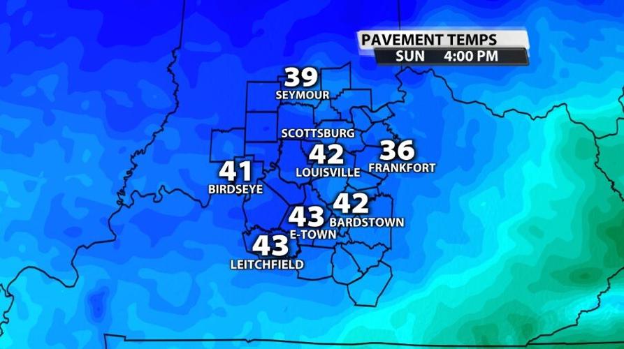
Through the day off and on snow will fall and temperatures will drop again into the middle and lower 20s by Tuesday morning. That could allow more moisture to freeze Monday night, so drive carefully where the road looks wet. As of Sunday afternoon, pavement temperatures are above freezing across our area. However the air temperature won't get out of the low 30s on Monday which will allow plenty of time for pavement temps to drop below 32 and stay colder than freezing. That's why you may see some additional slick spots late Monday and early Tuesday on untreated roads.

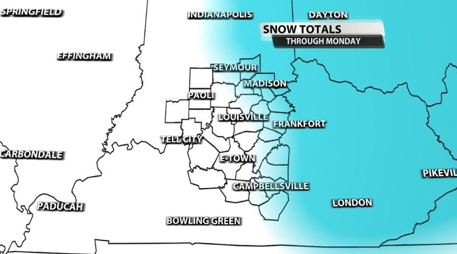
Snow totals haven't changed much since the last update. The snow will hang on longer through Monday east of I-65 which is why the Winter Weather Advisory lasts longer for you and why we are expecting you to see more snow. The blue shading in the map above is where we could se 1"-2" of snow, and the white shading is where we expect less than 1" of snow for most spots.


