

We are creeping closer and closer to Kentucky Derby season! Thunder over Louisville is set for Saturday with the fireworks lighting off that night! As we go into the rest of the week, there are two main storm chances that could bring impacts...and one could be on Saturday.
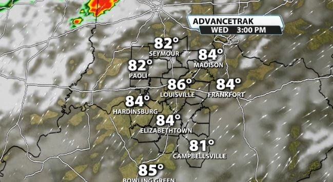
You'll notice temperatures really climbing the next couple of days. Tuesday and Wednesday, which remain mainly dry, end up in the mid-upper 80s with breezy conditions. Outdoor plans should be just fine through the middle of the week.
Thursday
Thursday brings in the first decent storm chance. Most data shows a disturbance rolling through our area on Thursday afternoon. We will be warm and breezy again, and this will provide some storm energy to get storms rolling as we get through the afternoon.
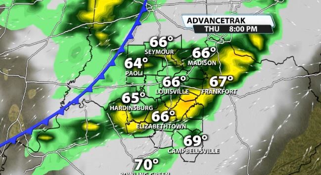
Wind energy for that system isn't great, so severe weather isn't incredibly likely other than maybe a rogue strong storm or two trying to eat up on the warm temperatures.
Saturday
Saturday is obviously what most people are interested in because of Thunder Over Louisville. Almost all data shows a strong cold front arriving at some point on Saturday/Saturday night. The question(s) that still remain this far out are...1.) When does the front actually arrive and 2.) Could any storms be severe?
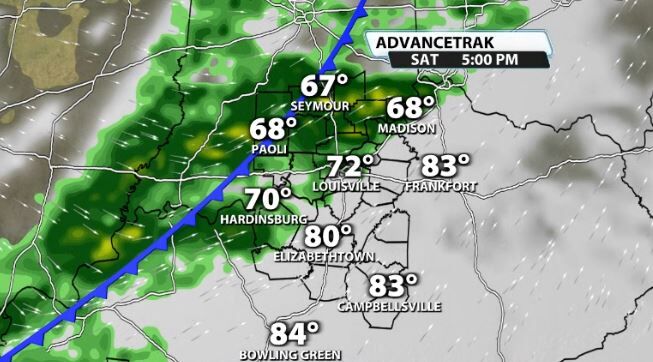
The exact timeline for this system is still too far away to narrow down exactly. For example, the GFS American model has storms arriving in Louisville with the front around mid-afternoon. Meanwhile, the European model (a little more reliable), shows the front arriving in Louisville with storms after sunset.
The chance of severe weather is not zero. Most data shows a decent (not crazy) amount of CAPE, or storm energy, available, along with wind shear that is sufficient enough to support strong storms.
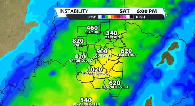
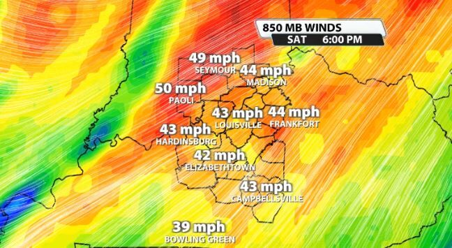
There is not currently a severe risk for our area for Saturday just yet since we are still far away, but one could be needed if the trends continue. We'll also have to watch the cloud deck and how low it is to see if it could limit a full vertical air show.
Be sure to watch WDRB daily for the latest updates with the front rolling through Saturday!


