

Last week was a really wet one with multiple days worth of rain and storm chances. With that wet pattern and warmer air, we've definitely felt more like Spring. Well...Spring also brings in chances for strong storms. It's pretty early on in storm season so we're just now getting into lower-end severe chances, but we already have one out for our area on Wednesday.
A strong cold front will arrive in our area on Wednesday. This could bring some strong storms to our area, but it's not all crystal clear just yet. Let's look at what model data is showing so far:
A more widespread chance of severe weather to our west will start to roll into our area Tuesday night and into Wednesday morning. Data shows some showers and storms rolling in early in the day to begin Wednesday. This could be important. If those do form, that can help limit storm development for later in the day.
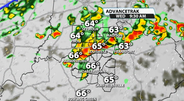
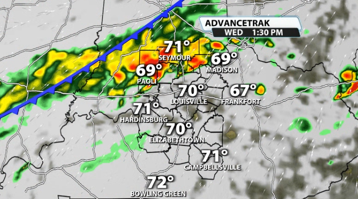
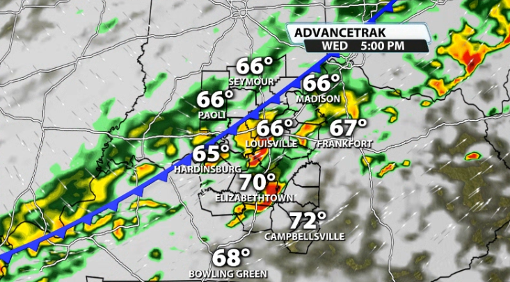
We do get a little bit of a break for the atmosphere to try and recover if that morning wave pans out, but which would allow more instability to try and grow across our area again for the actual front. Storms start early afternoon in Indiana and move south through the afternoon and evening.
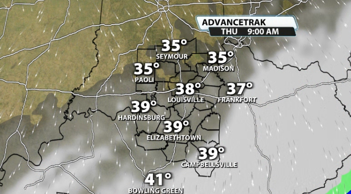
Behind the front, it gets colder really quickly. We'll be in the 30s by Thursday morning and some of us will struggle to get out of the 40s on Thursday afternoon.
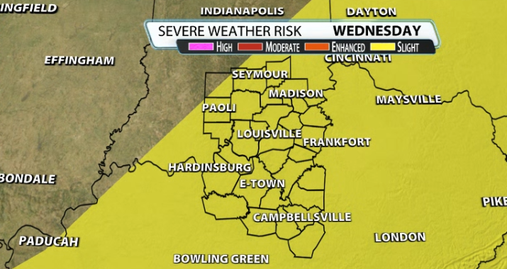
For now, the Storm Prediction Center has almost our entire area under the Slight (2/5) risk for severe weather on Wednesday.
A lot of this will be tweaked the next 24-36 hours as we get closer to the front arriving. If the front moves in earlier, it won't have as much instability to work with, while if it holds off a bit, it can use more warmth from the afternoon to produce a few strong storms.
What is needed for severe weather?
We know there are main ingredients you have to have for organized severe weather. Those are moisture, instability, wind shear, & forcing.
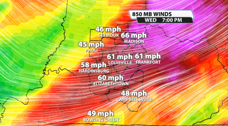
How does Wednesday look with these ingredients? Well, 3 of the 4 are pretty much a done deal. Dew points will be in the mid 60s, which is plenty of moisture; forcing will be there because the actual cold front is rolling in with the storms, and wind shear easily reaches our criteria of around 40mph winds or greater about a mile above the ground.
The questionable ingredient is going to be instability. How much storm energy, or CAPE, will we have available? If that morning wave rolls in and takes a lot out of the atmosphere, we may not have a ton left over for the main show in the afternoon. On the other hand, if we have plenty of dry time that would allow for more CAPE to be in our area.
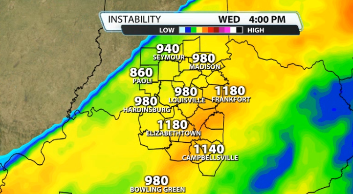
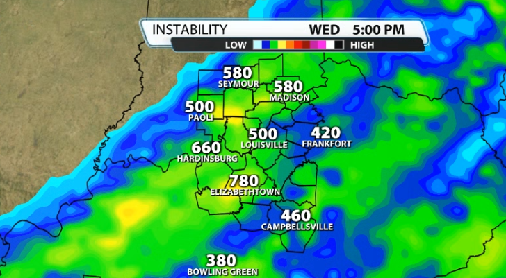
Some data shows more CAPE than others in this scenario, but it is sufficient enough for strong storms. There isn't much turning in the atmosphere, but there is some, so an isolated spin-up or two can't be ruled out.


