
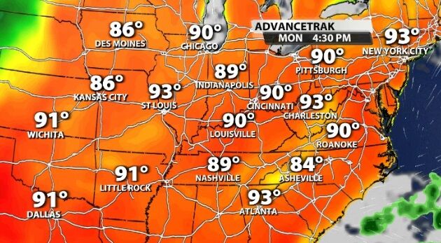
After clouds and rain have suppressed our temperatures over the last few days, we are about to see a significant warmup! High temperatures will jump into the 90s next week which may signal a pattern change. A ridge of high pressure will build over the eastern U.S. early next week bringing that warmer air to us.
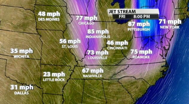
As we transition out of spring into summer, we will see a pattern shift in the jet stream. That's the level at which planes fly and is shown in the two images below. The first image is from today (Friday), and shows a curve in the jet stream right over the Ohio River Valley.
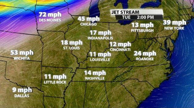
This second image looks ahead to Tuesday of next week (four days from now) and shows the jet stream positioned north of our area. It's not just Tuesday, though. That pattern develops early next week and holds true for several days. That's the type of pattern shift we are looking for to push us out of spring storm season into the season of summer heat.
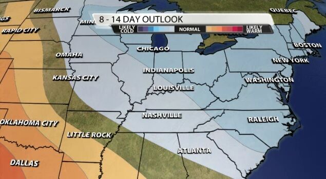
The Climate Prediction Center 8-14 day outlook shows we don't hold onto 90s for an unlimited amount of time. Our next cold front toward the end of next week will drop our temperatures a bit, and two weeks from now, it looks like we will see temperatures near average or slightly below. Average high temperatures at that point are in the low 80s.
We will keep updating the forecast to show you when the heat moves in and how quickly it moves out. You can check that here on wdrb.com, in our WDRB Weather app, and on TV with our meteorologists.


