


The storm is still on track to arrive Sunday morning and leave Monday afternoon. In that timeframe, we will have periods of snow, sleet, rain/freezing rain, more snow... you get the picture. It will be an absolute mess across Kentuckiana. And depending on where you live, you could have all snow or mostly rain. Here is a break down of our latest maps showing potential impacts and some helpful tips for last minute preparations.
The storm is still almost 1,000 miles away, but it is quickly evolving and heading toward us.
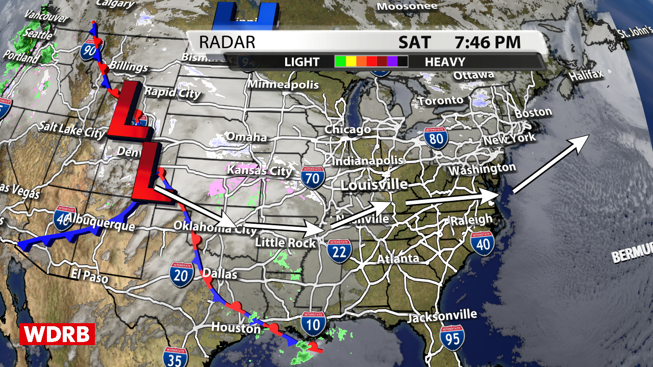
Satellite/Radar map made in WDRB's WSI weather graphics system
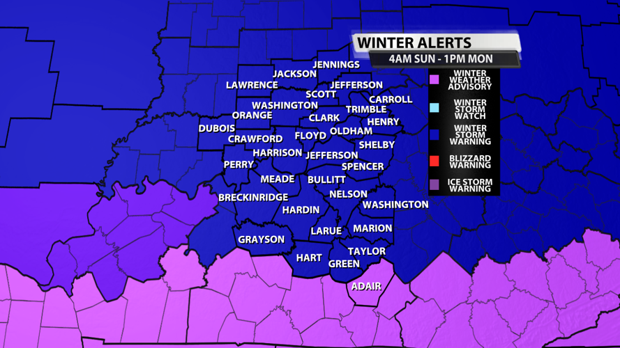
Our Winter Storm Warning starts at 4 AM on Sunday and end at 1 AM on Monday. Snow should start falling between 6 AM and 9 AM EDT in most places. The farther south you are, the more likely it is that you have an extended period of time of mostly cold rain. Because air surface temperatures will be above freezing in our southernmost communities, this cold rain won't always result in freezing rain. That's why counties close to the KY/TN border (i.e. Adair County) are only under a Winter Weather Advisory. Southern counties could still receive accumulating snowfall on Monday.

Winter Weather Alerts map made in WDRB's WSI weather graphics system
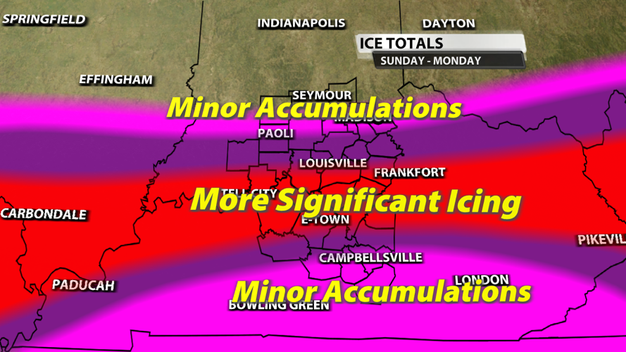
Ice accumulations around 1/2" are definitely possible. The area of the most significant icing is still expected to be along and south of I-64. This will cause power outages, especially when tree branches fall on powerlines as winds pick up on Monday.

Ice accumulation map made in WDRB's WSI weather graphics system
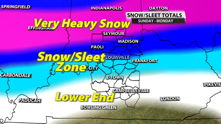
Snowfall is likely for everyone in our viewing area, but the highest amounts will be north of State Road 56 in Indiana. A foot or more is possible near Seymour. Between Scottsburg and Etown, there will be an area with a mixture of sleet and snow. The more sleet you get, the smaller your sleet/snow total will be overall. This is an area of uncertainty when it comes to snow/sleet depth by the end of the event. We'll have the latest and more refined numbers at 10 PM on WDRB.

Snow accumulation map made in WDRB's WSI weather graphics system
Impacts from this event will be significant in some places. Not everyone will lose power, but those that do lose it could be without it for a few days. Roads will be quite hazardous, so don't travel unless you absolutely have to after 9 AM in most spots. Gas generators must be used outside and 20 feet from your home. Fumes from the generator can slowly and quietly kill you if they enter the home. It's not something you want to risk. Temperatures will drop into the single digits and possibly below freezing once the system moves out of our area, so give some special attention to your water lines Tuesday through Friday!
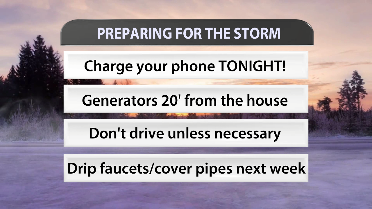
Winter storm tips graphic made in WDRB's WSI weather graphics system
Yes, school cancellations will happen, but we'll let the schools' administrative figures make those calls. Just be prepared for your kids to have an extended Winter Break!


