

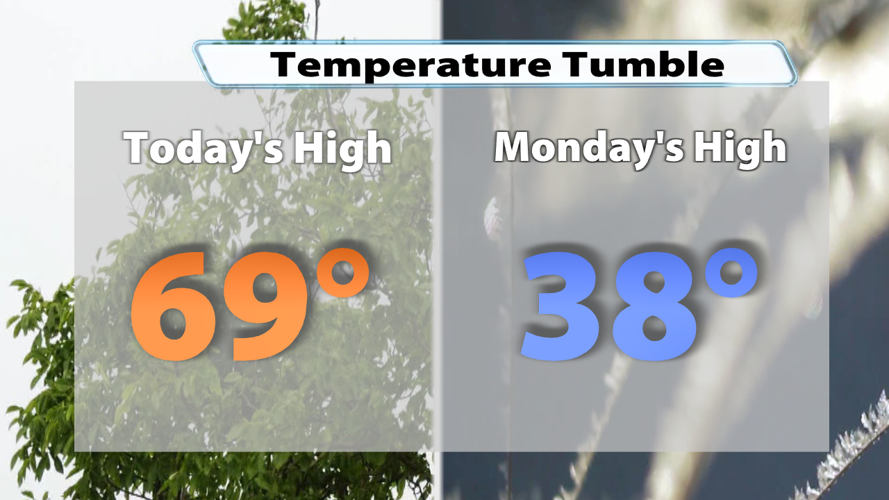


Saturday was a bit mild by November standards with highs topping out close to 70 degrees in our warm spots. But don't worry... the snow is still on its way to the Ohio River Valley. The area of low pressure moving out of the Plains and into the Midwest brought us rain Saturday tonight and then snow heading into next week!

The temperature change with this system will be quite sudden. We almost topped out at 70 degrees in Louisville today, but Monday won't even make it into the 40s!

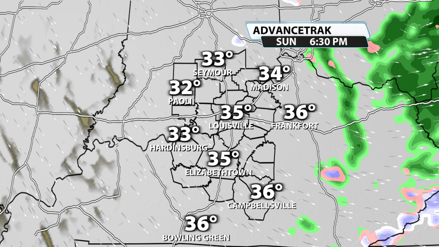
Showers persisted Saturday night with a light drizzle and a batches of showers in Southwest Indiana. Most of the rain is out of our area early Sunday.

Sprinkles or light showers will be possible throughout the day Sunday, but the main change is the dip in temperatures. Sunday's high will come at roughly midnight, but the afternoon temperatures will sit in the low 40s for the most part. Even colder air will move in Sunday evening, and this will bring a transition from rain to snow. However, you shouldn't expect any accumulations at this point.

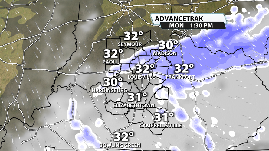
Monday's temperatures continue the downward trend with widespread 20s in the morning. Highs will stay in the 30s all day. Moisture will wrap around the area of low pressure and possibly be enhanced by the Great Lakes. This will lead to widespread flurries and a few snow bursts. Any snow bursts that do form could put down a quick dusting on roads and a quick coating on elevated surfaces. Slick spots will be possible on the roads, but the snow itself should melt very quickly considering ground surface temperatures will be too warm to sustain anything frozen for long. The best chance for snow bursts will probably be along and east of I-65.

Tuesday morning will be extra frigid with a hard freeze likely and "feels-like" temperatures in the teens!! Bundle up the kiddos before sending them to the bus stop both Monday and Tuesday.

This early winter blast won't stick around forever! Temperatures will climb to the 50s and 60s on Wednesday.


