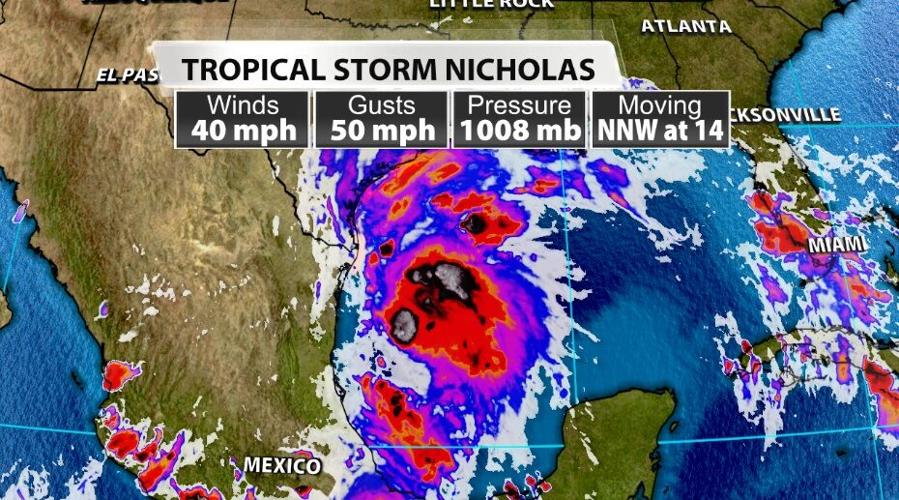
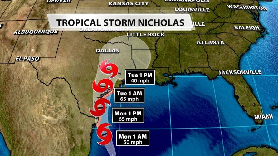
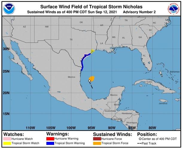
Tropical Storm Nicholas got its name Sunday and is headed toward coastal Texas. As of the 8 PM Eastern update from the National Hurricane Center, Nicholas is estimated to have winds of 40 mph, gusting to 50 mph. It is moving north at 2 mph (so hardly moving at all) and has an estimated minimum central pressure of 1008 mb.

That is not the strongest storm we will see this year - far from it - but this storm will produce a lot of rain. As it makes landfall and tries to move inland, it slows down significantly. It will also be weakening through that same period but will be dropping all its rain over the same places for a day or two.

The map below shows a Tropical Storm Warning has been issued for the Texas coastline (dark blue) and a Hurricane Watch (light pink). Since they are layered on top of each other, I know it's difficult to see, but trust me they are both there. But it's only forecast to strengthen to a tropical storm, so why is there a Hurricane Watch?

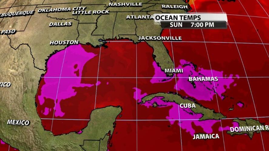
If this storm takes even a slightly more eastern track, it would likely strengthen to a hurricane. In fact it's already headed for some nice, warm ocean water (see the bright pink shading in the image below), so even if it stays on this track, it could become a hurricane before making landfall.

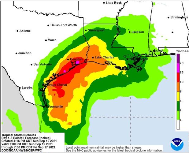
Regardless of whether or not Nicholas becomes a hurricane, it will dump a lot of rain on coastal Texas communities over a few days. The Weather Prediction Center estimates (in the map below) up to 15 inches of rain may be possible in some isolated communities. The National Hurricane Center warns of widespread 8-16 inches with isolated occurrences of 20 inches. Even if you only see half that much rain, that's enough to cause significant flash flooding and cause area rivers to swell.

Wind speed won't be the problem with Nicholas, it will be the rain and flooding. We will keep you posted in the coming days as Nicholas makes landfall and begins to impact these southern spots.


