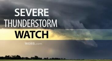
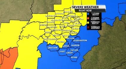
A new Severe Thunderstorm Watch has been issued for the parts of our area not covered by the Tornado Watch. In the image below, the yellow shading is the Tornado Watch that is valid until 5 PM. The blue shading is the new Severe Thunderstorm Watch valid until 10 PM. Remember a Watch means you need to be watching the weather. All the ingredients are here to get tornadoes and severe thunderstorms. Those storms haven't happened yet, but can happen within these windows of time, so you need to be alert.
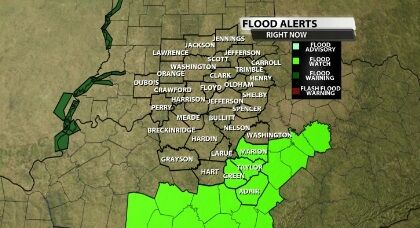
The National Weather Service has also issued a Flood Watch from midnight tonight until 2 PM Thursday. Two to three inches of rain will be possible in these areas overnight and early Thursday making flooding and flash flooding possible in that timeframe.
This is in addition to the Wind Advisory that is also in effect for our entire area until 8 PM. Outside of these potentially severe storms, wind gusts up to 45 mph will be possible.


