

Besides April 4th, it has been a minute since we last had widespread, moderate to heavy rain across the entirety of Kentuckiana. In fact, the last time we had more than 0.5" of rain recorded at the Louisville International Airport was March 11th. That's almost a full month! Let's talk about the increasing drought conditions across the region and when we could see some relief.

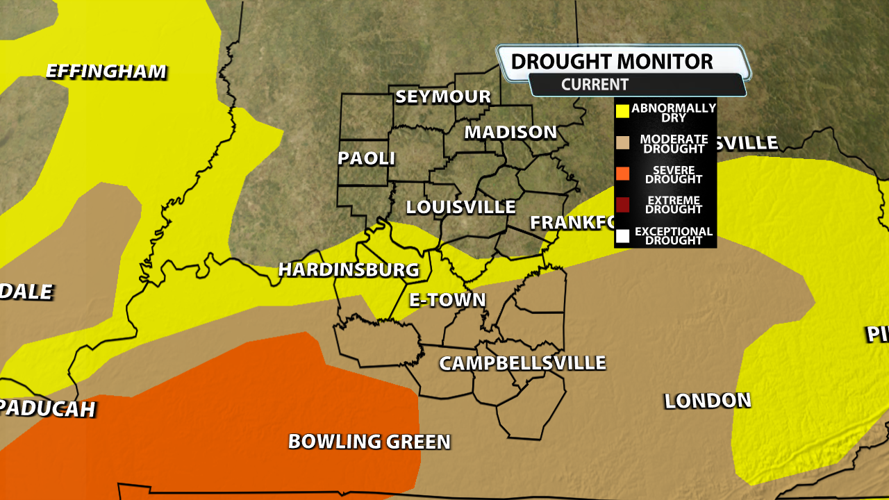
Last week, the Climate Prediction Center placed much of Kentucky south of I-64 in the yellow, abnormally dry category. This week, many of those same place, especially south of the Parkways, have been upgraded to Moderate Drought. Severe drought is now taking over much of Western Kentucky. Southern Indiana is fairly free of drought right now.

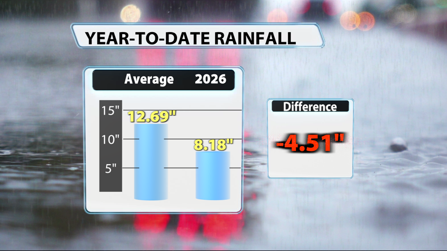
The rain gauge at the Louisville International Airport was filled up past average during the month of March, but January and February were quite dry. January barely surpassed half its average rainfall total while February received less than a third of its average rainfall. April has also seen less than half of it's average up to this point. One data point isn't sufficient for telling the weather story for an entire region, but it's something to consider.

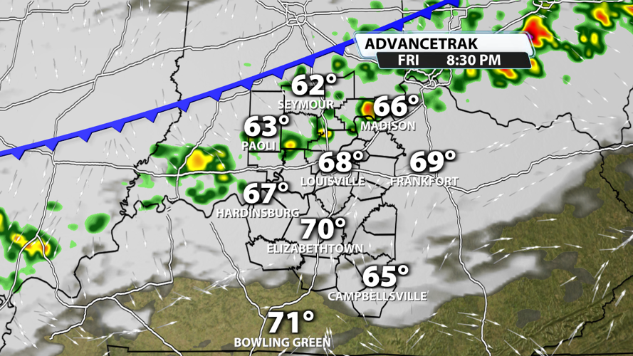
Our next rain chance come Friday evening, and it's definitely not a slam dunk. Southern Indiana and places close to the Ohio River in Kentucky have the best chance of getting showers and maybe some thunder and lightning late Friday. Rain will probably taper off some overnight as showers continue to move south. The picture above is an example of one model that is quite bullish compared to other models. Rainfall totals should stay below 0.25" even in the heavier showers.

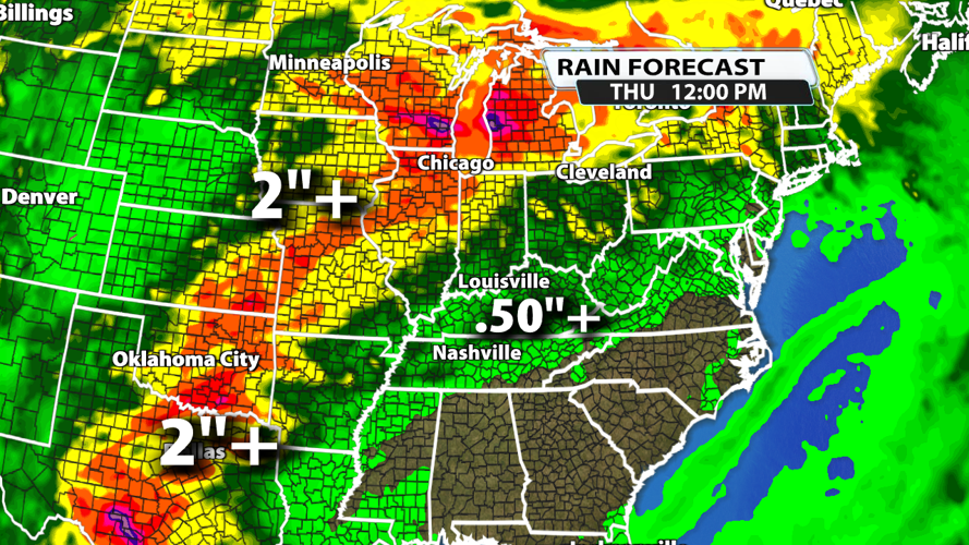
Over the next seven days, rainfall will stay quite limited. Rainfall amounts to our north and west will probably exceed 2 inches, but our region is unlikely to see much more than 0.5" in any one spot.


