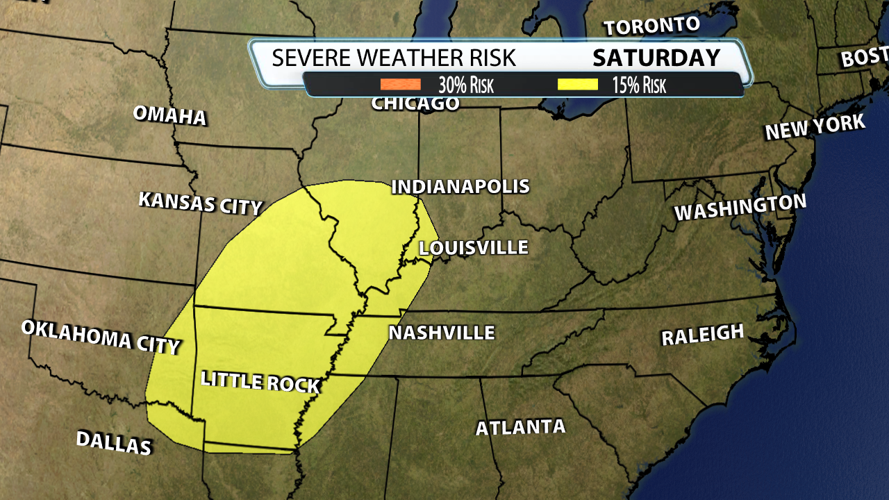


The Storm Prediction Center does not include our area in their severe risk on Saturday, but it does bank up against our western counties. This risk is 6 days into the future which means you can almost guarantee changes. Wind energy is more than sufficient, the forcing is powerful, and the amount of instability will all depend on timing.

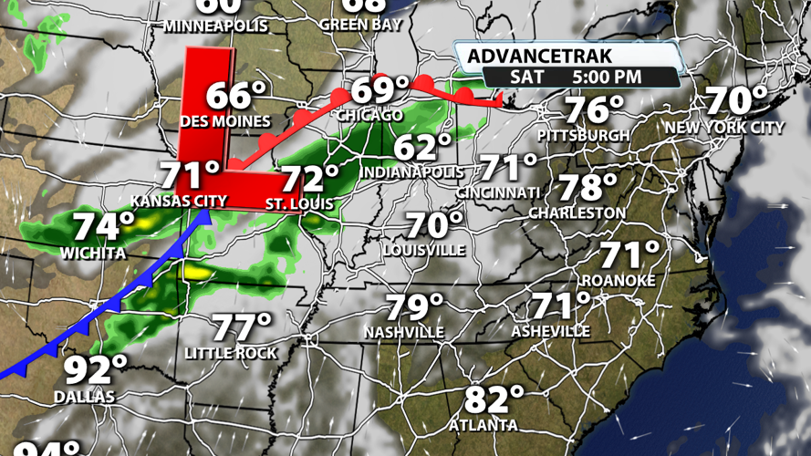
As of Monday, data holds off on the storms until Saturday night. After midnight to be more specific. Sunday offers up widespread rain and storms as the cold front moves in. While mornings are the cooler, more stable part of the day, there is still enough fuel to produce strong storms. If a severe risk was needed for Sunday, I would highlight southern and eastern Kentucky during the afternoon as storms reenergize and the low pressure strengthens.

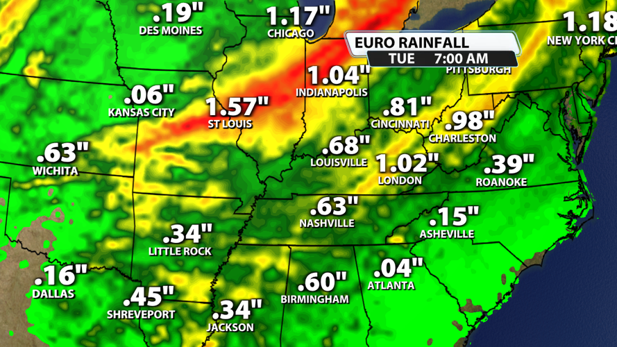
When all is said and done, I would say this is worth a minimum of .50" to 1" of rain with some locations getting close to 2". We will take rain to help avoid drought, but obviously don't want that to come with severe weather. We have all week to nail down this forecast down, but for now keep tabs on Saturday night and Sunday. Even then, it doesn't look like a major event with damaging winds being the main threat.


