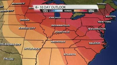

We've been talking a lot lately about how our temperatures compare to "normal," so let's establish what normal is and why it provides important context.
The Glossary of Meteorology from the American Meteorological Society says climatological normals are "averages of climatological data calculated for consecutive 30 year periods." The normals we are using now come from data from 1991-2020. The next batch of normals will go through 2030 and be released in 2031.
A "normal" is a statistical number, not just a vague grouping. According to NOAA:
Rather than assess long-term climate trends, Normals reflect the impacts of the changing climate on our day-to-day weather experience. Normals are not merely averages of raw data. Thirty years of U.S. weather station observations are compiled, checked for quality, compared to surrounding stations, filled in for missing periods, and used to calculate not only averages, but many other measures. These then provide a basis for comparisons of temperature, precipitation, and other variables to today’s observations.

So when we say this week's forecast high temperatures in the 50s are above normal, we mean this 30-year climatological value. Since those numbers are updated every 10 years with a new set of data, they should account for how the climate is changing to try to compare apples to apples instead of apples to oranges (for example, temperatures now compared with temperatures in the 1890s). When we say the upcoming high temperatures in the 50s are above average, that means the statistical average based on all data collected in Louisville dating back to the 1800s. That number does not account for how the climate has changed over the period of record.


